
BRIDGE MAIL
Cargo
Current Trip
| Trip Time | --- |
|---|---|
| Trip Distance | --- |
| AVG Speed | --- |
| MAX Speed | --- |
| Diepgang | --- |
| AVG Wind | --- |
| MAX Wind | --- |
| MIN Temp | --- |
| MAX Temp | --- |
| Positie ontvangen | 1 m geleden |
Current Position
| Lengtegraad | --- |
|---|---|
| Breedtegraat | --- |
| Status | Moored |
| Snelheid | |
| Koers | --- |
| Gebied | North Atlantic Ocean |
| Station | T-AIS |
| Positie ontvangen | 1 m geleden |
Info
Information
The current position of BRIDGE MAIL is in North Atlantic Ocean with coordinates 25.07842° / -77.32396° as reported on 2026-01-03 11:28 by AIS to our vessel tracker app. The vessel's current speed is 0 Knopen and is currently inside the port of NASSAU.
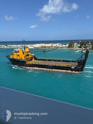
The vessel BRIDGE MAIL (IMO: 9208887, MMSI: 577574000) is a Cargo It's sailing under the flag of [VU] Vanuatu.
In this page you can find informations about the vessels current position, last detected port calls, and current voyage information. If the vessels is not in coverage by AIS you will find the latest position.
The current position of BRIDGE MAIL is detected by our AIS receivers and we are not responsible for the reliability of the data. The last position was recorded while the vessel was in Coverage by the Ais receivers of our vessel tracking app.
The current draught of BRIDGE MAIL as reported by AIS is 3.2 meters
Weather
| Temperature | 20.9°C / 69.62°F |
|---|---|
| Wind Speed | 4 knots |
| Direction | 208° SSW |
| Pressure | 1016 hPa |
| Humidity | 58.1 % |
| Cloud Coverage | 41 % |
Featured Company
Last Port Calls
| Port | Arrival | Departure | Time In Port |
|---|---|---|---|
| 2025-12-29 08:32 | 2025-12-29 19:42 | 11 h | |
| 2025-12-29 08:15 | 2025-12-29 08:21 | 6 m | |
| 2025-12-28 01:24 | 2025-12-28 08:48 | 7 h | |
| 2025-12-26 12:04 | 2025-12-26 19:16 | 7 h | |
| 2025-12-26 11:46 | 2025-12-26 11:53 | 6 m | |
| 2025-12-23 04:02 | |||
| 2025-12-21 19:08 | 2025-12-22 00:43 | 5 h | |
| 2025-12-20 18:20 | |||
| 2025-12-19 18:04 | 2025-12-19 21:52 | 3 h | |
| 2025-12-18 14:18 | 2025-12-18 21:31 | 7 h |
Most Visited Ports (Last year)
| Port | Arrivals | |
|---|---|---|
| 90 | ||
| 61 | ||
| 57 | ||
| 14 |
Last Trips
| Origin | Departure | Destination | Arrival | Distance | |
|---|---|---|---|---|---|
| 2025-12-29 08:21 | 2025-12-29 08:32 | 0.96 nm | |||
| 2025-12-28 08:48 | 2025-12-29 08:15 | 161.85 nm | |||
| 2025-12-26 19:16 | 2025-12-28 01:24 | 195.52 nm | |||
| 2025-12-26 11:53 | 2025-12-26 12:04 | 0.98 nm | |||
| 2025-12-26 11:53 | 2025-12-26 11:46 | 0.98 nm | |||
| 2025-12-22 00:43 | 2025-12-23 04:02 | 162.09 nm | |||
| 2025-12-19 21:52 | 2025-12-20 18:20 | 161.83 nm | |||
| 2025-12-18 21:31 | 2025-12-19 18:04 | 161.82 nm | |||
| 2025-12-17 17:25 | 2025-12-18 14:18 | 161.97 nm | |||
| 2025-12-14 00:12 | 2025-12-17 07:13 | 32.00 nm |
Events
| Tijd | Evenement | Details | Positie / Bestemming | Info |
|---|---|---|---|---|
| 2026-01-02 17:55 | Binnenbereik |
25.07848 / -77.32415
North Atlantic Ocean
[BS] NASSAU
|
Snelheid: Koers: 349.2° |
|
| 2026-01-01 14:37 | Buitenbereik |
25.07846 / -77.32408
North Atlantic Ocean
[BS] NASSAU
|
Snelheid: Koers: 219° |
|
| 2026-01-01 14:37 | Binnenbereik |
25.07846 / -77.32408
North Atlantic Ocean
[BS] NASSAU
|
Snelheid: Koers: 219° |
|
| 2025-12-30 18:02 | Buitenbereik |
25.33717 / -77.87101
North Atlantic Ocean
|
Snelheid: 7.3 kn Koers: 117.9° |
|
| 2025-12-30 15:40 | Gevonden in zee | Bahamas part of the North Atlantic Ocean |
25.47054 / -78.15205
North Atlantic Ocean
NASSAU
|
Snelheid: 6 kn Koers: 111.2° |
| 2025-12-30 15:40 | Binnenbereik |
25.47054 / -78.15205
North Atlantic Ocean
NASSAU
|
Snelheid: 6 kn Koers: 111.2° |
|
| 2025-12-30 01:27 | Buitenbereik |
26.07357 / -80.00393
North Atlantic Ocean
NASSAU
|
Snelheid: 8.3 kn Koers: 104.9° |
|
| 2025-12-30 00:42 | Vertrekhaven |
|
26.08735 / -80.11393
NASSAU
|
Snelheid: 6.9 kn Koers: 349.7° |
| 2025-12-30 00:31 | Start beweging |
26.06641 / -80.11485
[US] FORT LAUDERDALE
|
Snelheid: 3.1 kn Koers: 17.4° |
|
| 2025-12-30 00:25 | Destination Changed | NASSAU PORT EVERGLADES |
26.06578 / -80.11537
[US] FORT LAUDERDALE
|
Snelheid: Koers: 511° |