
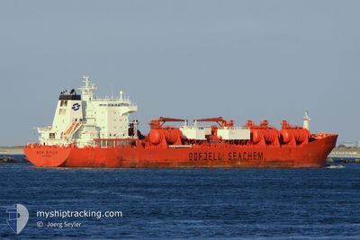
BOW SIRIUS
Oil/Chemical Tanker
Current Trip
| Time Travelled | 7 days |
|---|---|
| Remaining Time | 8 days |
| Distance Travelled | 2388.44 nm |
| Remaining Distance | 2756.97 nm |
| AVG Speed | 13.4 Knopen |
| MAX Speed | 15.3 Knopen |
| AVG Wind | 13.6 knots |
| MAX Wind | 26 knots |
| MIN Temp | 17.8°C / 64.04°F |
| MAX Temp | 27.8°C / 82.04°F |
| Diepgang | 9.3 M |
| Positie ontvangen | 5 d geleden |
Current Position
| Lengtegraad | -14.36602° |
|---|---|
| Breedtegraat | 27.07578° |
| Status | Under way using engine |
| Snelheid | 14.5 Knopen |
| Koers | 216.9° |
| Gebied | North Atlantic Ocean |
| Station | T-AIS |
| Positie ontvangen | 5 d geleden |
Info
Information
The current position of BOW SIRIUS is in North Atlantic Ocean with coordinates 27.07578° / -14.36602° as reported on 2024-06-03 04:41 by AIS to our vessel tracker app. The vessel's current speed is 14.5 Knopen and is heading at the port of CAPE TOWN. The estimated time of arrival as calculated by MyShipTracking vessel tracking app is 2024-06-17 02:50 LT
The vessel BOW SIRIUS (IMO: 9215294, MMSI: 258910000) is a Oil/Chemical Tanker that was built in 2006 ( 18 Jaar oud ). It's sailing under the flag of [NO] Norway.
In this page you can find informations about the vessels current position, last detected port calls, and current voyage information. If the vessels is not in coverage by AIS you will find the latest position.
The current position of BOW SIRIUS is detected by our AIS receivers and we are not responsible for the reliability of the data. The last position was recorded while the vessel was in Coverage by the Ais receivers of our vessel tracking app.
The current draught of BOW SIRIUS as reported by AIS is 9.3 meters
Weather
| Temperature | 25.8°C / 78.44°F |
|---|---|
| Wind Speed | 11 knots |
| Direction | 159° SSE |
| Pressure | 1015.1 hPa |
| Humidity | 73.4 % |
| Cloud Coverage | 69 % |
Featured Company
Last Port Calls
| Port | Arrival | Departure | Time In Port |
|---|---|---|---|
| 2024-05-31 12:04 | 2024-06-01 02:55 | 14 h | |
| 2024-05-20 14:08 | 2024-05-25 07:08 | 4 d | |
| 2024-05-19 23:27 | 2024-05-20 13:37 | 14 h | |
| 2024-05-13 19:30 | 2024-05-19 22:54 | 6 d | |
| 2024-05-11 16:32 | 2024-05-13 18:36 | 2 d | |
| 2024-05-03 12:59 | 2024-05-09 09:55 | 5 d | |
| 2024-04-09 15:00 | 2024-04-12 02:05 | 2 d | |
| 2024-04-07 07:28 | 2024-04-08 01:12 | 17 h | |
| 2024-04-06 14:56 |
Most Visited Ports (Last year)
| Port | Arrivals | |
|---|---|---|
| 6 | ||
| 5 | ||
| 4 | ||
| 3 | ||
| 3 | ||
| 3 |
Last Trips
| Origin | Departure | Destination | Arrival | Distance | |
|---|---|---|---|---|---|
| 2024-05-25 07:08 | 2024-05-31 12:04 | 1512.02 nm | |||
| 2024-05-20 13:37 | 2024-05-20 14:08 | 1.67 nm | |||
| 2024-05-19 22:54 | 2024-05-19 23:27 | 2.18 nm | |||
| 2024-05-13 18:36 | 2024-05-13 19:30 | 3.29 nm | |||
| 2024-05-09 09:55 | 2024-05-11 16:32 | 457.10 nm | |||
| 2024-04-12 02:05 | 2024-05-03 12:59 | 7097.05 nm | |||
| 2024-04-08 01:12 | 2024-04-09 15:00 | 14.80 nm | |||
| 2024-04-06 14:56 | 2024-04-07 07:28 | 106.27 nm |
Events
| Tijd | Evenement | Details | Positie / Bestemming | Info |
|---|---|---|---|---|
| 2024-06-03 04:48 | Status Changed | Default Under way using engine |
27.05034 / -14.38693
ZACPT
|
Snelheid: 14.5 kn Koers: 216.9° |
| 2024-06-03 04:41 | Buitenbereik |
27.07578 / -14.36602
North Atlantic Ocean
ZACPT
|
Snelheid: 14.5 kn Koers: 216.9° |
|
| 2024-06-03 03:41 | Status Changed | Under way using engine Default |
27.27887 / -14.21590
ZACPT
|
Snelheid: 14.8 kn Koers: 215° |
| 2024-06-03 03:36 | Status Changed | Default Under way using engine |
27.29403 / -14.20435
ZACPT
|
Snelheid: 14.7 kn Koers: 214.9° |
| 2024-06-03 03:27 | Status Changed | Under way using engine Default |
27.32289 / -14.18189
ZACPT
|
Snelheid: 14.8 kn Koers: 215° |
| 2024-06-03 03:16 | Status Changed | Default Under way using engine |
27.36096 / -14.15206
ZACPT
|
Snelheid: 15 kn Koers: 216.2° |
| 2024-06-03 03:07 | Wijzig zee gebeid | Western Saharan part of the North Atlantic Ocean Spanish (Canary Islands) part of the North Atlantic Ocean |
27.39293 / -14.12621
North Atlantic Ocean
ZACPT
|
Snelheid: 15 kn Koers: 216.2° |
| 2024-06-02 21:38 | Status Changed | Under way using engine Default |
28.49026 / -13.27914
ZACPT
|
Snelheid: 14.5 kn Koers: 212° |
| 2024-06-02 21:35 | Status Changed | Default Under way using engine |
28.49964 / -13.27208
ZACPT
|
Snelheid: 14.5 kn Koers: 216.9° |
| 2024-06-02 20:13 | Status Changed | Under way using engine Default |
28.76300 / -13.05158
ZACPT
|
Snelheid: 14.3 kn Koers: 217° |