
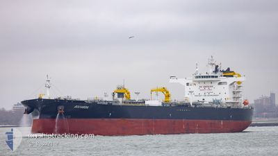
BOUVARDIA
Tanker
Current Trip
| Time Travelled | 8 days |
|---|---|
| Remaining Time | 1 day |
| Distance Travelled | 2072.67 nm |
| Remaining Distance | 437.51 nm |
| AVG Speed | 11 Knopen |
| MAX Speed | 13.7 Knopen |
| AVG Wind | 16.7 knots |
| MAX Wind | 29 knots |
| MIN Temp | 25°C / 77°F |
| MAX Temp | 35.3°C / 95.54°F |
| Diepgang | 14.6 M |
| Positie ontvangen | 8 d geleden |
Current Position
| Lengtegraad | 57.25952° |
|---|---|
| Breedtegraat | 24.79837° |
| Status | Under way using engine |
| Snelheid | 12.7 Knopen |
| Koers | 121.8° |
| Gebied | Gulf of Oman |
| Station | T-AIS |
| Positie ontvangen | 8 d geleden |
Info
Information
The current position of BOUVARDIA is in Gulf of Oman with coordinates 24.79837° / 57.25952° as reported on 2024-06-18 04:43 by AIS to our vessel tracker app. The vessel's current speed is 12.7 Knopen and is heading at the port of DAR ES SALAAM. The estimated time of arrival as calculated by MyShipTracking vessel tracking app is 2024-06-27 18:12 LT
The vessel BOUVARDIA (IMO: 9935595, MMSI: 636021772) is a Tanker It's sailing under the flag of [LR] Liberia.
In this page you can find informations about the vessels current position, last detected port calls, and current voyage information. If the vessels is not in coverage by AIS you will find the latest position.
The current position of BOUVARDIA is detected by our AIS receivers and we are not responsible for the reliability of the data. The last position was recorded while the vessel was in Coverage by the Ais receivers of our vessel tracking app.
The current draught of BOUVARDIA as reported by AIS is 14.6 meters
Weather
| Temperature | 25.1°C / 77.18°F |
|---|---|
| Wind Speed | 15 knots |
| Direction | 165° SSE |
| Pressure | 1014.3 hPa |
| Humidity | 87.3 % |
| Cloud Coverage | 32 % |
Featured Company
Last Port Calls
| Port | Arrival | Departure | Time In Port |
|---|---|---|---|
| 2024-06-14 18:55 | 2024-06-18 00:10 | 3 d | |
| 2024-05-24 12:44 | 2024-05-28 03:29 | 3 d | |
| 2024-05-10 02:11 | 2024-05-11 17:58 | 1 d | |
| 2024-04-13 22:46 | 2024-04-15 08:42 | 1 d |
Most Visited Ports (Last year)
| Port | Arrivals | |
|---|---|---|
| 6 | ||
| 4 | ||
| 2 | ||
| 1 | ||
| 1 | ||
| 1 |
Last Trips
| Origin | Departure | Destination | Arrival | Distance | |
|---|---|---|---|---|---|
| 2024-05-28 11:29 | 2024-06-14 22:55 | 3340.50 nm | |||
| 2024-05-11 20:58 | 2024-05-24 20:44 | 3778.09 nm | |||
| 2024-04-15 15:42 | 2024-05-10 05:11 | 4593.80 nm | |||
| 2024-03-30 19:04 | 2024-04-14 05:46 | 4438.06 nm |
Events
| Tijd | Evenement | Details | Positie / Bestemming | Info |
|---|---|---|---|---|
| 2024-06-18 04:50 | Status Changed | Default Under way using engine |
24.78620 / 57.28118
TZDAR
|
Snelheid: 12.7 kn Koers: 121.8° |
| 2024-06-18 04:43 | Buitenbereik |
24.79837 / 57.25952
Gulf of Oman
TZDAR
|
Snelheid: 12.7 kn Koers: 121.8° |
|
| 2024-06-18 02:26 | Wijzig zee gebeid | Omani part of the Gulf of Oman United Arab Emirates part of the Gulf of Oman |
25.05009 / 56.80587
Gulf of Oman
TZDAR
|
Snelheid: 12.6 kn Koers: 121.9° |
| 2024-06-18 00:10 | Vertrekhaven |
|
25.17223 / 56.37786
TZDAR
|
Snelheid: 6.2 kn Koers: 187° |
| 2024-06-17 23:53 | Start beweging |
25.18841 / 56.37331
[AE] FUJAIRAH
|
Snelheid: 3.1 kn Koers: 74° |
|
| 2024-06-17 23:41 | Status Changed | Under way using engine Moored |
25.18566 / 56.37024
[AE] FUJAIRAH
|
Snelheid: 0.5 kn Koers: 112° |
| 2024-06-17 22:47 | Draught Changed | 14.6 9 |
25.18484 / 56.36992
[AE] FUJAIRAH
|
Snelheid: Koers: 118° |
| 2024-06-17 21:27 | ETA Changed | 2024/06/26 01:00 2024/06/13 05:00 |
25.18485 / 56.36995
[AE] FUJAIRAH
|
Snelheid: Koers: 118° |
| 2024-06-17 21:21 | Destination Changed | TZDAR AEFJR |
25.18483 / 56.36993
[AE] FUJAIRAH
|
Snelheid: Koers: 118° |
| 2024-06-17 18:06 | Status Changed | Moored Default |
25.18486 / 56.36991
[AE] FUJAIRAH
|
Snelheid: Koers: 118° |