
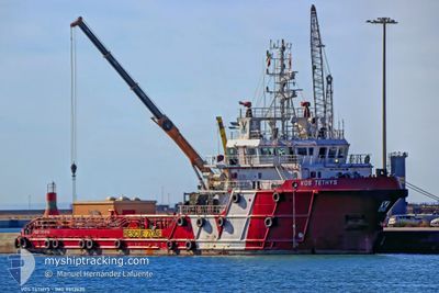
BOS TETHYS
Offshore Supply Ship
Current Trip
| Time Travelled | 2 days |
|---|---|
| Remaining Time | 1 day |
| Distance Travelled | 528.50 nm |
| Remaining Distance | 309.24 nm |
| AVG Speed | 8.3 Knopen |
| MAX Speed | 8.9 Knopen |
| AVG Wind | 11.5 knots |
| MAX Wind | 16.8 knots |
| MIN Temp | 17.5°C / 63.5°F |
| MAX Temp | 20°C / 68°F |
| Diepgang | 4.4 M |
| Positie ontvangen | 2 m geleden |
Current Position
| Lengtegraad | --- |
|---|---|
| Breedtegraat | --- |
| Status | Under way using engine |
| Snelheid | 8 Knopen |
| Koers | 290.7° |
| Gebied | Mediterranean Sea - Eastern Basin |
| Station | T-AIS |
| Positie ontvangen | 2 m geleden |
Info
Information
The current position of BOS TETHYS is in Mediterranean Sea - Eastern Basin with coordinates 34.35038° / 20.29725° as reported on 2025-03-15 04:28 by AIS to our vessel tracker app. The vessel's current speed is 8 Knopen and is heading at the port of VALLETTA. The estimated time of arrival as calculated by MyShipTracking vessel tracking app is 2025-03-16 20:09 LT
The vessel BOS TETHYS (IMO: 9552630, MMSI: 247280800) is a Offshore Supply Ship that was built in 2010 ( 15 Jaar oud ). It's sailing under the flag of [IT] Italy.
In this page you can find informations about the vessels current position, last detected port calls, and current voyage information. If the vessels is not in coverage by AIS you will find the latest position.
The current position of BOS TETHYS is detected by our AIS receivers and we are not responsible for the reliability of the data. The last position was recorded while the vessel was in Coverage by the Ais receivers of our vessel tracking app.
The current draught of BOS TETHYS as reported by AIS is 4.4 meters
Weather
| Temperature | 18.7°C / 65.66°F |
|---|---|
| Wind Speed | 15 knots |
| Direction | 134° SE |
| Pressure | 1014.2 hPa |
| Humidity | 80.1 % |
| Cloud Coverage | --- |
Featured Company
Last Port Calls
| Port | Arrival | Departure | Time In Port |
|---|---|---|---|
| 2025-03-12 07:05 | 2025-03-12 14:29 | 7 h | |
| 2025-03-10 15:21 | 2025-03-10 23:37 | 8 h | |
| 2025-03-09 07:27 | 2025-03-09 19:09 | 11 h | |
| 2025-03-01 07:28 | 2025-03-01 23:39 | 16 h | |
| 2025-02-26 22:33 | 2025-02-27 16:58 | 18 h | |
| 2025-02-20 07:47 | 2025-02-23 16:11 | 3 d | |
| 2025-02-13 10:41 | 2025-02-14 15:53 | 1 d | |
| 2025-02-05 08:59 | 2025-02-08 12:39 | 3 d | |
| 2025-02-03 09:02 | 2025-02-03 19:01 | 9 h | |
| 2025-01-30 08:22 | 2025-01-31 16:46 | 1 d |
Most Visited Ports (Last year)
| Port | Arrivals | |
|---|---|---|
| 60 | ||
| 5 | ||
| 1 | ||
| 1 | ||
| 1 |
Last Trips
| Origin | Departure | Destination | Arrival | Distance | |
|---|---|---|---|---|---|
| 2025-03-10 23:37 | 2025-03-12 07:05 | 159.82 nm | |||
| 2025-03-09 19:09 | 2025-03-10 15:21 | 95.19 nm | |||
| 2025-03-01 23:39 | 2025-03-09 07:27 | 260.00 nm | |||
| 2025-02-27 16:58 | 2025-03-01 07:28 | 76.47 nm | |||
| 2025-02-23 16:11 | 2025-02-26 22:33 | 171.51 nm | |||
| 2025-02-14 15:53 | 2025-02-20 07:47 | 78.49 nm | |||
| 2025-02-08 12:39 | 2025-02-13 10:41 | 116.65 nm | |||
| 2025-02-03 19:01 | 2025-02-05 08:59 | 81.63 nm | |||
| 2025-01-31 16:46 | 2025-02-03 09:02 | 81.30 nm | |||
| 2025-01-29 00:06 | 2025-01-30 08:22 | 122.81 nm |
Events
| Tijd | Evenement | Details | Positie / Bestemming | Info |
|---|---|---|---|---|
| 2025-03-15 04:24 | Status Changed | Under way using engine Default |
34.34753 / 20.30670
MTMLA
|
Snelheid: 8 kn Koers: 289° |
| 2025-03-15 04:14 | Binnenbereik |
34.34753 / 20.30670
Mediterranean Sea - Eastern Basin
MTMLA
|
Snelheid: 8 kn Koers: 289.6° |
|
| 2025-03-15 03:29 | Status Changed | Default Under way using engine |
34.30617 / 20.44798
MTMLA
|
Snelheid: 8 kn Koers: 291.3° |
| 2025-03-15 03:21 | Buitenbereik |
34.30030 / 20.46788
Mediterranean Sea - Eastern Basin
MTMLA
|
Snelheid: 8 kn Koers: 291.3° |
|
| 2025-03-15 02:18 | Status Changed | Under way using engine Default |
34.25198 / 20.62899
MTMLA
|
Snelheid: 8 kn Koers: 292° |
| 2025-03-15 02:07 | Binnenbereik |
34.25198 / 20.62899
Mediterranean Sea - Eastern Basin
MTMLA
|
Snelheid: 8 kn Koers: 289.9° |
|
| 2025-03-14 23:49 | Status Changed | Default Under way using engine |
34.13880 / 21.00339
MTMLA
|
Snelheid: 7.6 kn Koers: 289.8° |
| 2025-03-14 23:47 | Buitenbereik |
34.13749 / 21.00789
Mediterranean Sea - Eastern Basin
MTMLA
|
Snelheid: 7.6 kn Koers: 289.8° |
|
| 2025-03-14 23:39 | Status Changed | Under way using engine Default |
34.13193 / 21.02726
MTMLA
|
Snelheid: 7.6 kn Koers: 290° |
| 2025-03-14 23:39 | Binnenbereik |
34.13309 / 21.02323
Mediterranean Sea - Eastern Basin
MTMLA
|
Snelheid: 7.6 kn Koers: 288.8° |