
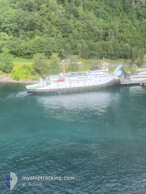
BOLSOY
Ro-Ro/Passenger Ship
Current Trip
VEGSUND
| Time Travelled | 6 days |
|---|---|
| Remaining Time | --- |
| Distance Travelled | 104.19 nm |
| Remaining Distance | --- |
| AVG Speed | 9.2 Knopen |
| MAX Speed | 12.9 Knopen |
| AVG Wind | 5.9 knots |
| MAX Wind | 13 knots |
| MIN Temp | -2.7°C / 27.14°F |
| MAX Temp | 5.8°C / 42.44°F |
| Diepgang | 3.5 M |
| Positie ontvangen | 5 d geleden |
Current Position
| Lengtegraad | --- |
|---|---|
| Breedtegraat | --- |
| Status | Moored |
| Snelheid | |
| Koers | 91° |
| Gebied | Norwegian Sea |
| Station | T-AIS |
| Positie ontvangen | 5 d geleden |
Info
Information
The current position of BOLSOY is in Norwegian Sea with coordinates 62.43117° / 6.34206° as reported on 2025-02-03 13:03 by AIS to our vessel tracker app. The vessel's current speed is 0 Knopen
The vessel BOLSOY (IMO: 7120031, MMSI: 257221400) is a Ro-Ro/Passenger Ship that was built in 1971 ( 54 Jaar oud ). It's sailing under the flag of [NO] Norway.
In this page you can find informations about the vessels current position, last detected port calls, and current voyage information. If the vessels is not in coverage by AIS you will find the latest position.
The current position of BOLSOY is detected by our AIS receivers and we are not responsible for the reliability of the data. The last position was recorded while the vessel was in Coverage by the Ais receivers of our vessel tracking app.
The current draught of BOLSOY as reported by AIS is 3.5 meters
Weather
| Temperature | 5.6°C / 42.08°F |
|---|---|
| Wind Speed | 10 knots |
| Direction | 146° SE |
| Pressure | 1011.8 hPa |
| Humidity | 73.6 % |
| Cloud Coverage | 100 % |
Featured Company
Last Port Calls
| Port | Arrival | Departure | Time In Port |
|---|---|---|---|
| 2025-02-02 08:51 | |||
| 2024-12-17 17:30 | 2024-12-18 08:35 | 15 h | |
| 2024-12-17 14:28 | 2024-12-17 15:05 | 37 m | |
| 2024-12-17 10:58 | 2024-12-17 12:03 | 1 h | |
| 2024-12-16 17:28 | 2024-12-17 08:34 | 15 h | |
| 2024-12-16 16:01 | 2024-12-16 16:31 | 29 m | |
| 2024-12-16 14:27 | 2024-12-16 15:04 | 36 m | |
| 2024-12-16 10:58 | 2024-12-16 12:06 | 1 h | |
| 2024-12-15 17:53 | 2024-12-16 08:38 | 14 h | |
| 2024-12-15 17:28 | 2024-12-15 17:41 | 12 m |
Last Trips
| Origin | Departure | Destination | Arrival | Distance | |
|---|---|---|---|---|---|
| 2024-12-17 16:05 | 2024-12-17 18:30 | 20.32 nm | |||
| 2024-12-17 13:03 | 2024-12-17 15:28 | 19.38 nm | |||
| 2024-12-17 09:34 | 2024-12-17 11:58 | 20.00 nm | |||
| 2024-12-16 17:31 | 2024-12-16 18:28 | 8.74 nm | |||
| 2024-12-16 16:04 | 2024-12-16 17:01 | 10.27 nm | |||
| 2024-12-16 13:06 | 2024-12-16 15:27 | 19.53 nm | |||
| 2024-12-16 09:38 | 2024-12-16 11:58 | 18.79 nm | |||
| 2024-12-15 18:41 | 2024-12-15 18:53 | 0.91 nm | |||
| 2024-12-15 17:32 | 2024-12-15 18:28 | 8.78 nm | |||
| 2024-12-15 16:08 | 2024-12-15 17:04 | 10.34 nm |
Events
| Tijd | Evenement | Details | Positie / Bestemming | Info |
|---|---|---|---|---|
| 2025-02-03 13:03 | Buitenbereik |
62.43117 / 6.34206
Norwegian Sea
VEGSUND
|
Snelheid: Koers: 153.6° |
|
| 2025-02-03 12:57 | Status Changed | Moored Under way using engine |
62.43115 / 6.34211
VEGSUND
|
Snelheid: Koers: 92° |
| 2025-02-03 12:48 | Stop beweging | 1.19 nm, North East of SOLAVAGEN |
62.43118 / 6.34209
VEGSUND
|
Snelheid: Koers: 87° |
| 2025-02-03 12:40 | Start beweging | 1.07 nm, North of SOLAVAGEN |
62.43080 / 6.32832
VEGSUND
|
Snelheid: 4.6 kn Koers: 85° |
| 2025-02-03 11:55 | Stop beweging | 1.13 nm, North of SOLAVAGEN |
62.43156 / 6.31771
VEGSUND
|
Snelheid: 0.3 kn Koers: 121° |
| 2025-02-03 10:48 | Status Changed | Under way using engine Default |
62.41002 / 6.08029
VEGSUND
|
Snelheid: 12 kn Koers: 297° |
| 2025-02-03 10:40 | Status Changed | Default Under way using engine |
62.39448 / 6.13192
VEGSUND
|
Snelheid: 11.8 kn Koers: 273.3° |
| 2025-02-03 10:26 | Status Changed | Under way using engine Default |
62.39026 / 6.23135
VEGSUND
|
Snelheid: 11.8 kn Koers: 259° |
| 2025-02-03 10:14 | Status Changed | Default Under way using engine |
62.39724 / 6.31982
VEGSUND
|
Snelheid: 11.3 kn Koers: 252.8° |
| 2025-02-03 09:44 | Start beweging | 1.67 nm, North West of SYKKYLVEN |
62.42900 / 6.50427
VEGSUND
|
Snelheid: 7.1 kn Koers: 207.4° |