

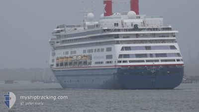
BOLETTE
Passengers Ship

Current Trip
| Time Travelled | 17 h, 45 mins |
|---|---|
| Remaining Time | 14 h, 34 mins |
| Distance Travelled | 239.38 nm |
| Remaining Distance | 201.45 nm |
| AVG Speed | 13.3 Knopen |
| MAX Speed | 15.6 Knopen |
| AVG Wind | 16.8 knots |
| MAX Wind | 25 knots |
| MIN Temp | 18.1°C / 64.58°F |
| MAX Temp | 23.1°C / 73.58°F |
| Diepgang | 8.1 M |
| Positie ontvangen | 17 m geleden |
Current Position
| Lengtegraad | --- |
|---|---|
| Breedtegraat | --- |
| Status | Under way using engine |
| Snelheid | 13.7 Knopen |
| Koers | 126.8° |
| Gebied | Bass Strait |
| Station | T-AIS |
| Positie ontvangen | 17 m geleden |
Information
The current position of BOLETTE is in Bass Strait with coordinates -40.40448° / 147.67675° as reported on 2025-03-07 00:46 by AIS to our vessel tracker app. The vessel's current speed is 13.7 Knopen and is heading at the port of HOBART. The estimated time of arrival as calculated by MyShipTracking vessel tracking app is 2025-03-07 15:37 LT
The vessel BOLETTE (IMO: 9188037, MMSI: 311000986) is a Passengers Ship that was built in 2000 ( 25 Jaar oud ). It's sailing under the flag of [BS] Bahamas.
In this page you can find informations about the vessels current position, last detected port calls, and current voyage information. If the vessels is not in coverage by AIS you will find the latest position.
The current position of BOLETTE is detected by our AIS receivers and we are not responsible for the reliability of the data. The last position was recorded while the vessel was in Coverage by the Ais receivers of our vessel tracking app.
The current draught of BOLETTE as reported by AIS is 8.1 meters
Weather
| Temperature | 18.2°C / 64.76°F |
|---|---|
| Wind Speed | 13 knots |
| Direction | 103° ESE |
| Pressure | 1025.5 hPa |
| Humidity | 82.2 % |
| Cloud Coverage | 9 % |


Featured Company
Last Port Calls
| Port | Arrival | Departure | Time In Port |
|---|---|---|---|
| 2025-03-05 20:44 | 2025-03-06 07:18 | 10 h | |
| 2025-03-02 20:10 | 2025-03-04 07:32 | 1 d | |
| 2025-02-24 17:20 | 2025-02-25 08:58 | 15 h | |
| 2025-02-05 10:10 | 2025-02-06 02:18 | 16 h | |
| 2025-01-31 03:21 | 2025-01-31 20:28 | 17 h | |
| 2025-01-26 09:22 | 2025-01-27 03:30 | 18 h | |
| 2025-01-25 10:58 | 2025-01-25 20:45 | 9 h | |
| 2025-01-21 10:50 | 2025-01-22 01:14 | 14 h | |
| 2025-01-11 11:40 | 2025-01-11 20:24 | 8 h | |
| 2025-01-09 07:29 | 2025-01-09 17:15 | 9 h |
Last Trips
| Origin | Departure | Destination | Arrival | Distance | |
|---|---|---|---|---|---|
| 2025-03-04 18:32 | 2025-03-06 07:44 | 610.08 nm | |||
| 2025-02-25 21:58 | 2025-03-03 07:10 | 1978.28 nm | |||
| 2025-02-05 23:18 | 2025-02-25 06:20 | 6021.87 nm | |||
| 2025-01-31 17:28 | 2025-02-05 07:10 | 1671.22 nm | |||
| 2025-01-27 00:30 | 2025-01-31 00:21 | 1446.81 nm | |||
| 2025-01-25 17:45 | 2025-01-26 06:22 | 139.76 nm | |||
| 2025-01-21 22:14 | 2025-01-25 07:58 | 1069.71 nm | |||
| 2025-01-11 20:24 | 2025-01-21 07:50 | 3527.07 nm | |||
| 2025-01-09 17:15 | 2025-01-11 11:40 | 721.33 nm | |||
| 2025-01-06 18:16 | 2025-01-09 07:29 | 932.23 nm |
Events
| Tijd | Evenement | Details | Positie / Bestemming | Info |
|---|---|---|---|---|
| 2025-03-07 00:52 | Status Changed | Default Under way using engine |
-40.41974 / 147.70520
AU HBA
|
Snelheid: 13.7 kn Koers: 126.8° |
| 2025-03-07 00:46 | Status Changed | Under way using engine Default |
-40.40448 / 147.67675
AU HBA
|
Snelheid: 13.6 kn Koers: 127° |
| 2025-03-07 00:40 | Status Changed | Default Under way using engine |
-40.39425 / 147.65880
AU HBA
|
Snelheid: 13.7 kn Koers: 126.8° |
| 2025-03-07 00:34 | Status Changed | Under way using engine Default |
-40.37945 / 147.63292
AU HBA
|
Snelheid: 13.6 kn Koers: 127° |
| 2025-03-06 23:44 | Status Changed | Default Under way using engine |
-40.26600 / 147.43256
AU HBA
|
Snelheid: 13.6 kn Koers: 126.5° |
| 2025-03-06 23:36 | Status Changed | Under way using engine Default |
-40.24763 / 147.39987
AU HBA
|
Snelheid: 13.6 kn Koers: 126° |
| 2025-03-06 23:33 | Status Changed | Default Under way using engine |
-40.24047 / 147.38715
AU HBA
|
Snelheid: 13.6 kn Koers: 126.6° |
| 2025-03-06 23:28 | Status Changed | Under way using engine Default |
-40.22958 / 147.36780
AU HBA
|
Snelheid: 13.7 kn Koers: 126° |
| 2025-03-06 23:25 | Status Changed | Default Under way using engine |
-40.22330 / 147.35661
AU HBA
|
Snelheid: 13.6 kn Koers: 126.1° |
| 2025-03-06 23:14 | Status Changed | Under way using engine Default |
-40.19900 / 147.31305
AU HBA
|
Snelheid: 13.7 kn Koers: 126° |