
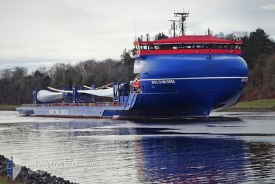
BOLDWIND
Cargo
Current Trip
| Time Travelled | 1 day |
|---|---|
| Remaining Time | 1 day |
| Distance Travelled | 246.28 nm |
| Remaining Distance | 448.14 nm |
| AVG Speed | 9.1 Knopen |
| MAX Speed | 17.4 Knopen |
| AVG Wind | 7.8 knots |
| MAX Wind | 17 knots |
| MIN Temp | 7.2°C / 44.96°F |
| MAX Temp | 12.3°C / 54.14°F |
| Diepgang | 5 M |
| Positie ontvangen | Nu |
Current Position
| Lengtegraad | 8.65649° |
|---|---|
| Breedtegraat | 53.94136° |
| Status | Under way using engine |
| Snelheid | 16 Knopen |
| Koers | 320.5° |
| Gebied | North Sea |
| Station | T-AIS |
| Positie ontvangen | Nu |
Info
Information
The current position of BOLDWIND is in North Sea with coordinates 53.94136° / 8.65649° as reported on 2024-04-28 07:07 by AIS to our vessel tracker app. The vessel's current speed is 16 Knopen and is heading at the port of PORTSMOUTH. The estimated time of arrival as calculated by MyShipTracking vessel tracking app is 2024-04-29 09:17 LT
The vessel BOLDWIND (IMO: 9870018, MMSI: 211341960) is a Cargo It's sailing under the flag of [DE] Germany.
In this page you can find informations about the vessels current position, last detected port calls, and current voyage information. If the vessels is not in coverage by AIS you will find the latest position.
The current position of BOLDWIND is detected by our AIS receivers and we are not responsible for the reliability of the data. The last position was recorded while the vessel was in Coverage by the Ais receivers of our vessel tracking app.
The current draught of BOLDWIND as reported by AIS is 5 meters
Weather
| Temperature | 11.3°C / 52.34°F |
|---|---|
| Wind Speed | 12 knots |
| Direction | 113° ESE |
| Pressure | 1006.8 hPa |
| Humidity | 83.1 % |
| Cloud Coverage | 100 % |
Featured Company
Last Port Calls
| Port | Arrival | Departure | Time In Port |
|---|---|---|---|
| 2024-04-26 03:51 | 2024-04-27 06:20 | 1 d | |
| 2024-04-24 11:22 | 2024-04-25 09:33 | 22 h | |
| 2024-04-24 05:46 | 2024-04-24 05:50 | 3 m | |
| 2024-04-18 17:09 | 2024-04-21 18:01 | 3 d | |
| 2024-04-15 03:53 | 2024-04-15 15:44 | 11 h | |
| 2024-04-12 00:47 | 2024-04-12 20:29 | 19 h | |
| 2024-04-10 04:50 | 2024-04-10 05:32 | 42 m | |
| 2024-04-08 05:43 | 2024-04-08 17:52 | 12 h | |
| 2024-04-04 13:20 | 2024-04-08 04:59 | 3 d | |
| 2024-04-03 05:15 | 2024-04-03 16:01 | 10 h |
Last Trips
| Origin | Departure | Destination | Arrival | Distance | |
|---|---|---|---|---|---|
| 2024-04-25 11:33 | 2024-04-26 05:51 | 167.07 nm | |||
| 2024-04-24 07:50 | 2024-04-24 13:22 | 50.98 nm | |||
| 2024-04-21 19:01 | 2024-04-24 07:46 | 534.21 nm | |||
| 2024-04-15 17:44 | 2024-04-18 18:09 | 697.32 nm | |||
| 2024-04-12 22:29 | 2024-04-15 05:53 | 482.50 nm | |||
| 2024-04-10 07:32 | 2024-04-12 02:47 | 190.60 nm | |||
| 2024-04-08 19:52 | 2024-04-10 06:50 | 175.35 nm | |||
| 2024-04-08 06:59 | 2024-04-08 07:43 | 1.99 nm | |||
| 2024-04-03 18:01 | 2024-04-04 15:20 | 226.81 nm | |||
| 2024-03-31 13:14 | 2024-04-03 07:15 | 2.07 nm |
Events
| Tijd | Evenement | Details | Positie / Bestemming | Info |
|---|---|---|---|---|
| 2024-04-28 06:06 | ETA Changed | 2024/04/30 05:00 2024/04/30 07:00 |
53.86054 / 9.02573
GBPME
|
Snelheid: 15.1 kn Koers: 246.8° |
| 2024-04-28 05:45 | Start beweging | 0.89 nm, South West of BRUNSBUETTEL |
53.89224 / 9.14276
GBPME
|
Snelheid: 3.2 kn Koers: 227° |
| 2024-04-28 05:44 | Gevonden in zee | German part of the North Sea |
53.89269 / 9.14357
North Sea
GBPME
|
Snelheid: 2.3 kn Koers: 227.9° |
| 2024-04-28 05:11 | Stop beweging | 0.77 nm, South West of BRUNSBUETTEL |
53.89359 / 9.14518
GBPME
|
Snelheid: 0.3 kn Koers: 228° |
| 2024-04-27 21:13 | Start beweging | 3.8 nm, North West of KIEL |
54.36096 / 10.06044
GBPME
|
Snelheid: 3.2 kn Koers: 242° |
| 2024-04-27 21:02 | Stop beweging | 3.73 nm, North West of KIEL |
54.36192 / 10.06331
GBPME
|
Snelheid: 0.3 kn Koers: 230° |
| 2024-04-27 20:26 | Start beweging | 1.43 nm, South West of STICKENHΟRN SPORT |
54.36668 / 10.13799
GBPME
|
Snelheid: 3.2 kn Koers: 284° |
| 2024-04-27 20:02 | Stop beweging | 1.37 nm, South West of STICKENHΟRN SPORT |
54.36622 / 10.14144
GBPME
|
Snelheid: 0.3 kn Koers: 284° |
| 2024-04-27 18:05 | Wijzig zee gebeid | German part of the Baltic Sea Danish part of the Baltic Sea |
54.56260 / 10.56244
Baltic Sea
GBPME
|
Snelheid: 12.7 kn Koers: 247.8° |
| 2024-04-27 17:26 | Wijzig zee gebeid | Danish part of the Baltic Sea German part of the Baltic Sea |
54.58167 / 10.79813
Baltic Sea
GBPME
|
Snelheid: 12.9 kn Koers: 260.6° |