
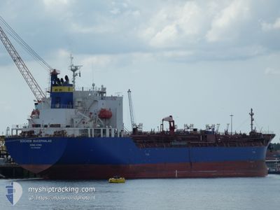
BOCHEM BUCEPHALAS
Tanker
Current Trip
| Time Travelled | 12 days |
|---|---|
| Remaining Time | 1 day |
| Distance Travelled | 3027.81 nm |
| Remaining Distance | 425.14 nm |
| AVG Speed | 11.5 Knopen |
| MAX Speed | 16.5 Knopen |
| AVG Wind | 14.1 knots |
| MAX Wind | 35.1 knots |
| MIN Temp | -4.3°C / 24.26°F |
| MAX Temp | 26.6°C / 79.88°F |
| Diepgang | 10 M |
| Positie ontvangen | 2 d geleden |
Current Position
| Lengtegraad | -79.52102° |
|---|---|
| Breedtegraat | 25.47876° |
| Status | Under way using engine |
| Snelheid | 11.1 Knopen |
| Koers | 184.8° |
| Gebied | North Atlantic Ocean |
| Station | T-AIS |
| Positie ontvangen | 2 d geleden |
Info
Information
The current position of BOCHEM BUCEPHALAS is in North Atlantic Ocean with coordinates 25.47876° / -79.52102° as reported on 2024-05-02 17:09 by AIS to our vessel tracker app. The vessel's current speed is 11.1 Knopen and is heading at the port of HOUSTON. The estimated time of arrival as calculated by MyShipTracking vessel tracking app is 2024-05-06 02:27 LT
The vessel BOCHEM BUCEPHALAS (IMO: 9760550, MMSI: 477142400) is a Tanker It's sailing under the flag of [HK] Hong Kong.
In this page you can find informations about the vessels current position, last detected port calls, and current voyage information. If the vessels is not in coverage by AIS you will find the latest position.
The current position of BOCHEM BUCEPHALAS is detected by our AIS receivers and we are not responsible for the reliability of the data. The last position was recorded while the vessel was in Coverage by the Ais receivers of our vessel tracking app.
The current draught of BOCHEM BUCEPHALAS as reported by AIS is 10 meters
Weather
| Temperature | 25.7°C / 78.26°F |
|---|---|
| Wind Speed | 13 knots |
| Direction | 106° ESE |
| Pressure | 1013.7 hPa |
| Humidity | 83.8 % |
| Cloud Coverage | 10 % |
Featured Company
Last Port Calls
| Port | Arrival | Departure | Time In Port |
|---|---|---|---|
| 2024-04-20 18:11 | 2024-04-21 22:22 | 1 d | |
| 2024-04-03 02:28 | 2024-04-07 23:26 | 4 d | |
| 2024-04-02 04:59 | 2024-04-03 01:54 | 20 h | |
| 2024-03-31 14:05 | 2024-04-02 04:40 | 1 d | |
| 2024-03-25 05:06 | 2024-03-30 17:12 | 5 d | |
| 2024-03-23 23:15 | 2024-03-24 00:13 | 58 m | |
| 2024-03-22 22:44 | 2024-03-23 00:08 | 1 h | |
| 2024-03-01 19:32 | 2024-03-02 17:11 | 21 h | |
| 2024-03-01 19:07 |
Most Visited Ports (Last year)
| Port | Arrivals | |
|---|---|---|
| 9 | ||
| 5 | ||
| 4 | ||
| 3 | ||
| 3 | ||
| 3 |
Last Trips
| Origin | Departure | Destination | Arrival | Distance | |
|---|---|---|---|---|---|
| 2024-04-08 01:26 | 2024-04-20 14:11 | 3406.03 nm | |||
| 2024-04-03 03:54 | 2024-04-03 04:28 | 1.17 nm | |||
| 2024-04-02 06:40 | 2024-04-02 06:59 | 1.79 nm | |||
| 2024-03-30 18:12 | 2024-03-31 16:05 | 189.73 nm | |||
| 2024-03-24 01:13 | 2024-03-25 06:06 | 281.37 nm | |||
| 2024-03-23 01:08 | 2024-03-24 00:15 | 3.39 nm | |||
| 2024-03-02 11:11 | 2024-03-22 23:44 | 4833.21 nm | |||
| 2024-03-01 13:07 | 2024-03-01 13:32 | 1.83 nm |
Events
| Tijd | Evenement | Details | Positie / Bestemming | Info |
|---|---|---|---|---|
| 2024-05-02 17:48 | Status Changed | Default Under way using engine |
25.35754 / -79.53583
US HOU
|
Snelheid: 11.1 kn Koers: 184.8° |
| 2024-05-02 17:09 | Buitenbereik |
25.47876 / -79.52102
North Atlantic Ocean
US HOU
|
Snelheid: 11.1 kn Koers: 184.8° |
|
| 2024-05-02 16:49 | Status Changed | Under way using engine Default |
25.54024 / -79.51531
US HOU
|
Snelheid: 10.9 kn Koers: 186° |
| 2024-05-02 16:28 | Status Changed | Default Under way using engine |
25.60381 / -79.50927
US HOU
|
Snelheid: 10.9 kn Koers: 185° |
| 2024-05-02 15:31 | Status Changed | Under way using engine Default |
25.77386 / -79.48605
US HOU
|
Snelheid: 11.1 kn Koers: 190° |
| 2024-05-02 15:28 | Status Changed | Default Under way using engine |
25.78463 / -79.48389
US HOU
|
Snelheid: 11 kn Koers: 183.7° |
| 2024-05-02 14:30 | Status Changed | Under way using engine Default |
25.96120 / -79.46929
US HOU
|
Snelheid: 11 kn Koers: 183° |
| 2024-05-02 14:07 | Status Changed | Default Under way using engine |
26.03262 / -79.46476
US HOU
|
Snelheid: 11.1 kn Koers: 183° |
| 2024-05-02 12:47 | ETA Changed | 2024/05/06 07:00 2024/05/06 01:00 |
26.27923 / -79.44852
US HOU
|
Snelheid: 10.8 kn Koers: 189.9° |
| 2024-05-02 12:36 | Wijzig zee gebeid | Bahamas part of the North Atlantic Ocean Canadian part of the Gulf of St-Lawrence |
26.30756 / -79.44291
North Atlantic Ocean
US HOU
|
Snelheid: 10.9 kn Koers: 189.3° |