

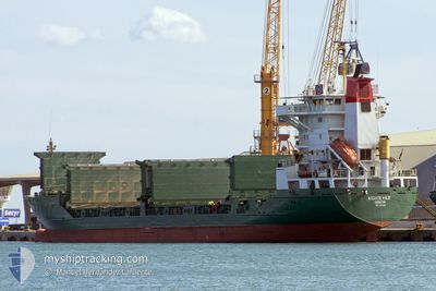
BLUE OCEAN A
Livestock Carrier

Current Trip
| Time Travelled | 16 days |
|---|---|
| Remaining Time | --- |
| Distance Travelled | 2693.10 nm |
| Remaining Distance | --- |
| AVG Speed | 13.9 Knopen |
| MAX Speed | 17.1 Knopen |
| AVG Wind | 12.7 knots |
| MAX Wind | 24 knots |
| MIN Temp | 16.1°C / 60.98°F |
| MAX Temp | 27.2°C / 80.96°F |
| Diepgang | 7.1 M |
| Positie ontvangen | 7 h, 14 m geleden |
Current Position
| Lengtegraad | --- |
|---|---|
| Breedtegraat | --- |
| Status | At anchor |
| Snelheid | 0.1 Knopen |
| Koers | 124° |
| Gebied | South Atlantic Ocean |
| Station | T-AIS |
| Positie ontvangen | 7 h, 14 m geleden |
Information
The current position of BLUE OCEAN A is in South Atlantic Ocean with coordinates -1.49355° / -48.76000° as reported on 2025-02-18 11:59 by AIS to our vessel tracker app. The vessel's current speed is 0.1 Knopen and is heading at the port of VILA DO CONDE. The estimated time of arrival as calculated by MyShipTracking vessel tracking app is 2025-02-09 17:00 LT
The vessel BLUE OCEAN A (IMO: 9045089, MMSI: 511038000) is a Livestock Carrier that was built in 1992 ( 33 Jaar oud ). It's sailing under the flag of [PW] Palau.
In this page you can find informations about the vessels current position, last detected port calls, and current voyage information. If the vessels is not in coverage by AIS you will find the latest position.
The current position of BLUE OCEAN A is detected by our AIS receivers and we are not responsible for the reliability of the data. The last position was recorded while the vessel was in Coverage by the Ais receivers of our vessel tracking app.
The current draught of BLUE OCEAN A as reported by AIS is 7.1 meters
Weather
| Temperature | 27°C / 80.6°F |
|---|---|
| Wind Speed | 10 knots |
| Direction | 33° NNE |
| Pressure | 1007.9 hPa |
| Humidity | 83.8 % |
| Cloud Coverage | 22 % |


Featured Company
Last Port Calls
| Port | Arrival | Departure | Time In Port |
|---|---|---|---|
| 2025-02-02 08:13 | 2025-02-02 16:11 | 7 h | |
| 2025-01-29 08:54 | 2025-01-30 08:29 | 23 h | |
| 2025-01-16 02:38 | 2025-01-17 00:01 | 21 h | |
| 2025-01-09 19:09 | 2025-01-11 22:55 | 2 d | |
| 2025-01-07 10:32 | 2025-01-07 19:55 | 9 h | |
| 2024-12-30 07:37 | 2024-12-30 14:30 | 6 h | |
| 2024-12-15 10:49 | 2024-12-18 12:43 | 3 d |
Most Visited Ports (Last year)
| Port | Arrivals | |
|---|---|---|
| 7 | ||
| 4 | ||
| 4 | ||
| 4 | ||
| 3 | ||
| 2 |
Last Trips
| Origin | Departure | Destination | Arrival | Distance | |
|---|---|---|---|---|---|
| 2025-01-30 08:29 | 2025-02-02 08:13 | 971.11 nm | |||
| 2025-01-11 22:55 | 2025-01-29 08:54 | 2533.34 nm | |||
| 2025-01-11 22:55 | 2025-01-16 02:38 | 685.25 nm | |||
| 2024-12-30 14:30 | 2025-01-09 19:09 | 2772.09 nm | |||
| 2024-12-30 14:30 | 2025-01-07 10:32 | 2057.76 nm | |||
| 2024-12-18 12:43 | 2024-12-30 07:37 | 3363.57 nm | |||
| 2024-11-24 19:18 | 2024-12-15 10:49 | 3380.27 nm |
Events
| Tijd | Evenement | Details | Positie / Bestemming | Info |
|---|---|---|---|---|
| 2025-02-18 12:07 | Status Changed | Default At anchor |
-1.49333 / -48.75740
BRVDC
|
Snelheid: 0.1 kn Koers: 124° |
| 2025-02-18 11:59 | Status Changed | At anchor Default |
-1.49355 / -48.76000
BRVDC
|
Snelheid: Koers: 222° |
| 2025-02-18 11:59 | Buitenbereik |
-1.49355 / -48.76000
South Atlantic Ocean
|
Snelheid: 0.1 kn Koers: 39.4° |
|
| 2025-02-18 11:52 | Binnenbereik |
-1.49355 / -48.76000
South Atlantic Ocean
|
Snelheid: 0.1 kn Koers: 39.4° |
|
| 2025-02-17 19:01 | Status Changed | Default At anchor |
-1.49443 / -48.76112
BRVDC
|
Snelheid: Koers: 41° |
| 2025-02-17 18:57 | Status Changed | At anchor Default |
-1.49487 / -48.76080
BRVDC
|
Snelheid: Koers: 37° |
| 2025-02-17 18:57 | Buitenbereik |
-1.49487 / -48.76080
South Atlantic Ocean
|
Snelheid: Koers: 142.4° |
|
| 2025-02-17 18:52 | Binnenbereik |
-1.49487 / -48.76080
South Atlantic Ocean
|
Snelheid: Koers: 142.4° |
|
| 2025-02-17 08:49 | Status Changed | Default At anchor |
-1.49400 / -48.76085
BRVDC
|
Snelheid: Koers: 326° |
| 2025-02-17 08:44 | Buitenbereik |
-1.49500 / -48.76000
South Atlantic Ocean
|
Snelheid: Koers: 270° |