
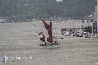
BLUE MERMAID
Sailing
Current Trip
Unknown
| Time Travelled | 1 day |
|---|---|
| Remaining Time | --- |
| Distance Travelled | 20.73 nm |
| Remaining Distance | --- |
| AVG Speed | 5.3 Knopen |
| MAX Speed | 8.1 Knopen |
| AVG Wind | 13.3 knots |
| MAX Wind | 15 knots |
| MIN Temp | 8.4°C / 47.12°F |
| MAX Temp | 15.9°C / 60.62°F |
| Diepgang | --- |
| Positie ontvangen | 3 m geleden |
Current Position
| Lengtegraad | 1.24416° |
|---|---|
| Breedtegraat | 51.88457° |
| Status | Default |
| Snelheid | 0.3 Knopen |
| Koers | --- |
| Gebied | North Sea |
| Station | T-AIS |
| Positie ontvangen | 3 m geleden |
Info
Information
The current position of BLUE MERMAID is in North Sea with coordinates 51.88457° / 1.24416° as reported on 2024-05-28 20:45 by AIS to our vessel tracker app. The vessel's current speed is 0.3 Knopen
The vessel BLUE MERMAID (MMSI: 232021168) is a Sailing It's sailing under the flag of [GB] United Kingdom.
In this page you can find informations about the vessels current position, last detected port calls, and current voyage information. If the vessels is not in coverage by AIS you will find the latest position.
The current position of BLUE MERMAID is detected by our AIS receivers and we are not responsible for the reliability of the data. The last position was recorded while the vessel was in Coverage by the Ais receivers of our vessel tracking app.
Weather
| Temperature | 14.1°C / 57.38°F |
|---|---|
| Wind Speed | 14 knots |
| Direction | 223° SW |
| Pressure | 1008.7 hPa |
| Humidity | 96.4 % |
| Cloud Coverage | 100 % |
Featured Company
Last Port Calls
| Port | Arrival | Departure | Time In Port |
|---|---|---|---|
| 2024-05-24 10:42 | 2024-05-27 12:25 | 3 d | |
| 2024-05-16 15:47 | 2024-05-21 07:38 | 4 d | |
| 2024-05-01 18:52 | 2024-05-13 16:00 | 11 d | |
| 2024-04-24 17:21 | 2024-04-29 17:24 | 5 d | |
| 2024-04-23 12:11 | 2024-04-24 14:36 | 1 d | |
| 2024-04-23 10:46 | 2024-04-23 11:42 | 56 m | |
| 2024-04-22 22:35 | 2024-04-23 08:51 | 10 h | |
| 2024-03-14 15:58 | |||
| 2024-03-11 12:09 | 2024-03-14 14:02 | 3 d | |
| 2024-03-05 18:19 |
Last Trips
| Origin | Departure | Destination | Arrival | Distance | |
|---|---|---|---|---|---|
| 2024-05-21 07:38 | 2024-05-24 10:42 | 10.70 nm | |||
| 2024-05-13 16:00 | 2024-05-16 15:47 | 45.97 nm | |||
| 2024-04-29 17:24 | 2024-05-01 18:52 | 68.18 nm | |||
| 2024-04-24 14:36 | 2024-04-24 17:21 | 16.03 nm | |||
| 2024-04-23 11:42 | 2024-04-23 12:11 | 2.66 nm | |||
| 2024-04-23 08:51 | 2024-04-23 10:46 | 7.17 nm | |||
| 2024-03-14 14:02 | 2024-04-22 22:35 | 175.13 nm | |||
| 2024-03-14 14:02 | 2024-03-14 15:58 | 4.97 nm | |||
| 2024-03-05 18:19 | 2024-03-11 12:09 | 5.99 nm |
Events
| Tijd | Evenement | Details | Positie / Bestemming | Info |
|---|---|---|---|---|
| 2024-05-28 13:30 | Stop beweging | 1.33 nm, North West of TITCHMARSH |
51.88400 / 1.24320
|
Snelheid: 0.3 kn Koers: 511° |
| 2024-05-28 10:13 | Start beweging | 3.42 nm, West of HARWICH |
51.95084 / 1.17674
|
Snelheid: 3.2 kn Koers: 89.4° |
| 2024-05-27 12:31 | Stop beweging | 3.3 nm, East of MISTLEY |
51.95053 / 1.17205
|
Snelheid: 0.1 kn Koers: 511° |
| 2024-05-27 11:25 | Vertrekhaven |
|
51.94962 / 1.27822
|
Snelheid: 6.2 kn Koers: 276.4° |
| 2024-05-27 11:23 | Start beweging |
51.94916 / 1.28234
[GB] HARWICH
|
Snelheid: 5.1 kn Koers: 288° |
|
| 2024-05-24 09:45 | Stop beweging |
51.94818 / 1.28519
[GB] HARWICH
|
Snelheid: Koers: 511° |
|
| 2024-05-24 09:42 | Aankomsthaven |
|
51.94854 / 1.28484
[GB] HARWICH
|
Snelheid: 1 kn Koers: 511° |
| 2024-05-24 09:12 | Start beweging | 0.61 nm, South of FELIXSTOWE |
51.94876 / 1.29868
|
Snelheid: 3.1 kn Koers: 348.9° |
| 2024-05-23 12:48 | Stop beweging | 0.99 nm, South of FELIXSTOWE |
51.94243 / 1.29876
|
Snelheid: 0.3 kn Koers: 511° |
| 2024-05-23 11:47 | Start beweging | 1.12 nm, South East of WOOLVERSTONE |
51.99764 / 1.22203
|
Snelheid: 3.3 kn Koers: 92.1° |