
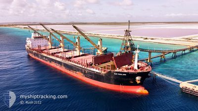
BIANCA
Bulk Carrier
Current Trip
| Time Travelled | 26 days |
|---|---|
| Remaining Time | --- |
| Distance Travelled | 7234.12 nm |
| Remaining Distance | --- |
| AVG Speed | 11.1 Knopen |
| MAX Speed | 17.9 Knopen |
| AVG Wind | 15.7 knots |
| MAX Wind | 40 knots |
| MIN Temp | 4.9°C / 40.82°F |
| MAX Temp | 27.3°C / 81.14°F |
| Diepgang | 8.7 M |
| Positie ontvangen | 7 h, 49 m geleden |
Current Position
| Lengtegraad | --- |
|---|---|
| Breedtegraat | --- |
| Status | Under way using engine |
| Snelheid | 11.3 Knopen |
| Koers | 13.9° |
| Gebied | North Atlantic Ocean |
| Station | T-AIS |
| Positie ontvangen | 7 h, 49 m geleden |
Info
Information
The current position of BIANCA is in North Atlantic Ocean with coordinates 30.40455° / -14.96470° as reported on 2025-12-06 07:57 by AIS to our vessel tracker app. The vessel's current speed is 11.3 Knopen and is heading at the port of GENT. The estimated time of arrival as calculated by MyShipTracking vessel tracking app is 2025-12-11 18:00 LT
The vessel BIANCA (IMO: 9467615, MMSI: 538005074) is a Bulk Carrier that was built in 2013 ( 12 Jaar oud ). It's sailing under the flag of [MH] Marshall Is.
In this page you can find informations about the vessels current position, last detected port calls, and current voyage information. If the vessels is not in coverage by AIS you will find the latest position.
The current position of BIANCA is detected by our AIS receivers and we are not responsible for the reliability of the data. The last position was recorded while the vessel was in Coverage by the Ais receivers of our vessel tracking app.
The current draught of BIANCA as reported by AIS is 8.7 meters
Weather
| Temperature | 19.1°C / 66.38°F |
|---|---|
| Wind Speed | 7 knots |
| Direction | 77° ENE |
| Pressure | 1022.2 hPa |
| Humidity | 61.8 % |
| Cloud Coverage | 79 % |
Featured Company
Last Port Calls
| Port | Arrival | Departure | Time In Port |
|---|---|---|---|
| 2025-11-04 22:49 | 2025-11-09 15:53 | 4 d | |
| 2025-10-27 14:37 | 2025-10-30 09:15 | 2 d | |
| 2025-10-02 22:49 | 2025-10-05 15:49 | 2 d |
Most Visited Ports (Last year)
| Port | Arrivals | |
|---|---|---|
| 2 | ||
| 1 | ||
| 1 | ||
| 1 | ||
| 1 | ||
| 1 |
Last Trips
| Origin | Departure | Destination | Arrival | Distance | |
|---|---|---|---|---|---|
| 2025-10-30 09:15 | 2025-11-04 22:49 | 330.06 nm | |||
| 2025-10-05 15:49 | 2025-10-27 14:37 | 3300.38 nm | |||
| 2025-09-28 01:05 | 2025-10-02 22:49 | 1169.09 nm |
Events
| Tijd | Evenement | Details | Positie / Bestemming | Info |
|---|---|---|---|---|
| 2025-12-06 08:00 | Status Changed | Default Under way using engine |
30.41260 / -14.96152
BE GNE
|
Snelheid: 11.3 kn Koers: 13.9° |
| 2025-12-06 07:57 | Buitenbereik |
30.40455 / -14.96470
North Atlantic Ocean
BE GNE
|
Snelheid: 11.3 kn Koers: 13.9° |
|
| 2025-12-06 05:41 | Status Changed | Under way using engine Default |
30.01040 / -15.12027
BE GNE
|
Snelheid: 11 kn Koers: 17° |
| 2025-12-06 05:36 | Status Changed | Default Under way using engine |
29.99333 / -15.12500
BE GNE
|
Snelheid: 11.2 kn Koers: 14.7° |
| 2025-12-06 05:13 | Status Changed | Under way using engine Default |
29.92940 / -15.14950
BE GNE
|
Snelheid: 10 kn Koers: 17° |
| 2025-12-06 05:09 | Status Changed | Default Under way using engine |
29.91500 / -15.15333
BE GNE
|
Snelheid: 10.8 kn Koers: 22° |
| 2025-12-06 02:40 | Status Changed | Under way using engine Default |
29.47735 / -15.32268
BE GNE
|
Snelheid: 11 kn Koers: 11° |
| 2025-12-06 02:33 | Status Changed | Default Under way using engine |
29.45333 / -15.33167
BE GNE
|
Snelheid: 11.2 kn Koers: 21.4° |
| 2025-12-06 02:29 | Status Changed | Under way using engine Default |
29.44458 / -15.33615
BE GNE
|
Snelheid: 11 kn Koers: 25° |
| 2025-12-06 02:24 | Status Changed | Default Under way using engine |
29.42667 / -15.34167
BE GNE
|
Snelheid: 11.4 kn Koers: 17.8° |