

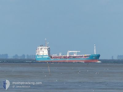
BERGEN ENERGY
Bunkering Tanker

Current Trip
| Time Travelled | 1 day |
|---|---|
| Remaining Time | --- |
| Distance Travelled | 91.40 nm |
| Remaining Distance | --- |
| AVG Speed | 7.3 Knopen |
| MAX Speed | 10 Knopen |
| AVG Wind | 3.9 knots |
| MAX Wind | 8 knots |
| MIN Temp | 2.3°C / 36.14°F |
| MAX Temp | 6.2°C / 43.16°F |
| Diepgang | 3.2 M |
| Positie ontvangen | 2 m geleden |
Current Position
| Lengtegraad | --- |
|---|---|
| Breedtegraat | --- |
| Status | Under way using engine |
| Snelheid | 8.3 Knopen |
| Koers | 316.8° |
| Gebied | North Sea |
| Station | T-AIS |
| Positie ontvangen | 2 m geleden |
Information
The current position of BERGEN ENERGY is in North Sea with coordinates 58.44087° / 5.80916° as reported on 2025-02-23 05:06 by AIS to our vessel tracker app. The vessel's current speed is 8.3 Knopen and is heading at the port of KLEPPESTO. The estimated time of arrival as calculated by MyShipTracking vessel tracking app is 2025-02-23 22:45 LT
The vessel BERGEN ENERGY (IMO: 8827052, MMSI: 258018390) is a Bunkering Tanker that was built in 1968 ( 57 Jaar oud ). It's sailing under the flag of [NO] Norway.
In this page you can find informations about the vessels current position, last detected port calls, and current voyage information. If the vessels is not in coverage by AIS you will find the latest position.
The current position of BERGEN ENERGY is detected by our AIS receivers and we are not responsible for the reliability of the data. The last position was recorded while the vessel was in Coverage by the Ais receivers of our vessel tracking app.
The current draught of BERGEN ENERGY as reported by AIS is 3.2 meters
Weather
| Temperature | 5.1°C / 41.18°F |
|---|---|
| Wind Speed | 7 knots |
| Direction | 142° SE |
| Pressure | 1015.9 hPa |
| Humidity | 93.8 % |
| Cloud Coverage | 7 % |


Featured Company
Last Port Calls
| Port | Arrival | Departure | Time In Port |
|---|---|---|---|
| 2025-02-21 20:36 | 2025-02-21 22:47 | 2 h | |
| 2025-02-21 00:29 | 2025-02-21 02:48 | 2 h | |
| 2025-02-17 05:57 | 2025-02-17 08:51 | 2 h | |
| 2025-02-16 04:31 | 2025-02-16 16:00 | 11 h | |
| 2025-02-14 07:25 | 2025-02-14 10:59 | 3 h | |
| 2025-02-10 08:37 | 2025-02-10 11:30 | 2 h | |
| 2025-02-07 09:59 | 2025-02-07 11:06 | 1 h | |
| 2025-02-06 19:53 | 2025-02-07 00:05 | 4 h | |
| 2025-02-05 21:56 | 2025-02-06 00:10 | 2 h | |
| 2025-02-05 15:35 | 2025-02-05 15:55 | 19 m |
Last Trips
| Origin | Departure | Destination | Arrival | Distance | |
|---|---|---|---|---|---|
| 2025-02-21 03:48 | 2025-02-21 21:36 | 122.33 nm | |||
| 2025-02-17 09:51 | 2025-02-21 01:29 | 208.02 nm | |||
| 2025-02-16 17:00 | 2025-02-17 06:57 | 103.08 nm | |||
| 2025-02-14 11:59 | 2025-02-16 05:31 | 283.25 nm | |||
| 2025-02-10 12:30 | 2025-02-14 08:25 | 20.20 nm | |||
| 2025-02-07 12:06 | 2025-02-10 09:37 | 92.94 nm | |||
| 2025-02-07 01:05 | 2025-02-07 10:59 | 60.21 nm | |||
| 2025-02-06 01:10 | 2025-02-06 20:53 | 137.11 nm | |||
| 2025-02-05 16:55 | 2025-02-05 22:56 | 30.62 nm | |||
| 2025-02-04 23:17 | 2025-02-05 16:35 | 135.82 nm |
Events
| Tijd | Evenement | Details | Positie / Bestemming | Info |
|---|---|---|---|---|
| 2025-02-23 03:44 | Binnenbereik |
58.31619 / 6.07510
North Sea
NO KLE
|
Snelheid: 8 kn Koers: 310.8° |
|
| 2025-02-23 02:34 | Buitenbereik |
58.21047 / 6.31818
North Sea
NO KLE
|
Snelheid: 9.3 kn Koers: 315.2° |
|
| 2025-02-23 02:26 | Status Changed | Under way using engine Default |
58.19826 / 6.34741
NO KLE
|
Snelheid: 9.4 kn Koers: 306° |
| 2025-02-23 02:25 | Status Changed | Default Under way using engine |
58.19721 / 6.34990
NO KLE
|
Snelheid: 8.9 kn Koers: 302.2° |
| 2025-02-23 02:22 | Binnenbereik |
58.21047 / 6.31818
North Sea
NO KLE
|
Snelheid: 9.3 kn Koers: 315.2° |
|
| 2025-02-23 02:15 | Status Changed | Under way using engine Default |
58.17923 / 6.39026
NO KLE
|
Snelheid: 8.9 kn Koers: 310° |
| 2025-02-23 02:13 | Status Changed | Default Under way using engine |
58.17728 / 6.39455
NO KLE
|
Snelheid: 9.6 kn Koers: 299.5° |
| 2025-02-23 02:10 | Status Changed | Under way using engine Default |
58.17192 / 6.40604
NO KLE
|
Snelheid: 9 kn Koers: 312° |
| 2025-02-23 02:09 | Status Changed | Default Under way using engine |
58.17023 / 6.40964
NO KLE
|
Snelheid: 8.7 kn Koers: 321° |
| 2025-02-23 01:13 | Buitenbereik |
58.08564 / 6.56026
North Sea
NO KLE
|
Snelheid: 7.6 kn Koers: 331.3° |