
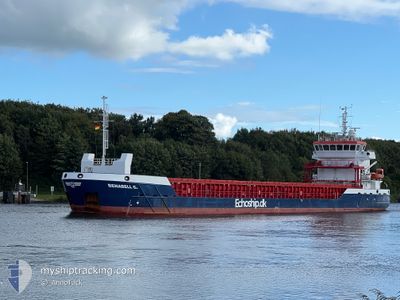
BENABELL G
Cargo
Current Trip
| Time Travelled | 1 day |
|---|---|
| Remaining Time | 1 day |
| Distance Travelled | 174.00 nm |
| Remaining Distance | 97.06 nm |
| AVG Speed | 5.1 Knopen |
| MAX Speed | 13.2 Knopen |
| AVG Wind | 32.7 knots |
| MAX Wind | 37 knots |
| MIN Temp | 3.6°C / 38.48°F |
| MAX Temp | 13.9°C / 57.02°F |
| Diepgang | 3.6 M |
| Positie ontvangen | Nu |
Current Position
| Lengtegraad | --- |
|---|---|
| Breedtegraat | --- |
| Status | Under way using engine |
| Snelheid | 3.5 Knopen |
| Koers | 203° |
| Gebied | English Channel |
| Station | T-AIS |
| Positie ontvangen | Nu |
Info
Information
The current position of BENABELL G is in English Channel with coordinates 49.85084° / -0.09122° as reported on 2024-11-23 21:20 by AIS to our vessel tracker app. The vessel's current speed is 3.5 Knopen and is heading at the port of ROUEN. The estimated time of arrival as calculated by MyShipTracking vessel tracking app is 2024-11-25 06:21 LT
The vessel BENABELL G (IMO: 9864772, MMSI: 305919000) is a Cargo It's sailing under the flag of [AG] Antigua Barbuda.
In this page you can find informations about the vessels current position, last detected port calls, and current voyage information. If the vessels is not in coverage by AIS you will find the latest position.
The current position of BENABELL G is detected by our AIS receivers and we are not responsible for the reliability of the data. The last position was recorded while the vessel was in Coverage by the Ais receivers of our vessel tracking app.
The current draught of BENABELL G as reported by AIS is 3.6 meters
Weather
| Temperature | 13.9°C / 57.02°F |
|---|---|
| Wind Speed | 33 knots |
| Direction | 201° SSW |
| Pressure | 1004.4 hPa |
| Humidity | 80.1 % |
| Cloud Coverage | 100 % |
Featured Company
Last Port Calls
| Port | Arrival | Departure | Time In Port |
|---|---|---|---|
| 2024-11-20 13:48 | 2024-11-22 17:35 | 2 d | |
| 2024-11-13 00:48 | 2024-11-14 16:03 | 1 d | |
| 2024-11-10 14:15 | 2024-11-12 10:42 | 1 d | |
| 2024-11-06 10:54 | 2024-11-07 15:44 | 1 d | |
| 2024-11-02 05:43 | 2024-11-04 19:50 | 2 d | |
| 2024-10-30 14:47 | 2024-10-31 16:04 | 1 d | |
| 2024-10-25 23:55 | 2024-10-28 14:42 | 2 d | |
| 2024-10-11 20:48 | 2024-10-13 17:44 | 1 d | |
| 2024-10-09 22:54 | 2024-10-10 13:12 | 14 h | |
| 2024-09-30 14:41 | 2024-09-30 15:01 | 20 m |
Most Visited Ports (Last year)
| Port | Arrivals | |
|---|---|---|
| 7 | ||
| 5 | ||
| 4 | ||
| 4 | ||
| 3 | ||
| 3 |
Last Trips
| Origin | Departure | Destination | Arrival | Distance | |
|---|---|---|---|---|---|
| 2024-11-14 17:03 | 2024-11-20 13:48 | 622.52 nm | |||
| 2024-11-12 11:42 | 2024-11-13 01:48 | 115.86 nm | |||
| 2024-11-07 15:44 | 2024-11-10 15:15 | 580.59 nm | |||
| 2024-11-04 19:50 | 2024-11-06 10:54 | 206.24 nm | |||
| 2024-10-31 16:04 | 2024-11-02 05:43 | 243.59 nm | |||
| 2024-10-28 15:42 | 2024-10-30 14:47 | 453.44 nm | |||
| 2024-10-13 20:44 | 2024-10-26 01:55 | 1620.86 nm | |||
| 2024-10-10 15:12 | 2024-10-11 23:48 | 256.93 nm | |||
| 2024-09-30 16:01 | 2024-10-10 00:54 | 1411.33 nm | |||
| 2024-09-28 02:31 | 2024-09-30 15:41 | 0.69 nm |
Events
| Tijd | Evenement | Details | Positie / Bestemming | Info |
|---|---|---|---|---|
| 2024-11-23 17:36 | Start beweging | 17.3 nm, North West of FECAMP |
49.98063 / .08223
FRURO
|
Snelheid: 3.1 kn Koers: 213° |
| 2024-11-23 17:30 | Stop beweging | 17.35 nm, North West of FECAMP |
49.98239 / .08359
FRURO
|
Snelheid: 0.2 kn Koers: 202° |
| 2024-11-23 17:28 | Start beweging | 17.36 nm, North West of FECAMP |
49.98364 / .08537
FRURO
|
Snelheid: 3.2 kn Koers: 212° |
| 2024-11-23 16:23 | Stop beweging | 17.84 nm, North West of FECAMP |
50.00454 / .10705
FRURO
|
Snelheid: Koers: 210° |
| 2024-11-23 16:16 | Start beweging | 17.91 nm, North West of FECAMP |
50.00657 / .10860
FRURO
|
Snelheid: 3.2 kn Koers: 205° |
| 2024-11-23 15:24 | Stop beweging | 18.75 nm, North West of FECAMP |
50.02713 / .11762
FRURO
|
Snelheid: 0.3 kn Koers: 209° |
| 2024-11-23 15:20 | Start beweging | 18.69 nm, North West of FECAMP |
50.02677 / .11926
FRURO
|
Snelheid: 3.1 kn Koers: 255° |
| 2024-11-23 13:48 | Stop beweging | 19.52 nm, North West of FECAMP |
50.04545 / .12644
FRURO
|
Snelheid: 0.1 kn Koers: 215° |
| 2024-11-23 13:20 | Start beweging | 20.68 nm, North West of FECAMP |
50.05943 / .10408
FRURO
|
Snelheid: 3.1 kn Koers: 172° |
| 2024-11-23 12:53 | Stop beweging | 21.12 nm, North West of FECAMP |
50.06826 / .10522
FRURO
|
Snelheid: 0.2 kn Koers: 203° |