
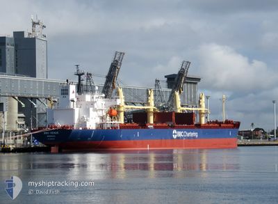
BBC VENUS
Cargo
Current Trip
| Trip Time | 5 days |
|---|---|
| Trip Distance | 977.46 nm |
| AVG Speed | 10.9 Knopen |
| MAX Speed | 14.5 Knopen |
| Diepgang | 9.8 M |
| AVG Wind | 13.2 knots |
| MAX Wind | 22.9 knots |
| MIN Temp | 14.9°C / 58.82°F |
| MAX Temp | 20.3°C / 68.54°F |
| Positie ontvangen | 6 d geleden |
Current Position
| Lengtegraad | -5.66728° |
|---|---|
| Breedtegraat | 35.95031° |
| Status | Under way using engine |
| Snelheid | 11.5 Knopen |
| Koers | 274.8° |
| Gebied | Strait of Gibraltar |
| Station | T-AIS |
| Positie ontvangen | 6 d geleden |
Info
Information
The current position of BBC VENUS is in Strait of Gibraltar with coordinates 35.95031° / -5.66728° as reported on 2024-05-17 08:11 by AIS to our vessel tracker app. The vessel's current speed is 11.5 Knopen and is currently inside the port of SAFI.
The vessel BBC VENUS (IMO: 9965590, MMSI: 636093229) is a Cargo It's sailing under the flag of [LR] Liberia.
In this page you can find informations about the vessels current position, last detected port calls, and current voyage information. If the vessels is not in coverage by AIS you will find the latest position.
The current position of BBC VENUS is detected by our AIS receivers and we are not responsible for the reliability of the data. The last position was recorded while the vessel was in Coverage by the Ais receivers of our vessel tracking app.
The current draught of BBC VENUS as reported by AIS is 9.8 meters
Weather
| Temperature | 19.8°C / 67.64°F |
|---|---|
| Wind Speed | 22 knots |
| Direction | 352° N |
| Pressure | 1014.5 hPa |
| Humidity | 70.1 % |
| Cloud Coverage | --- |
Featured Company
Last Trips
Events
| Tijd | Evenement | Details | Positie / Bestemming | Info |
|---|---|---|---|---|
| 2024-05-20 12:24 | Stop beweging |
32.30667 / -9.24833
[MA] SAFI
|
Snelheid: Koers: -1° |
|
| 2024-05-20 12:15 | Aankomsthaven |
|
32.31333 / -9.25333
[MA] SAFI
|
Snelheid: 3 kn Koers: -1° |
| 2024-05-20 12:03 | Start beweging | 0.96 nm, West of SAFI |
32.31667 / -9.26833
MASFI
|
Snelheid: 4 kn Koers: -1° |
| 2024-05-18 06:45 | Stop beweging | 3.19 nm, West of SAFI |
32.30500 / -9.31333
MASFI
|
Snelheid: Koers: -1° |
| 2024-05-17 08:18 | Status Changed | Default Under way using engine |
35.94868 / -5.69770
MASFI
|
Snelheid: 11.5 kn Koers: 274.8° |
| 2024-05-17 08:11 | Buitenbereik |
35.95031 / -5.66728
Strait of Gibraltar
MASFI
|
Snelheid: 11.5 kn Koers: 274.8° |
|
| 2024-05-17 08:02 | Status Changed | Under way using engine Default |
35.95002 / -5.63526
MASFI
|
Snelheid: 10.9 kn Koers: 252° |
| 2024-05-17 07:58 | Status Changed | Default Under way using engine |
35.95374 / -5.62068
MASFI
|
Snelheid: 10.7 kn Koers: 252.3° |
| 2024-05-17 06:54 | ETA Changed | 2024/05/18 08:00 2024/05/18 03:00 |
36.01026 / -5.41275
MASFI
|
Snelheid: 8.9 kn Koers: 252.5° |
| 2024-05-17 06:32 | Gevonden in zee | Spanish part of the Strait of Gibraltar |
36.02702 / -5.35005
Strait of Gibraltar
MASFI
|
Snelheid: 8.4 kn Koers: 252.9° |