
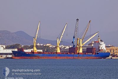
BBC RAINBOW
General Cargo
Current Trip
| Time Travelled | 24 days |
|---|---|
| Remaining Time | --- |
| Distance Travelled | 6207.56 nm |
| Remaining Distance | --- |
| AVG Speed | 11.6 Knopen |
| MAX Speed | 15.3 Knopen |
| AVG Wind | 15 knots |
| MAX Wind | 36 knots |
| MIN Temp | 7.2°C / 44.96°F |
| MAX Temp | 29.8°C / 85.64°F |
| Diepgang | 8.4 M |
| Positie ontvangen | 14 d geleden |
Current Position
| Lengtegraad | -17.54273° |
|---|---|
| Breedtegraat | 23.17016° |
| Status | Under way using engine |
| Snelheid | 13.4 Knopen |
| Koers | 205.4° |
| Gebied | North Atlantic Ocean |
| Station | T-AIS |
| Positie ontvangen | 14 d geleden |
Info
Information
The current position of BBC RAINBOW is in North Atlantic Ocean with coordinates 23.17016° / -17.54273° as reported on 2024-04-13 12:19 by AIS to our vessel tracker app. The vessel's current speed is 13.4 Knopen
The vessel BBC RAINBOW (IMO: 9423516, MMSI: 352001219) is a General Cargo that was built in 2010 ( 14 Jaar oud ). It's sailing under the flag of [PA] Panama.
In this page you can find informations about the vessels current position, last detected port calls, and current voyage information. If the vessels is not in coverage by AIS you will find the latest position.
The current position of BBC RAINBOW is detected by our AIS receivers and we are not responsible for the reliability of the data. The last position was recorded while the vessel was in Coverage by the Ais receivers of our vessel tracking app.
The current draught of BBC RAINBOW as reported by AIS is 8.4 meters
Weather
| Temperature | 18.5°C / 65.3°F |
|---|---|
| Wind Speed | 13 knots |
| Direction | 193° SSW |
| Pressure | 1009.6 hPa |
| Humidity | 66 % |
| Cloud Coverage | 40 % |
Featured Company
Last Port Calls
| Port | Arrival | Departure | Time In Port |
|---|---|---|---|
| 2024-04-03 10:25 | 2024-04-03 12:09 | 1 h | |
| 2024-03-29 04:29 | 2024-04-01 16:27 | 3 d | |
| 2024-03-27 16:43 | 2024-03-27 16:47 | 4 m | |
| 2024-03-23 22:19 | 2024-03-24 14:21 | 16 h | |
| 2024-03-09 13:46 | 2024-03-10 11:43 | 21 h | |
| 2024-02-20 16:52 | 2024-02-26 14:06 | 5 d |
Most Visited Ports (Last year)
| Port | Arrivals | |
|---|---|---|
| 3 | ||
| 2 | ||
| 2 | ||
| 1 | ||
| 1 | ||
| 1 |
Last Trips
| Origin | Departure | Destination | Arrival | Distance | |
|---|---|---|---|---|---|
| 2024-04-01 19:27 | 2024-04-03 12:25 | 463.66 nm | |||
| 2024-03-27 17:47 | 2024-03-29 06:29 | 408.56 nm | |||
| 2024-03-24 15:21 | 2024-03-27 17:43 | 939.19 nm | |||
| 2024-03-10 07:43 | 2024-03-23 23:19 | 4239.28 nm | |||
| 2024-02-26 09:06 | 2024-03-09 08:46 | 1140.23 nm | |||
| 2024-01-29 12:35 | 2024-02-20 11:52 | 7058.64 nm |
Events
| Tijd | Evenement | Details | Positie / Bestemming | Info |
|---|---|---|---|---|
| 2024-04-26 20:03 | Stop beweging | 3.84 nm, North of WALVIS BAY |
-22.88024 / 14.47397
NLVLI>NAWVB
|
Snelheid: 0.2 kn Koers: 198° |
| 2024-04-26 02:03 | Start beweging |
-22.06216 / 13.76097
NLVLI>NAWVB
|
Snelheid: 4.8 kn Koers: 175° |
|
| 2024-04-26 01:48 | Stop beweging |
-22.05333 / 13.76333
NLVLI>NAWVB
|
Snelheid: Koers: -1° |
|
| 2024-04-25 19:03 | Start beweging |
-22.72304 / 13.87716
NLVLI>NAWVB
|
Snelheid: 5.3 kn Koers: 59° |
|
| 2024-04-25 16:59 | Stop beweging |
-22.77163 / 13.86739
NLVLI>NAWVB
|
Snelheid: 0.1 kn Koers: 96° |