
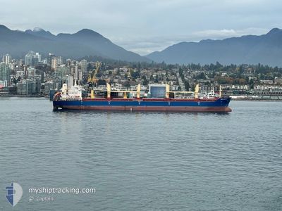
BBC JUPITER
Bulk Carrier
Current Trip
REREU
| Time Travelled | 43 days |
|---|---|
| Remaining Time | --- |
| Distance Travelled | 5564.50 nm |
| Remaining Distance | --- |
| AVG Speed | 10.5 Knopen |
| MAX Speed | 13.9 Knopen |
| AVG Wind | 14.3 knots |
| MAX Wind | 32.8 knots |
| MIN Temp | 15.3°C / 59.54°F |
| MAX Temp | 30°C / 86°F |
| Diepgang | 10.2 M |
| Positie ontvangen | 2025-11-14 03:07 |
Current Position
| Lengtegraad | --- |
|---|---|
| Breedtegraat | --- |
| Status | Under way using engine |
| Snelheid | 10.2 Knopen |
| Koers | 118.6° |
| Gebied | South Atlantic Ocean |
| Station | T-AIS |
| Positie ontvangen | 2025-11-14 03:07 |
Info
Information
The current position of BBC JUPITER is in South Atlantic Ocean with coordinates -34.57218° / 18.40260° as reported on 2025-11-14 03:07 by AIS to our vessel tracker app. The vessel's current speed is 10.2 Knopen
The vessel BBC JUPITER (IMO: 9577630, MMSI: 304137000) is a Bulk Carrier that was built in 2014 ( 12 Jaar oud ). It's sailing under the flag of [AG] Antigua Barbuda.
In this page you can find informations about the vessels current position, last detected port calls, and current voyage information. If the vessels is not in coverage by AIS you will find the latest position.
The current position of BBC JUPITER is detected by our AIS receivers and we are not responsible for the reliability of the data. The last position was recorded while the vessel was in Coverage by the Ais receivers of our vessel tracking app.
The current draught of BBC JUPITER as reported by AIS is 10.2 meters
Weather
| Temperature | 19.7°C / 67.46°F |
|---|---|
| Wind Speed | 8 knots |
| Direction | 115° ESE |
| Pressure | 1021 hPa |
| Humidity | 20.6 % |
| Cloud Coverage | 6 % |
Featured Company
Most Visited Ports (Last year)
| Port | Arrivals | |
|---|---|---|
| 2 | ||
| 1 | ||
| 1 | ||
| 1 | ||
| 1 | ||
| 1 |
Events
| Tijd | Evenement | Details | Positie / Bestemming | Info |
|---|---|---|---|---|
| 2026-01-09 06:35 | Stop beweging | 13.74 nm, East of SHUIDONG |
21.43390 / 111.28764
REREU
|
Snelheid: Koers: 44° |
| 2026-01-09 03:24 | Start beweging |
21.14947 / 111.23797
REREU
|
Snelheid: 4.6 kn Koers: 62° |
|
| 2026-01-09 00:31 | Stop beweging |
21.14800 / 111.23416
REREU
|
Snelheid: 0.3 kn Koers: 144° |
|
| 2026-01-03 09:34 | Start beweging | 3.12 nm, North East of SINGAPORE |
1.27961 / 103.90167
REREU
|
Snelheid: 3.2 kn Koers: 111° |
| 2026-01-02 12:30 | Stop beweging | 2.9 nm, North East of SINGAPORE |
1.27845 / 103.89819
REREU
|
Snelheid: 0.3 kn Koers: 53° |
| 2026-01-02 11:40 | Start beweging | 5.4 nm, South West of TANAH MERAH |
1.25499 / 103.94835
REREU
|
Snelheid: 4 kn Koers: 308° |
| 2026-01-02 11:21 | Stop beweging | 5.34 nm, South West of TANAH MERAH |
1.25297 / 103.95122
REREU
|
Snelheid: 0.2 kn Koers: 8° |