
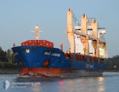
BBC DANUBE
General Cargo
Current Trip
| Time Travelled | 32 days |
|---|---|
| Remaining Time | --- |
| Distance Travelled | 7681.12 nm |
| Remaining Distance | --- |
| AVG Speed | 12.4 Knopen |
| MAX Speed | 14.9 Knopen |
| AVG Wind | 12.2 knots |
| MAX Wind | 30 knots |
| MIN Temp | -4.8°C / 23.36°F |
| MAX Temp | 29.1°C / 84.38°F |
| Diepgang | 7.9 M |
| Positie ontvangen | 21 d geleden |
Current Position
| Lengtegraad | -21.05303° |
|---|---|
| Breedtegraat | 16.19277° |
| Status | Under way using engine |
| Snelheid | 13 Knopen |
| Koers | 326.4° |
| Gebied | North Atlantic Ocean |
| Station | T-AIS |
| Positie ontvangen | 21 d geleden |
Info
Information
The current position of BBC DANUBE is in North Atlantic Ocean with coordinates 16.19277° / -21.05303° as reported on 2024-04-14 08:59 by AIS to our vessel tracker app. The vessel's current speed is 13 Knopen and is heading at the port of PORT CARTIER.
The vessel BBC DANUBE (IMO: 9571399, MMSI: 305756000) is a General Cargo that was built in 2012 ( 12 Jaar oud ). It's sailing under the flag of [AG] Antigua Barbuda.
In this page you can find informations about the vessels current position, last detected port calls, and current voyage information. If the vessels is not in coverage by AIS you will find the latest position.
The current position of BBC DANUBE is detected by our AIS receivers and we are not responsible for the reliability of the data. The last position was recorded while the vessel was in Coverage by the Ais receivers of our vessel tracking app.
The current draught of BBC DANUBE as reported by AIS is 7.9 meters
Weather
| Temperature | 10.8°C / 51.44°F |
|---|---|
| Wind Speed | 6 knots |
| Direction | 186° S |
| Pressure | 1027.9 hPa |
| Humidity | 66.8 % |
| Cloud Coverage | 78 % |
Featured Company
Most Visited Ports (Last year)
| Port | Arrivals | |
|---|---|---|
| 2 | ||
| 2 | ||
| 2 | ||
| 2 | ||
| 1 | ||
| 1 |
Events
| Tijd | Evenement | Details | Positie / Bestemming | Info |
|---|---|---|---|---|
| 2024-05-05 15:47 | Stop beweging | 7.25 nm, South West of CANAPORT LNG |
45.13668 / -66.11805
CAPCA
|
Snelheid: 0.1 kn Koers: 74° |
| 2024-05-01 23:01 | Start beweging | 1.66 nm, South West of PORT CARTIER |
50.00709 / -66.81220
CAPCA
|
Snelheid: 4.2 kn Koers: 143° |