
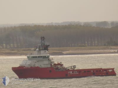
BB OCTOPUS
Anchor Handling Vessel
Current Trip
PENGUINS FIELD
| Time Travelled | 11 days |
|---|---|
| Remaining Time | --- |
| Distance Travelled | 552.28 nm |
| Remaining Distance | --- |
| AVG Speed | 7.5 Knopen |
| MAX Speed | 11.5 Knopen |
| AVG Wind | 13.8 knots |
| MAX Wind | 33 knots |
| MIN Temp | 3.5°C / 38.3°F |
| MAX Temp | 8.3°C / 46.94°F |
| Diepgang | 6.6 M |
| Positie ontvangen | 1 m geleden |
Current Position
| Lengtegraad | 1.59518° |
|---|---|
| Breedtegraat | 61.60172° |
| Status | Under way using engine |
| Snelheid | 0.4 Knopen |
| Koers | 116° |
| Gebied | Norwegian Sea |
| Station | T-AIS |
| Positie ontvangen | 1 m geleden |
Info
Information
The current position of BB OCTOPUS is in Norwegian Sea with coordinates 61.60172° / 1.59518° as reported on 2024-04-27 14:11 by AIS to our vessel tracker app. The vessel's current speed is 0.4 Knopen
The vessel BB OCTOPUS (IMO: 9355771, MMSI: 258184000) is a Anchor Handling Vessel that was built in 2006 ( 18 Jaar oud ). It's sailing under the flag of [NO] Norway.
In this page you can find informations about the vessels current position, last detected port calls, and current voyage information. If the vessels is not in coverage by AIS you will find the latest position.
The current position of BB OCTOPUS is detected by our AIS receivers and we are not responsible for the reliability of the data. The last position was recorded while the vessel was in Coverage by the Ais receivers of our vessel tracking app.
The current draught of BB OCTOPUS as reported by AIS is 6.6 meters
Weather
| Temperature | 7.7°C / 45.86°F |
|---|---|
| Wind Speed | 9 knots |
| Direction | 65° ENE |
| Pressure | 1014.6 hPa |
| Humidity | 67.4 % |
| Cloud Coverage | 100 % |
Featured Company
Last Port Calls
| Port | Arrival | Departure | Time In Port |
|---|---|---|---|
| 2024-03-29 11:08 | 2024-04-16 05:17 | 17 d | |
| 2024-03-10 13:13 | 2024-03-10 13:46 | 33 m | |
| 2024-03-08 02:32 | 2024-03-09 01:17 | 22 h | |
| 2024-02-27 16:34 | 2024-02-28 03:33 | 10 h | |
| 2024-02-17 08:10 | 2024-02-27 03:07 | 9 d | |
| 2024-02-11 03:28 |
Last Trips
| Origin | Departure | Destination | Arrival | Distance | |
|---|---|---|---|---|---|
| 2024-03-10 13:46 | 2024-03-29 11:08 | 318.83 nm | |||
| 2024-03-09 01:17 | 2024-03-10 13:13 | 153.19 nm | |||
| 2024-02-28 03:33 | 2024-03-08 02:32 | 599.72 nm | |||
| 2024-02-27 03:07 | 2024-02-27 16:34 | 8.36 nm | |||
| 2024-02-11 03:28 | 2024-02-17 08:10 | 500.53 nm |
Events
| Tijd | Evenement | Details | Positie / Bestemming | Info |
|---|---|---|---|---|
| 2024-04-27 13:18 | Status Changed | Under way using engine Default |
61.60316 / 1.57552
PENGUINS FIELD
|
Snelheid: 0.8 kn Koers: 82° |
| 2024-04-27 13:16 | Status Changed | Default Under way using engine |
61.60309 / 1.57460
PENGUINS FIELD
|
Snelheid: 0.7 kn Koers: 100° |
| 2024-04-27 12:22 | Status Changed | Under way using engine Restricted manoeuverability |
61.59780 / 1.56559
PENGUINS FIELD
|
Snelheid: 0.9 kn Koers: 69° |
| 2024-04-27 10:07 | Status Changed | Restricted manoeuverability Default |
61.58941 / 1.55250
PENGUINS FIELD
|
Snelheid: 0.3 kn Koers: 284° |
| 2024-04-27 09:54 | Binnenbereik |
61.58941 / 1.55250
Norwegian Sea
|
Snelheid: 0.2 kn Koers: 142.8° |
|
| 2024-04-27 02:57 | Stop beweging |
61.59500 / 1.54500
PENGUINS FIELD
|
Snelheid: Koers: -1° |
|
| 2024-04-27 01:59 | Start beweging |
61.58939 / 1.47954
PENGUINS FIELD
|
Snelheid: 3.1 kn Koers: 30° |
|
| 2024-04-26 19:48 | Status Changed | Default Under way using engine |
61.61167 / 1.49167
PENGUINS FIELD
|
Snelheid: 0.9 kn Koers: 262° |
| 2024-04-26 19:44 | Status Changed | Under way using engine Default |
61.61150 / 1.49218
PENGUINS FIELD
|
Snelheid: Koers: -1° |
| 2024-04-26 19:44 | Buitenbereik |
61.61150 / 1.49218
Norwegian Sea
|
Snelheid: 0.9 kn Koers: 358.9° |