

BARRINGTON ISLAND
Reefer

Current Trip
SRPBM
| Time Travelled | 5 days |
|---|---|
| Remaining Time | --- |
| Distance Travelled | 2093.78 nm |
| Remaining Distance | --- |
| AVG Speed | 15.6 Knopen |
| MAX Speed | 19.5 Knopen |
| AVG Wind | 11.3 knots |
| MAX Wind | 21 knots |
| MIN Temp | 22.3°C / 72.14°F |
| MAX Temp | 30.7°C / 87.26°F |
| Diepgang | 7.2 M |
| Positie ontvangen | 2 d geleden |
Current Position
| Lengtegraad | --- |
|---|---|
| Breedtegraat | --- |
| Status | Under way using engine |
| Snelheid | 16.2 Knopen |
| Koers | 52.8° |
| Gebied | Caribbean Sea |
| Station | T-AIS |
| Positie ontvangen | 2 d geleden |
Information
The current position of BARRINGTON ISLAND is in Caribbean Sea with coordinates 12.70703° / -75.57099° as reported on 2025-03-27 04:40 by AIS to our vessel tracker app. The vessel's current speed is 16.2 Knopen
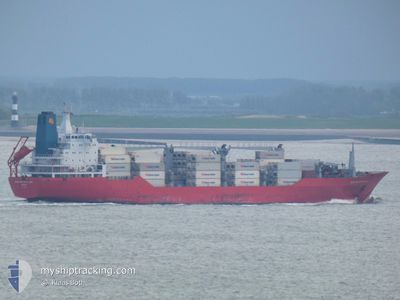
The vessel BARRINGTON ISLAND (IMO: 9059614, MMSI: 308701000) is a Reefer that was built in 1993 ( 32 Jaar oud ). It's sailing under the flag of [BS] Bahamas.
In this page you can find informations about the vessels current position, last detected port calls, and current voyage information. If the vessels is not in coverage by AIS you will find the latest position.
The current position of BARRINGTON ISLAND is detected by our AIS receivers and we are not responsible for the reliability of the data. The last position was recorded while the vessel was in Coverage by the Ais receivers of our vessel tracking app.
The current draught of BARRINGTON ISLAND as reported by AIS is 7.2 meters
Weather
| Temperature | 24.9°C / 76.82°F |
|---|---|
| Wind Speed | 21 knots |
| Direction | 75° ENE |
| Pressure | 1018.3 hPa |
| Humidity | 76.1 % |
| Cloud Coverage | 100 % |


Featured Company
Last Port Calls
| Port | Arrival | Departure | Time In Port |
|---|---|---|---|
| 2025-03-22 21:31 | 2025-03-23 06:45 | 9 h | |
| 2025-03-18 11:40 | 2025-03-21 01:29 | 2 d | |
| 2025-03-09 04:10 | 2025-03-10 00:52 | 20 h | |
| 2025-03-06 09:51 | 2025-03-08 11:00 | 2 d | |
| 2025-03-04 04:56 | 2025-03-04 12:48 | 7 h | |
| 2025-03-03 05:16 | 2025-03-03 14:35 | 9 h | |
| 2025-02-21 13:43 | 2025-02-22 03:22 | 13 h | |
| 2025-02-18 03:49 | 2025-02-20 17:55 | 2 d | |
| 2025-02-17 06:17 | 2025-02-17 18:51 | 12 h | |
| 2025-02-01 21:49 | 2025-02-02 07:16 | 9 h |
Most Visited Ports (Last year)
| Port | Arrivals | |
|---|---|---|
| 9 | ||
| 7 | ||
| 7 | ||
| 6 | ||
| 6 | ||
| 6 |
Last Trips
| Origin | Departure | Destination | Arrival | Distance | |
|---|---|---|---|---|---|
| 2025-03-21 01:29 | 2025-03-22 21:31 | 331.41 nm | |||
| 2025-03-10 00:52 | 2025-03-18 11:40 | 2331.49 nm | |||
| 2025-03-08 11:00 | 2025-03-09 04:10 | 216.50 nm | |||
| 2025-03-04 12:48 | 2025-03-06 09:51 | 655.83 nm | |||
| 2025-03-03 14:35 | 2025-03-04 04:56 | 122.75 nm | |||
| 2025-02-22 03:22 | 2025-03-03 05:16 | 3764.94 nm | |||
| 2025-02-20 17:55 | 2025-02-21 13:43 | 267.33 nm | |||
| 2025-02-17 18:51 | 2025-02-18 03:49 | 97.62 nm | |||
| 2025-02-02 07:16 | 2025-02-17 06:17 | 5757.08 nm | |||
| 2025-01-31 00:54 | 2025-02-01 21:49 | 330.81 nm |
Events
| Tijd | Evenement | Details | Positie / Bestemming | Info |
|---|---|---|---|---|
| 2025-03-27 04:45 | Status Changed | Default Under way using engine |
12.71956 / -75.55376
SRPBM
|
Snelheid: 16.2 kn Koers: 52.8° |
| 2025-03-27 04:40 | Buitenbereik |
12.70703 / -75.57099
Caribbean Sea
|
Snelheid: 16.2 kn Koers: 52.8° |
|
| 2025-03-27 00:50 | Status Changed | Under way using engine Default |
12.07814 / -76.45893
SRPBM
|
Snelheid: 16.8 kn Koers: 55° |
| 2025-03-27 00:47 | Status Changed | Default Under way using engine |
12.06898 / -76.47219
SRPBM
|
Snelheid: 16.7 kn Koers: 55° |
| 2025-03-27 00:31 | Status Changed | Under way using engine Default |
12.02452 / -76.53619
SRPBM
|
Snelheid: 16.6 kn Koers: 55° |
| 2025-03-26 23:51 | Status Changed | Default Under way using engine |
11.91528 / -76.68755
SRPBM
|
Snelheid: 16.4 kn Koers: 54.6° |
| 2025-03-26 23:40 | Wijzig zee gebeid | Colombian part of the Caribbean Sea Panamanian part of the Caribbean Sea |
11.88456 / -76.73049
Caribbean Sea
|
Snelheid: 16.4 kn Koers: 54.6° |
| 2025-03-26 23:38 | Status Changed | Under way using engine Default |
11.88061 / -76.73614
SRPBM
|
Snelheid: 16.3 kn Koers: 54° |
| 2025-03-26 23:38 | Binnenbereik |
11.88456 / -76.73049
Caribbean Sea
|
Snelheid: 16.4 kn Koers: 54.6° |
|
| 2025-03-26 09:43 | Buitenbereik |
9.48164 / -79.88171
Caribbean Sea
|
Snelheid: 15.1 kn Koers: 41.8° |