
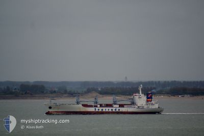
BALTIC PERFORMER
Reefer
Current Trip
| Time Travelled | 5 days |
|---|---|
| Remaining Time | --- |
| Distance Travelled | 2496.50 nm |
| Remaining Distance | --- |
| AVG Speed | 17.4 Knopen |
| MAX Speed | 19.7 Knopen |
| AVG Wind | 18.4 knots |
| MAX Wind | 28 knots |
| MIN Temp | 9.9°C / 49.82°F |
| MAX Temp | 28.7°C / 83.66°F |
| Diepgang | 8.3 M |
| Positie ontvangen | 4 d geleden |
Current Position
| Lengtegraad | -56.84605° |
|---|---|
| Breedtegraat | -37.82400° |
| Status | Under way using engine |
| Snelheid | 18.2 Knopen |
| Koers | 42.7° |
| Gebied | South Atlantic Ocean |
| Station | T-AIS |
| Positie ontvangen | 4 d geleden |
Info
Information
The current position of BALTIC PERFORMER is in South Atlantic Ocean with coordinates -37.82400° / -56.84605° as reported on 2024-05-02 22:09 by AIS to our vessel tracker app. The vessel's current speed is 18.2 Knopen and is heading at the port of TALLINN OLD HARBOR. The estimated time of arrival as calculated by MyShipTracking vessel tracking app is 2024-05-21 12:00 LT
The vessel BALTIC PERFORMER (IMO: 9016674, MMSI: 311000972) is a Reefer that was built in 1992 ( 32 Jaar oud ). It's sailing under the flag of [BS] Bahamas.
In this page you can find informations about the vessels current position, last detected port calls, and current voyage information. If the vessels is not in coverage by AIS you will find the latest position.
The current position of BALTIC PERFORMER is detected by our AIS receivers and we are not responsible for the reliability of the data. The last position was recorded while the vessel was in Coverage by the Ais receivers of our vessel tracking app.
The current draught of BALTIC PERFORMER as reported by AIS is 8.3 meters
Weather
| Temperature | 28.6°C / 83.48°F |
|---|---|
| Wind Speed | 15 knots |
| Direction | 121° ESE |
| Pressure | 1010.4 hPa |
| Humidity | 75.2 % |
| Cloud Coverage | 100 % |
Featured Company
Last Port Calls
| Port | Arrival | Departure | Time In Port |
|---|---|---|---|
| 2024-04-24 04:18 | 2024-05-01 19:49 | 7 d | |
| 2024-03-30 15:14 | 2024-04-04 20:41 | 5 d | |
| 2024-03-10 09:15 |
Most Visited Ports (Last year)
| Port | Arrivals | |
|---|---|---|
| 4 | ||
| 4 | ||
| 2 | ||
| 1 | ||
| 1 | ||
| 1 |
Last Trips
| Origin | Departure | Destination | Arrival | Distance | |
|---|---|---|---|---|---|
| 2024-04-04 23:41 | 2024-04-24 01:18 | 8081.83 nm | |||
| 2024-03-10 04:15 | 2024-03-30 18:14 | 7302.55 nm |
Events
| Tijd | Evenement | Details | Positie / Bestemming | Info |
|---|---|---|---|---|
| 2024-05-02 22:10 | Status Changed | Default Under way using engine |
-37.81786 / -56.83919
AR SAE ==> EE TLL
|
Snelheid: 18.2 kn Koers: 42.7° |
| 2024-05-02 22:09 | Buitenbereik |
-37.82400 / -56.84605
South Atlantic Ocean
AR SAE ==> EE TLL
|
Snelheid: 18.2 kn Koers: 42.7° |
|
| 2024-05-02 19:40 | Draught Changed | 8.3 6.8 |
-38.33608 / -57.55606
AR SAE ==> EE TLL
|
Snelheid: 18.7 kn Koers: 50.2° |
| 2024-05-02 19:40 | Destination Changed | AR SAE ==> EE TLL AR SAE |
-38.33608 / -57.55606
AR SAE ==> EE TLL
|
Snelheid: 18.7 kn Koers: 50.2° |
| 2024-05-02 19:40 | ETA Changed | 2024/05/21 12:00 2024/04/24 01:00 |
-38.33608 / -57.55606
AR SAE ==> EE TLL
|
Snelheid: 18.7 kn Koers: 50.2° |
| 2024-05-02 18:42 | Status Changed | Under way using engine Default |
-38.50968 / -57.86300
AR SAE
|
Snelheid: 18.2 kn Koers: 53° |
| 2024-05-02 18:40 | Binnenbereik |
-38.50968 / -57.86300
South Atlantic Ocean
|
Snelheid: 18.3 kn Koers: 52° |
|
| 2024-05-01 19:49 | Vertrekhaven |
|
-40.80230 / -64.90802
AR SAE
|
Snelheid: 4.8 kn Koers: 255° |
| 2024-05-01 19:44 | Start beweging |
-40.79773 / -64.89884
[AR] SAN ANTONIO OESTE
|
Snelheid: 4.8 kn Koers: 255° |