

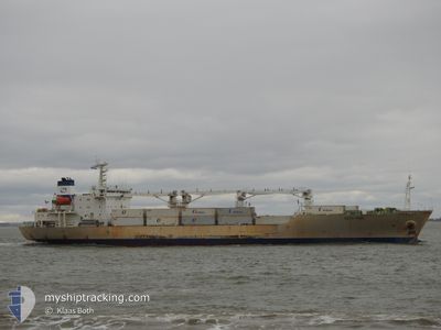
BALTIC PEARL
Reefer

Current Trip
| Time Travelled | 5 days |
|---|---|
| Remaining Time | --- |
| Distance Travelled | 2292.71 nm |
| Remaining Distance | --- |
| AVG Speed | 17 Knopen |
| MAX Speed | 20.8 Knopen |
| AVG Wind | 19.6 knots |
| MAX Wind | 36 knots |
| MIN Temp | 0.2°C / 32.36°F |
| MAX Temp | 13.7°C / 56.66°F |
| Diepgang | 6.5 M |
| Positie ontvangen | 1 d geleden |
Current Position
| Lengtegraad | --- |
|---|---|
| Breedtegraat | --- |
| Status | Under way using engine |
| Snelheid | 17.8 Knopen |
| Koers | 245.1° |
| Gebied | English Channel |
| Station | T-AIS |
| Positie ontvangen | 1 d geleden |
Information
The current position of BALTIC PEARL is in English Channel with coordinates 49.37895° / -4.97024° as reported on 2025-03-06 08:03 by AIS to our vessel tracker app. The vessel's current speed is 17.8 Knopen and is heading at the port of CRISTOBAL. The estimated time of arrival as calculated by MyShipTracking vessel tracking app is 2025-03-17 03:00 LT
The vessel BALTIC PEARL (IMO: 9008732, MMSI: 309841000) is a Reefer that was built in 1991 ( 34 Jaar oud ). It's sailing under the flag of [BS] Bahamas.
In this page you can find informations about the vessels current position, last detected port calls, and current voyage information. If the vessels is not in coverage by AIS you will find the latest position.
The current position of BALTIC PEARL is detected by our AIS receivers and we are not responsible for the reliability of the data. The last position was recorded while the vessel was in Coverage by the Ais receivers of our vessel tracking app.
The current draught of BALTIC PEARL as reported by AIS is 6.5 meters
Weather
| Temperature | 12.5°C / 54.5°F |
|---|---|
| Wind Speed | 27 knots |
| Direction | 258° WSW |
| Pressure | 993.6 hPa |
| Humidity | 65 % |
| Cloud Coverage | 57 % |


Featured Company
Last Port Calls
| Port | Arrival | Departure | Time In Port |
|---|---|---|---|
| 2025-02-23 06:01 | 2025-03-02 07:57 | 7 d | |
| 2025-01-30 00:07 | 2025-02-02 09:45 | 3 d | |
| 2025-01-20 19:40 | 2025-01-20 20:18 | 38 m | |
| 2025-01-06 17:32 | 2025-01-08 03:48 | 1 d | |
| 2025-01-04 00:08 |
Last Trips
| Origin | Departure | Destination | Arrival | Distance | |
|---|---|---|---|---|---|
| 2025-02-02 04:45 | 2025-02-23 09:01 | 7354.86 nm | |||
| 2025-01-20 15:18 | 2025-01-29 19:07 | 2845.30 nm | |||
| 2025-01-08 00:48 | 2025-01-20 14:40 | 4432.63 nm | |||
| 2025-01-03 21:08 | 2025-01-06 14:32 | 101.81 nm |
Events
| Tijd | Evenement | Details | Positie / Bestemming | Info |
|---|---|---|---|---|
| 2025-03-06 08:12 | Status Changed | Default Under way using engine |
49.36105 / -5.02474
PA CTB
|
Snelheid: 17.8 kn Koers: 245.1° |
| 2025-03-06 08:03 | Buitenbereik |
49.37895 / -4.97024
English Channel
PA CTB
|
Snelheid: 17.8 kn Koers: 245.1° |
|
| 2025-03-06 03:43 | Wijzig zee gebeid | United Kingdom part of the English Channel Guernsey part of the English Channel |
49.96868 / -3.02871
English Channel
PA CTB
|
Snelheid: 20 kn Koers: 253.6° |
| 2025-03-06 02:01 | Status Changed | Under way using engine Default |
50.12162 / -2.22713
PA CTB
|
Snelheid: 17.6 kn Koers: 254° |
| 2025-03-06 01:52 | Status Changed | Default Under way using engine |
50.13425 / -2.15519
PA CTB
|
Snelheid: 17.3 kn Koers: 254.5° |
| 2025-03-06 01:38 | Wijzig zee gebeid | Guernsey part of the English Channel United Kingdom part of the English Channel |
50.15136 / -2.05604
English Channel
PA CTB
|
Snelheid: 17.1 kn Koers: 256° |
| 2025-03-05 17:28 | Wijzig zee gebeid | United Kingdom part of the English Channel United Kingdom part of the North Sea |
51.07511 / 1.45973
English Channel
PA CTB
|
Snelheid: 17 kn Koers: 228.9° |
| 2025-03-05 14:04 | Wijzig zee gebeid | United Kingdom part of the North Sea Belgian part of the North Sea |
51.83071 / 2.49619
North Sea
PA CTB
|
Snelheid: 20 kn Koers: 227.2° |
| 2025-03-05 13:58 | Wijzig zee gebeid | Belgian part of the North Sea Dutch part of the North Sea |
51.85544 / 2.53507
North Sea
PA CTB
|
Snelheid: 20.1 kn Koers: 222.3° |
| 2025-03-05 13:53 | Wijzig zee gebeid | Dutch part of the North Sea United Kingdom part of the North Sea |
51.87935 / 2.55725
North Sea
PA CTB
|
Snelheid: 20.2 kn Koers: 188.8° |