

BALTIC ENABLER
Cargo

Current Trip
| Time Travelled | 18 h, 16 mins |
|---|---|
| Remaining Time | 1 day |
| Distance Travelled | 313.51 nm |
| Remaining Distance | 489.58 nm |
| AVG Speed | 16.9 Knopen |
| MAX Speed | 18.4 Knopen |
| AVG Wind | 9.9 knots |
| MAX Wind | 11.6 knots |
| MIN Temp | -4.3°C / 24.26°F |
| MAX Temp | 4.1°C / 39.38°F |
| Diepgang | 7.8 M |
| Positie ontvangen | 1 m geleden |
Current Position
| Lengtegraad | --- |
|---|---|
| Breedtegraat | --- |
| Status | Under way using engine |
| Snelheid | 18.1 Knopen |
| Koers | 245.2° |
| Gebied | Skaggerak |
| Station | T-AIS |
| Positie ontvangen | 1 m geleden |
Information
The current position of BALTIC ENABLER is in Skaggerak with coordinates 57.66159° / 9.80861° as reported on 2025-02-18 19:07 by AIS to our vessel tracker app. The vessel's current speed is 18.1 Knopen and is heading at the port of ANTWERP. The estimated time of arrival as calculated by MyShipTracking vessel tracking app is 2025-02-19 23:14 LT
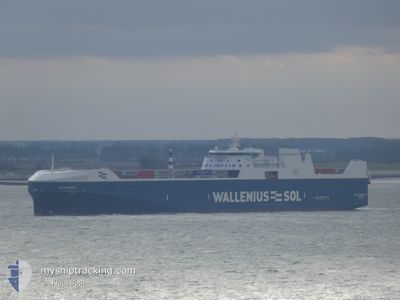
The vessel BALTIC ENABLER (IMO: 9884681, MMSI: 265039000) is a Cargo It's sailing under the flag of [SE] Sweden.
In this page you can find informations about the vessels current position, last detected port calls, and current voyage information. If the vessels is not in coverage by AIS you will find the latest position.
The current position of BALTIC ENABLER is detected by our AIS receivers and we are not responsible for the reliability of the data. The last position was recorded while the vessel was in Coverage by the Ais receivers of our vessel tracking app.
The current draught of BALTIC ENABLER as reported by AIS is 7.8 meters
Weather
| Temperature | 4.1°C / 39.38°F |
|---|---|
| Wind Speed | 11 knots |
| Direction | 258° WSW |
| Pressure | 1028.9 hPa |
| Humidity | 55.9 % |
| Cloud Coverage | --- |


Featured Company
Last Port Calls
| Port | Arrival | Departure | Time In Port |
|---|---|---|---|
| 2025-02-17 12:13 | 2025-02-18 00:52 | 12 h | |
| 2025-02-15 10:53 | 2025-02-15 18:33 | 7 h | |
| 2025-02-13 21:05 | 2025-02-15 01:57 | 1 d | |
| 2025-02-13 02:57 | 2025-02-13 16:49 | 13 h | |
| 2025-02-12 03:50 | 2025-02-12 17:23 | 13 h | |
| 2025-02-11 16:05 | 2025-02-11 22:29 | 6 h | |
| 2025-02-09 05:05 | 2025-02-09 12:42 | 7 h | |
| 2025-02-06 01:32 | 2025-02-07 05:59 | 1 d | |
| 2025-02-05 12:27 | 2025-02-05 21:46 | 9 h | |
| 2025-02-03 07:53 | 2025-02-03 15:40 | 7 h |
Most Visited Ports (Last year)
| Port | Arrivals | |
|---|---|---|
| 41 | ||
| 25 | ||
| 24 | ||
| 23 | ||
| 23 | ||
| 23 |
Last Trips
| Origin | Departure | Destination | Arrival | Distance | |
|---|---|---|---|---|---|
| 2025-02-15 20:33 | 2025-02-17 13:13 | 786.80 nm | |||
| 2025-02-15 03:57 | 2025-02-15 12:53 | 136.45 nm | |||
| 2025-02-13 18:49 | 2025-02-13 23:05 | 51.44 nm | |||
| 2025-02-12 19:23 | 2025-02-13 04:57 | 119.49 nm | |||
| 2025-02-11 23:29 | 2025-02-12 05:50 | 67.69 nm | |||
| 2025-02-09 13:42 | 2025-02-11 17:05 | 829.59 nm | |||
| 2025-02-07 06:59 | 2025-02-09 06:05 | 791.86 nm | |||
| 2025-02-05 22:46 | 2025-02-06 02:32 | 52.57 nm | |||
| 2025-02-03 16:40 | 2025-02-05 13:27 | 802.29 nm | |||
| 2025-02-01 15:09 | 2025-02-03 08:53 | 787.49 nm |
Events
| Tijd | Evenement | Details | Positie / Bestemming | Info |
|---|---|---|---|---|
| 2025-02-18 16:53 | Wijzig zee gebeid | Danish part of the Skaggerak Danish part of the Kattegat |
57.80730 / 10.92581
Skaggerak
BE ANR
|
Snelheid: 17.3 kn Koers: 302.6° |
| 2025-02-18 16:02 | Wijzig zee gebeid | Danish part of the Kattegat Swedish part of the Kattegat |
57.61942 / 11.23018
Kattegat
BE ANR
|
Snelheid: 17.5 kn Koers: 320.8° |
| 2025-02-18 15:02 | ETA Changed | 2025/02/19 20:00 2025/02/19 21:00 |
57.37316 / 11.50256
BE ANR
|
Snelheid: 17.5 kn Koers: 338° |
| 2025-02-18 13:43 | Wijzig zee gebeid | Swedish part of the Kattegat Danish part of the Kattegat |
57.00382 / 11.75520
Kattegat
BE ANR
|
Snelheid: 18.3 kn Koers: 340.3° |
| 2025-02-18 04:50 | Wijzig zee gebeid | Danish part of the Kattegat Danish part of the Baltic Sea |
54.74685 / 10.88407
Kattegat
BE ANR
|
Snelheid: 15.8 kn Koers: 355.9° |
| 2025-02-18 04:08 | Wijzig zee gebeid | Danish part of the Baltic Sea German part of the Baltic Sea |
54.63081 / 11.11848
Baltic Sea
BE ANR
|
Snelheid: 17.1 kn Koers: 300.1° |
| 2025-02-18 03:41 | Wijzig zee gebeid | German part of the Baltic Sea Danish part of the Baltic Sea |
54.57053 / 11.31293
Baltic Sea
BE ANR
|
Snelheid: 16.9 kn Koers: 297.6° |
| 2025-02-18 03:20 | Wijzig zee gebeid | Danish part of the Baltic Sea German part of the Baltic Sea |
54.50940 / 11.43912
Baltic Sea
BE ANR
|
Snelheid: 16.9 kn Koers: 348.8° |
| 2025-02-18 01:26 | ETA Changed | 2025/02/19 21:00 2025/02/19 11:00 |
54.04288 / 11.03776
BE ANR
|
Snelheid: 17.5 kn Koers: 46.7° |
| 2025-02-18 00:52 | Vertrekhaven |
|
53.96109 / 10.88878
BE ANR
|
Snelheid: 6.6 kn Koers: 54° |