

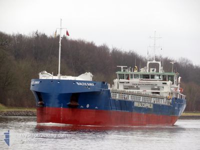
BALTIC ANKA
Cargo

Current Trip
| Time Travelled | 1 day |
|---|---|
| Remaining Time | 1 day |
| Distance Travelled | 210.56 nm |
| Remaining Distance | 415.05 nm |
| AVG Speed | 10.4 Knopen |
| MAX Speed | 12.2 Knopen |
| AVG Wind | 5.7 knots |
| MAX Wind | 9.5 knots |
| MIN Temp | 12.9°C / 55.22°F |
| MAX Temp | 15.2°C / 59.36°F |
| Diepgang | 4.2 M |
| Positie ontvangen | 4 h, 9 m geleden |
Current Position
| Lengtegraad | --- |
|---|---|
| Breedtegraat | --- |
| Status | Under way using engine |
| Snelheid | 10.2 Knopen |
| Koers | 144.6° |
| Gebied | Aegean Sea |
| Station | T-AIS |
| Positie ontvangen | 4 h, 9 m geleden |
Information
The current position of BALTIC ANKA is in Aegean Sea with coordinates 36.27564° / 26.93780° as reported on 2025-03-03 07:58 by AIS to our vessel tracker app. The vessel's current speed is 10.2 Knopen and is heading at the port of MERSIN. The estimated time of arrival as calculated by MyShipTracking vessel tracking app is 2025-03-04 22:34 LT
The vessel BALTIC ANKA (IMO: 9986506, MMSI: 255915790) is a Cargo It's sailing under the flag of [PT] Portugal.
In this page you can find informations about the vessels current position, last detected port calls, and current voyage information. If the vessels is not in coverage by AIS you will find the latest position.
The current position of BALTIC ANKA is detected by our AIS receivers and we are not responsible for the reliability of the data. The last position was recorded while the vessel was in Coverage by the Ais receivers of our vessel tracking app.
The current draught of BALTIC ANKA as reported by AIS is 4.2 meters
Weather
| Temperature | 15.1°C / 59.18°F |
|---|---|
| Wind Speed | 7 knots |
| Direction | 339° NNW |
| Pressure | 1017.9 hPa |
| Humidity | 70.4 % |
| Cloud Coverage | 66 % |


Featured Company
Last Port Calls
| Port | Arrival | Departure | Time In Port |
|---|---|---|---|
| 2025-03-01 18:47 | 2025-03-02 15:05 | 20 h | |
| 2025-02-22 19:18 | 2025-02-22 22:56 | 3 h | |
| 2025-02-14 21:23 | 2025-02-14 23:32 | 2 h | |
| 2025-02-09 16:27 | 2025-02-12 14:16 | 2 d | |
| 2025-02-06 03:45 | 2025-02-07 11:45 | 1 d | |
| 2025-02-04 22:03 | 2025-02-05 16:11 | 18 h | |
| 2025-02-02 09:47 | 2025-02-04 14:43 | 2 d | |
| 2025-01-29 23:27 | 2025-01-31 20:42 | 1 d | |
| 2025-01-28 09:36 | 2025-01-28 17:10 | 7 h | |
| 2025-01-25 22:54 | 2025-01-27 17:23 | 1 d |
Most Visited Ports (Last year)
| Port | Arrivals | |
|---|---|---|
| 4 | ||
| 3 | ||
| 3 | ||
| 3 | ||
| 2 | ||
| 2 |
Last Trips
| Origin | Departure | Destination | Arrival | Distance | |
|---|---|---|---|---|---|
| 2025-02-22 22:56 | 2025-03-01 18:47 | 1610.80 nm | |||
| 2025-02-14 23:32 | 2025-02-22 19:18 | 1629.20 nm | |||
| 2025-02-12 14:16 | 2025-02-14 21:23 | 486.83 nm | |||
| 2025-02-07 11:45 | 2025-02-09 16:27 | 482.47 nm | |||
| 2025-02-05 16:11 | 2025-02-06 03:45 | 109.75 nm | |||
| 2025-02-04 14:43 | 2025-02-04 22:03 | 73.18 nm | |||
| 2025-01-31 20:42 | 2025-02-02 09:47 | 249.15 nm | |||
| 2025-01-28 17:10 | 2025-01-29 23:27 | 230.82 nm | |||
| 2025-01-27 17:23 | 2025-01-28 09:36 | 151.84 nm | |||
| 2025-01-23 22:48 | 2025-01-25 22:54 | 268.12 nm |
Events
| Tijd | Evenement | Details | Positie / Bestemming | Info |
|---|---|---|---|---|
| 2025-03-03 07:58 | Buitenbereik |
36.27564 / 26.93780
Aegean Sea
|
Snelheid: 10.2 kn Koers: 144.6° |
|
| 2025-03-02 23:52 | Draught Changed | 4.2 3.7 |
37.46273 / 25.90710
TR MER
|
Snelheid: 10.7 kn Koers: 167.1° |
| 2025-03-02 23:27 | Binnenbereik |
37.53305 / 25.88472
Aegean Sea
|
Snelheid: 11.1 kn Koers: 164.3° |
|
| 2025-03-02 19:08 | Buitenbereik |
38.29798 / 25.68845
Aegean Sea
|
Snelheid: 10.9 kn Koers: 180.7° |
|
| 2025-03-02 19:08 | Binnenbereik |
38.29798 / 25.68845
Aegean Sea
|
Snelheid: 10.9 kn Koers: 180.7° |
|
| 2025-03-02 18:05 | Buitenbereik |
38.48786 / 25.72191
Aegean Sea
|
Snelheid: 11 kn Koers: 192.8° |
|
| 2025-03-02 15:25 | Wijzig zee gebeid | Greek part of the Aegean Sea Turkish part of the Aegean Sea |
38.68229 / 26.21453
Aegean Sea
|
Snelheid: 10.5 kn Koers: 255.6° |
| 2025-03-02 12:27 | Wijzig zee gebeid | Turkish part of the Aegean Sea Greek part of the Aegean Sea |
38.78532 / 26.85885
Aegean Sea
|
Snelheid: 7.3 kn Koers: 260.8° |
| 2025-03-02 12:22 | ETA Changed | 2025/05/01 05:00 2025/05/01 06:00 |
38.78610 / 26.87195
TR MER
|
Snelheid: 6 kn Koers: 276.4° |
| 2025-03-02 12:05 | Vertrekhaven |
|
38.77497 / 26.90420
TR MER
|
Snelheid: 7.1 kn Koers: 300° |