
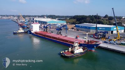
BALAT
General Cargo
Current Trip
| Time Travelled | 10 days |
|---|---|
| Remaining Time | 1 day |
| Distance Travelled | 1706.64 nm |
| Remaining Distance | 488.65 nm |
| AVG Speed | 9.6 Knopen |
| MAX Speed | 12.6 Knopen |
| AVG Wind | 7.6 knots |
| MAX Wind | 26.8 knots |
| MIN Temp | 4°C / 39.2°F |
| MAX Temp | 17.3°C / 63.14°F |
| Diepgang | 6.4 M |
| Positie ontvangen | 2 d geleden |
Current Position
| Lengtegraad | --- |
|---|---|
| Breedtegraat | --- |
| Status | Under way using engine |
| Snelheid | 9.1 Knopen |
| Koers | 286.5° |
| Gebied | Mediterranean Sea - Eastern Basin |
| Station | T-AIS |
| Positie ontvangen | 2 d geleden |
Info
Information
The current position of BALAT is in Mediterranean Sea - Eastern Basin with coordinates 36.78152° / 13.95064° as reported on 2025-01-29 14:12 by AIS to our vessel tracker app. The vessel's current speed is 9.1 Knopen and is heading at the port of CASABLANCA. The estimated time of arrival as calculated by MyShipTracking vessel tracking app is 2025-02-03 04:19 LT
The vessel BALAT (IMO: 9383730, MMSI: 374761000) is a General Cargo that was built in 2006 ( 19 Jaar oud ). It's sailing under the flag of [PA] Panama.
In this page you can find informations about the vessels current position, last detected port calls, and current voyage information. If the vessels is not in coverage by AIS you will find the latest position.
The current position of BALAT is detected by our AIS receivers and we are not responsible for the reliability of the data. The last position was recorded while the vessel was in Coverage by the Ais receivers of our vessel tracking app.
The current draught of BALAT as reported by AIS is 6.4 meters
Weather
| Temperature | 14.5°C / 58.1°F |
|---|---|
| Wind Speed | 20 knots |
| Direction | 269° W |
| Pressure | 1022 hPa |
| Humidity | 69.5 % |
| Cloud Coverage | 63 % |
Featured Company
Most Visited Ports (Last year)
| Port | Arrivals | |
|---|---|---|
| 4 | ||
| 2 | ||
| 2 | ||
| 2 | ||
| 2 | ||
| 2 |
Events
| Tijd | Evenement | Details | Positie / Bestemming | Info |
|---|---|---|---|---|
| 2025-01-29 14:14 | Status Changed | Default Under way using engine |
36.78252 / 13.94656
MACAS
|
Snelheid: 9.1 kn Koers: 286.5° |
| 2025-01-29 14:12 | Status Changed | Under way using engine Default |
36.78152 / 13.95064
MACAS
|
Snelheid: 9.6 kn Koers: 283° |
| 2025-01-29 14:12 | Buitenbereik |
36.78152 / 13.95064
Mediterranean Sea - Eastern Basin
MACAS
|
Snelheid: 9.1 kn Koers: 286.5° |
|
| 2025-01-29 13:59 | Status Changed | Default Under way using engine |
36.77195 / 13.99230
MACAS
|
Snelheid: 9.4 kn Koers: 283.1° |
| 2025-01-29 13:35 | Status Changed | Under way using engine Default |
36.75781 / 14.07093
MACAS
|
Snelheid: 10.2 kn Koers: 281° |
| 2025-01-29 13:12 | Status Changed | Default Under way using engine |
36.74522 / 14.14747
MACAS
|
Snelheid: 9.7 kn Koers: 283.9° |
| 2025-01-29 12:19 | Status Changed | Under way using engine Default |
36.70442 / 14.31266
MACAS
|
Snelheid: 9 kn Koers: 288° |
| 2025-01-29 12:16 | Status Changed | Default Under way using engine |
36.70258 / 14.32019
MACAS
|
Snelheid: 8.9 kn Koers: 287° |
| 2025-01-29 12:06 | Status Changed | Under way using engine Default |
36.69515 / 14.35128
MACAS
|
Snelheid: 9 kn Koers: 287° |
| 2025-01-29 11:56 | Status Changed | Default Under way using engine |
36.68833 / 14.38065
MACAS
|
Snelheid: 9.4 kn Koers: 286.4° |