

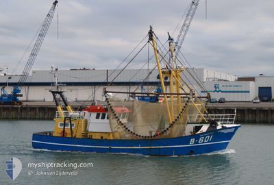
B-601 VAN MAERLANT
Fishing

Current Trip
| Trip Time | 6 days |
|---|---|
| Trip Distance | 807.62 nm |
| AVG Speed | 5.3 Knopen |
| MAX Speed | 11.7 Knopen |
| Diepgang | 1 M |
| AVG Wind | 18.4 knots |
| MAX Wind | 27 knots |
| MIN Temp | 3.7°C / 38.66°F |
| MAX Temp | 10.6°C / 51.08°F |
| Positie ontvangen | 1 m geleden |
Current Position
| Lengtegraad | --- |
|---|---|
| Breedtegraat | --- |
| Status | Engaged in Fishing |
| Snelheid | |
| Koers | --- |
| Gebied | North Sea |
| Station | T-AIS |
| Positie ontvangen | 1 m geleden |
Information
The current position of B-601 VAN MAERLANT is in North Sea with coordinates 51.23486° / 2.93176° as reported on 2025-02-13 13:15 by AIS to our vessel tracker app. The vessel's current speed is 0 Knopen and is currently inside the port of OOSTENDE.
The vessel B-601 VAN MAERLANT (IMO: 8341917, MMSI: 205261000) is a Fishing It's sailing under the flag of [BE] Belgium.
In this page you can find informations about the vessels current position, last detected port calls, and current voyage information. If the vessels is not in coverage by AIS you will find the latest position.
The current position of B-601 VAN MAERLANT is detected by our AIS receivers and we are not responsible for the reliability of the data. The last position was recorded while the vessel was in Coverage by the Ais receivers of our vessel tracking app.
The current draught of B-601 VAN MAERLANT as reported by AIS is 1 meters
Weather
| Temperature | 3.1°C / 37.58°F |
|---|---|
| Wind Speed | 14 knots |
| Direction | 39° NE |
| Pressure | 1022.7 hPa |
| Humidity | 71.6 % |
| Cloud Coverage | 83 % |


Featured Company
Last Port Calls
| Port | Arrival | Departure | Time In Port |
|---|---|---|---|
| 2025-02-11 17:22 | |||
| 2025-02-05 11:18 | 2025-02-05 15:07 | 3 h | |
| 2025-01-23 18:29 | 2025-01-29 13:55 | 5 d | |
| 2025-01-16 21:15 | 2025-01-20 01:43 | 3 d | |
| 2025-01-10 15:38 | 2025-01-13 01:52 | 2 d | |
| 2024-12-21 14:22 | 2025-01-06 17:12 | 16 d | |
| 2024-12-18 05:25 | 2024-12-18 21:25 | 15 h | |
| 2024-12-12 21:30 | 2024-12-16 02:17 | 3 d | |
| 2024-12-05 19:02 | 2024-12-09 01:41 | 3 d | |
| 2024-12-02 01:30 |
Most Visited Ports (Last year)
| Port | Arrivals | |
|---|---|---|
| 58 | ||
| 6 | ||
| 1 | ||
| 1 | ||
| 1 |
Last Trips
| Origin | Departure | Destination | Arrival | Distance | |
|---|---|---|---|---|---|
| 2025-02-05 15:07 | 2025-02-11 17:22 | 807.62 nm | |||
| 2025-01-29 13:55 | 2025-02-05 11:18 | 863.76 nm | |||
| 2025-01-20 01:43 | 2025-01-23 18:29 | 368.18 nm | |||
| 2025-01-13 01:52 | 2025-01-16 21:15 | 423.27 nm | |||
| 2025-01-06 17:12 | 2025-01-10 15:38 | 560.36 nm | |||
| 2024-12-18 21:25 | 2024-12-21 14:22 | 412.97 nm | |||
| 2024-12-16 02:17 | 2024-12-18 05:25 | 243.22 nm | |||
| 2024-12-09 01:41 | 2024-12-12 21:30 | 318.08 nm | |||
| 2024-12-02 01:30 | 2024-12-05 19:02 | 354.10 nm |
Events
| Tijd | Evenement | Details | Positie / Bestemming | Info |
|---|---|---|---|---|
| 2025-02-11 17:31 | Stop beweging |
51.23486 / 2.93178
[BE] OOSTENDE
|
Snelheid: 0.1 kn Koers: 511° |
|
| 2025-02-11 17:29 | Start beweging |
51.23470 / 2.93196
[BE] OOSTENDE
|
Snelheid: 3.6 kn Koers: 327.2° |
|
| 2025-02-11 16:41 | Stop beweging |
51.23263 / 2.93272
[BE] OOSTENDE
|
Snelheid: Koers: 511° |
|
| 2025-02-11 16:36 | Start beweging |
51.23449 / 2.93118
[BE] OOSTENDE
|
Snelheid: 6.7 kn Koers: 132.9° |
|
| 2025-02-11 16:22 | Stop beweging |
51.23490 / 2.92821
[BE] OOSTENDE
|
Snelheid: 0.3 kn Koers: 511° |
|
| 2025-02-11 16:22 | Aankomsthaven |
|
51.23491 / 2.92820
[BE] OOSTENDE
|
Snelheid: 0.6 kn Koers: 511° |
| 2025-02-11 14:20 | Wijzig zee gebeid | Belgian part of the North Sea French part of the North Sea |
51.17427 / 2.47675
North Sea
|
Snelheid: 9.6 kn Koers: 73.5° |
| 2025-02-11 12:56 | Gevonden in zee | French part of the North Sea |
51.08627 / 2.14109
North Sea
|
Snelheid: 10.7 kn Koers: 69.6° |
| 2025-02-11 12:56 | Binnenbereik |
51.08627 / 2.14109
North Sea
|
Snelheid: 10.7 kn Koers: 69.6° |
|
| 2025-02-11 06:04 | Buitenbereik |
50.56171 / .43426
English Channel
|
Snelheid: 8.9 kn Koers: 107.9° |