
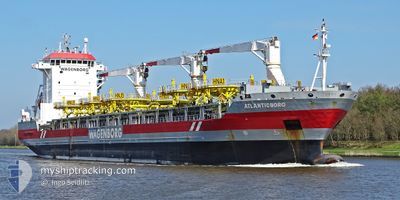
ATLANTICBORG
General Cargo
Current Trip
| Time Travelled | 6 days |
|---|---|
| Remaining Time | 3 h, 13 mins |
| Distance Travelled | 1915.24 nm |
| Remaining Distance | 39.88 nm |
| AVG Speed | 12.2 Knopen |
| MAX Speed | 15.6 Knopen |
| AVG Wind | 13.5 knots |
| MAX Wind | 21 knots |
| MIN Temp | 10.5°C / 50.9°F |
| MAX Temp | 27.3°C / 81.14°F |
| Diepgang | 8.3 M |
| Positie ontvangen | 2 d geleden |
Current Position
| Lengtegraad | -79.54538° |
|---|---|
| Breedtegraat | 25.50035° |
| Status | Under way using engine |
| Snelheid | 11.7 Knopen |
| Koers | 188.9° |
| Gebied | North Atlantic Ocean |
| Station | T-AIS |
| Positie ontvangen | 2 d geleden |
Info
Information
The current position of ATLANTICBORG is in North Atlantic Ocean with coordinates 25.50035° / -79.54538° as reported on 2024-05-06 21:21 by AIS to our vessel tracker app. The vessel's current speed is 11.7 Knopen and is heading at the port of MOBILE. The estimated time of arrival as calculated by MyShipTracking vessel tracking app is 2024-05-09 15:15 LT
The vessel ATLANTICBORG (IMO: 9466350, MMSI: 245299000) is a General Cargo that was built in 2012 ( 12 Jaar oud ). It's sailing under the flag of [NL] Netherlands.
In this page you can find informations about the vessels current position, last detected port calls, and current voyage information. If the vessels is not in coverage by AIS you will find the latest position.
The current position of ATLANTICBORG is detected by our AIS receivers and we are not responsible for the reliability of the data. The last position was recorded while the vessel was in Coverage by the Ais receivers of our vessel tracking app.
The current draught of ATLANTICBORG as reported by AIS is 8.3 meters
Weather
| Temperature | 26.2°C / 79.16°F |
|---|---|
| Wind Speed | 16 knots |
| Direction | 184° S |
| Pressure | 1009.8 hPa |
| Humidity | 89.7 % |
| Cloud Coverage | 3 % |
Featured Company
Last Port Calls
| Port | Arrival | Departure | Time In Port |
|---|---|---|---|
| 2024-04-30 04:02 | 2024-05-03 04:30 | 3 d | |
| 2024-03-26 07:45 | 2024-04-13 14:41 | 18 d | |
| 2024-03-13 19:21 | 2024-03-22 04:29 | 8 d | |
| 2024-03-02 13:56 |
Most Visited Ports (Last year)
| Port | Arrivals | |
|---|---|---|
| 2 | ||
| 2 | ||
| 1 | ||
| 1 | ||
| 1 | ||
| 1 |
Last Trips
| Origin | Departure | Destination | Arrival | Distance | |
|---|---|---|---|---|---|
| 2024-04-13 17:41 | 2024-04-30 00:02 | 4473.64 nm | |||
| 2024-03-22 04:29 | 2024-03-26 09:45 | 1067.83 nm | |||
| 2024-03-02 08:56 | 2024-03-13 19:21 | 2898.37 nm |
Events
| Tijd | Evenement | Details | Positie / Bestemming | Info |
|---|---|---|---|---|
| 2024-05-06 21:31 | Status Changed | Default Under way using engine |
25.46860 / -79.55070
USMOB
|
Snelheid: 11.7 kn Koers: 188.9° |
| 2024-05-06 21:21 | Buitenbereik |
25.50035 / -79.54538
North Atlantic Ocean
USMOB
|
Snelheid: 11.7 kn Koers: 188.9° |
|
| 2024-05-06 19:30 | Status Changed | Under way using engine Default |
25.85171 / -79.48612
USMOB
|
Snelheid: 11.4 kn Koers: 190° |
| 2024-05-06 19:08 | Status Changed | Default Under way using engine |
25.92095 / -79.47445
USMOB
|
Snelheid: 11.4 kn Koers: 189° |
| 2024-05-06 17:19 | ETA Changed | 2024/05/09 23:00 2024/05/09 23:30 |
26.25669 / -79.41766
USMOB
|
Snelheid: 11 kn Koers: 189° |
| 2024-05-06 17:01 | Status Changed | Under way using engine Default |
26.31032 / -79.40859
USMOB
|
Snelheid: 11.2 kn Koers: 182° |
| 2024-05-06 17:01 | Binnenbereik |
26.31032 / -79.40859
North Atlantic Ocean
USMOB
|
Snelheid: 11.2 kn Koers: 189° |
|
| 2024-05-06 15:46 | Status Changed | Default Under way using engine |
26.54388 / -79.39270
USMOB
|
Snelheid: 11.2 kn Koers: 181.9° |
| 2024-05-06 15:29 | Buitenbereik |
26.59759 / -79.38952
North Atlantic Ocean
USMOB
|
Snelheid: 11.2 kn Koers: 181.9° |
|
| 2024-05-06 12:56 | Draught Changed | 8.3 9 |
27.08049 / -79.35115
USMOB
|
Snelheid: 11.6 kn Koers: 182° |