
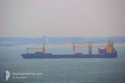
ATLANTIC NAVIGATORII
General Cargo
Current Trip
| Time Travelled | 6 days |
|---|---|
| Remaining Time | 1 h, 6 mins |
| Distance Travelled | 2235.38 nm |
| Remaining Distance | 33.75 nm |
| AVG Speed | 13.3 Knopen |
| MAX Speed | 17.2 Knopen |
| AVG Wind | 13.5 knots |
| MAX Wind | 31 knots |
| MIN Temp | 1.7°C / 35.06°F |
| MAX Temp | 25.2°C / 77.36°F |
| Diepgang | 10.5 M |
| Positie ontvangen | 2 d geleden |
Current Position
| Lengtegraad | --- |
|---|---|
| Breedtegraat | --- |
| Status | Under way using engine |
| Snelheid | 13.2 Knopen |
| Koers | 267.5° |
| Gebied | North Atlantic Ocean |
| Station | T-AIS |
| Positie ontvangen | 2 d geleden |
Info
Information
The current position of ATLANTIC NAVIGATORII is in North Atlantic Ocean with coordinates 23.78119° / -81.58213° as reported on 2025-02-17 05:13 by AIS to our vessel tracker app. The vessel's current speed is 13.2 Knopen and is heading at the port of HOUSTON. The estimated time of arrival as calculated by MyShipTracking vessel tracking app is 2025-02-19 21:22 LT
The vessel ATLANTIC NAVIGATORII (IMO: 9231145, MMSI: 538010311) is a General Cargo that was built in 2003 ( 22 Jaar oud ). It's sailing under the flag of [MH] Marshall Is.
In this page you can find informations about the vessels current position, last detected port calls, and current voyage information. If the vessels is not in coverage by AIS you will find the latest position.
The current position of ATLANTIC NAVIGATORII is detected by our AIS receivers and we are not responsible for the reliability of the data. The last position was recorded while the vessel was in Coverage by the Ais receivers of our vessel tracking app.
The current draught of ATLANTIC NAVIGATORII as reported by AIS is 10.5 meters
Weather
| Temperature | 8.3°C / 46.94°F |
|---|---|
| Wind Speed | 24 knots |
| Direction | --- N |
| Pressure | 1024.4 hPa |
| Humidity | 76.7 % |
| Cloud Coverage | 100 % |
Featured Company
Last Port Calls
| Port | Arrival | Departure | Time In Port |
|---|---|---|---|
| 2025-02-12 10:56 | 2025-02-13 04:34 | 17 h | |
| 2025-01-18 11:05 | |||
| 2024-12-08 20:38 | 2024-12-09 04:12 | 7 h | |
| 2024-12-04 20:15 | 2024-12-06 13:18 | 1 d |
Most Visited Ports (Last year)
| Port | Arrivals | |
|---|---|---|
| 4 | ||
| 4 | ||
| 4 | ||
| 3 | ||
| 2 | ||
| 2 |
Events
| Tijd | Evenement | Details | Positie / Bestemming | Info |
|---|---|---|---|---|
| 2025-02-19 19:07 | Stop beweging | 14.37 nm, South East of GALVESTON |
29.17566 / -94.56849
USHOU
|
Snelheid: 0.1 kn Koers: 16° |
| 2025-02-17 05:20 | Status Changed | Default Under way using engine |
23.77981 / -81.60995
USHOU
|
Snelheid: 13.2 kn Koers: 267.5° |
| 2025-02-17 05:13 | Buitenbereik |
23.78119 / -81.58213
North Atlantic Ocean
USHOU
|
Snelheid: 13.2 kn Koers: 267.5° |
|
| 2025-02-17 04:56 | Status Changed | Under way using engine Default |
23.78361 / -81.51629
USHOU
|
Snelheid: 13.3 kn Koers: 259° |
| 2025-02-17 04:50 | Status Changed | Default Under way using engine |
23.78798 / -81.49052
USHOU
|
Snelheid: 13.3 kn Koers: 258.9° |
| 2025-02-17 04:50 | Status Changed | Under way using engine Default |
23.78810 / -81.48987
USHOU
|
Snelheid: 13.4 kn Koers: 252° |
| 2025-02-17 04:45 | Status Changed | Default Under way using engine |
23.79270 / -81.47027
USHOU
|
Snelheid: 13.4 kn Koers: 252.7° |
| 2025-02-17 04:41 | Gevonden in zee | Cuban part of the North Atlantic Ocean |
23.79749 / -81.45340
North Atlantic Ocean
USHOU
|
Snelheid: 13.4 kn Koers: 252.7° |
| 2025-02-17 04:41 | Status Changed | Under way using engine Default |
23.79749 / -81.45340
USHOU
|
Snelheid: 13.6 kn Koers: 253° |
| 2025-02-17 04:31 | Binnenbereik |
23.79749 / -81.45340
North Atlantic Ocean
USHOU
|
Snelheid: 13.4 kn Koers: 252.7° |