
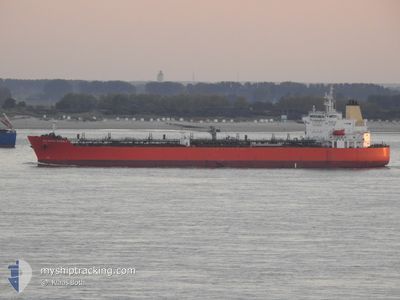
ATLANTIC MARBLE
Tanker
Current Trip
PORT ESQUIVEL
| Time Travelled | 9 days |
|---|---|
| Remaining Time | --- |
| Distance Travelled | 888.93 nm |
| Remaining Distance | --- |
| AVG Speed | 8.7 Knopen |
| MAX Speed | 13.7 Knopen |
| AVG Wind | 20.1 knots |
| MAX Wind | 31.1 knots |
| MIN Temp | 22.5°C / 72.5°F |
| MAX Temp | 27°C / 80.6°F |
| Diepgang | 11 M |
| Positie ontvangen | 23 h, 29 m geleden |
Current Position
| Lengtegraad | --- |
|---|---|
| Breedtegraat | --- |
| Status | Under way using engine |
| Snelheid | 2.3 Knopen |
| Koers | 45° |
| Gebied | Caribbean Sea |
| Station | T-AIS |
| Positie ontvangen | 23 h, 29 m geleden |
Info
Information
The current position of ATLANTIC MARBLE is in Caribbean Sea with coordinates 11.18479° / -75.19427° as reported on 2026-01-09 20:17 by AIS to our vessel tracker app. The vessel's current speed is 2.3 Knopen
The vessel ATLANTIC MARBLE (IMO: 9798959, MMSI: 538007896) is a Tanker It's sailing under the flag of [MH] Marshall Is.
In this page you can find informations about the vessels current position, last detected port calls, and current voyage information. If the vessels is not in coverage by AIS you will find the latest position.
The current position of ATLANTIC MARBLE is detected by our AIS receivers and we are not responsible for the reliability of the data. The last position was recorded while the vessel was in Coverage by the Ais receivers of our vessel tracking app.
The current draught of ATLANTIC MARBLE as reported by AIS is 11 meters
Weather
| Temperature | 26.5°C / 79.7°F |
|---|---|
| Wind Speed | 24 knots |
| Direction | 57° ENE |
| Pressure | 1008.2 hPa |
| Humidity | 81.3 % |
| Cloud Coverage | 100 % |
Featured Company
Most Visited Ports (Last year)
| Port | Arrivals | |
|---|---|---|
| 5 | ||
| 3 | ||
| 2 | ||
| 2 | ||
| 1 | ||
| 1 |
Last Trips
| Origin | Departure | Destination | Arrival | Distance | |
|---|---|---|---|---|---|
| 2025-12-24 16:56 | 2025-12-29 10:14 | 1372.49 nm | |||
| 2025-12-12 11:31 | 2025-12-19 19:08 | 675.98 nm | |||
| 2025-12-07 19:57 | 2025-12-09 17:30 | 569.80 nm | |||
| 2025-11-29 14:44 | 2025-12-04 18:56 | 1716.89 nm | |||
| 2025-10-18 15:53 | 2025-11-28 08:45 | 5899.51 nm |
Events
| Tijd | Evenement | Details | Positie / Bestemming | Info |
|---|---|---|---|---|
| 2026-01-10 19:36 | Stop beweging |
11.53500 / -74.89500
PORT ESQUIVEL
|
Snelheid: Koers: -1° |
|
| 2026-01-10 11:48 | Start beweging |
11.34231 / -75.37740
PORT ESQUIVEL
|
Snelheid: 3.7 kn Koers: 74° |
|
| 2026-01-10 07:51 | Stop beweging |
11.34333 / -75.46667
PORT ESQUIVEL
|
Snelheid: Koers: -1° |
|
| 2026-01-10 07:25 | Start beweging |
11.34287 / -75.48677
PORT ESQUIVEL
|
Snelheid: 3.4 kn Koers: 68° |
|
| 2026-01-10 06:57 | Stop beweging |
11.34833 / -75.49500
PORT ESQUIVEL
|
Snelheid: Koers: -1° |
|
| 2026-01-09 20:21 | Status Changed | Default Under way using engine |
11.18667 / -75.19167
PORT ESQUIVEL
|
Snelheid: 2.3 kn Koers: 45° |
| 2026-01-09 20:17 | Buitenbereik |
11.18479 / -75.19427
Caribbean Sea
|
Snelheid: 2.3 kn Koers: 32.5° |
|
| 2026-01-09 17:27 | Status Changed | Under way using engine Default |
11.22171 / -75.27587
PORT ESQUIVEL
|
Snelheid: 2 kn Koers: 101° |
| 2026-01-09 17:20 | Status Changed | Default Under way using engine |
11.22608 / -75.27876
PORT ESQUIVEL
|
Snelheid: 4.9 kn Koers: 91° |
| 2026-01-09 17:07 | Status Changed | Under way using engine Default |
11.23389 / -75.29728
PORT ESQUIVEL
|
Snelheid: 6.8 kn Koers: 113° |