
ATENI
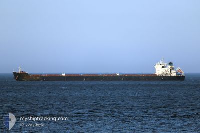
Bulk Carrier
Current Trip
| Time Travelled | 12 days |
|---|---|
| Remaining Time | --- |
| Distance Travelled | 3540.45 nm |
| Remaining Distance | --- |
| AVG Speed | 11.9 Knopen |
| MAX Speed | 17.6 Knopen |
| AVG Wind | 14.9 knots |
| MAX Wind | 32 knots |
| MIN Temp | 13.6°C / 56.48°F |
| MAX Temp | 23.9°C / 75.02°F |
| Diepgang | 8.1 M |
| Positie ontvangen | 2 m geleden |
Current Position
| Lengtegraad | --- |
|---|---|
| Breedtegraat | --- |
| Status | At anchor |
| Snelheid | |
| Koers | 356° |
| Gebied | North Atlantic Ocean |
| Station | T-AIS |
| Positie ontvangen | 2 m geleden |
Info
Information
The current position of ATENI is in North Atlantic Ocean with coordinates 37.20694° / -76.11671° as reported on 2024-10-02 21:49 by AIS to our vessel tracker app. The vessel's current speed is 0 Knopen
The vessel ATENI (IMO: 9656175, MMSI: 229712000) is a Bulk Carrier that was built in 2014 ( 10 Jaar oud ). It's sailing under the flag of [MT] Malta.
In this page you can find informations about the vessels current position, last detected port calls, and current voyage information. If the vessels is not in coverage by AIS you will find the latest position.
The current position of ATENI is detected by our AIS receivers and we are not responsible for the reliability of the data. The last position was recorded while the vessel was in Coverage by the Ais receivers of our vessel tracking app.
The current draught of ATENI as reported by AIS is 8.1 meters
Weather
| Temperature | 21.7°C / 71.06°F |
|---|---|
| Wind Speed | 7 knots |
| Direction | 56° NE |
| Pressure | 1013.7 hPa |
| Humidity | 72.6 % |
| Cloud Coverage | 80 % |
Featured Company
Last Port Calls
| Port | Arrival | Departure | Time In Port |
|---|---|---|---|
| 2024-09-16 14:10 | 2024-09-20 01:59 | 3 d | |
| 2024-09-06 05:52 | 2024-09-06 17:40 | 11 h | |
| 2024-08-23 19:48 | 2024-08-24 20:33 | 1 d | |
| 2024-08-14 14:13 | 2024-08-18 10:00 | 3 d |
Last Trips
| Origin | Departure | Destination | Arrival | Distance | |
|---|---|---|---|---|---|
| 2024-09-06 18:40 | 2024-09-16 16:10 | 1767.04 nm | |||
| 2024-08-24 17:33 | 2024-09-06 06:52 | 3326.73 nm | |||
| 2024-08-18 07:00 | 2024-08-23 16:48 | 151.98 nm | |||
| 2024-07-01 13:34 | 2024-08-14 11:13 | 5483.95 nm |
Events
| Tijd | Evenement | Details | Positie / Bestemming | Info |
|---|---|---|---|---|
| 2024-10-02 18:49 | Status Changed | At anchor Default |
37.20721 / -76.11580
US NNS
|
Snelheid: 0.1 kn Koers: 336° |
| 2024-10-02 18:46 | Status Changed | Default At anchor |
37.20721 / -76.11577
US NNS
|
Snelheid: Koers: 336° |
| 2024-10-02 18:16 | Stop beweging | 20.01 nm, North East of NORFOLK |
37.20734 / -76.11541
US NNS
|
Snelheid: 0.3 kn Koers: 328° |
| 2024-10-02 17:49 | Status Changed | At anchor Under way using engine |
37.21047 / -76.11641
US NNS
|
Snelheid: 0.8 kn Koers: 213° |
| 2024-10-02 16:31 | Draught Changed | 8.1 8 |
37.02709 / -76.05594
US NNS
|
Snelheid: 13.2 kn Koers: 322.4° |
| 2024-10-02 16:31 | ETA Changed | 2024/10/02 16:00 |
37.02709 / -76.05594
US NNS
|
Snelheid: 13.2 kn Koers: 322.4° |
| 2024-10-02 15:43 | Draught Changed | 8 8.1 |
36.92419 / -75.92071
US NNS
|
Snelheid: 7.9 kn Koers: 293° |
| 2024-10-02 15:37 | Status Changed | Under way using engine Default |
36.91550 / -75.90746
US NNS
|
Snelheid: 8.7 kn Koers: 318° |
| 2024-10-02 15:35 | Status Changed | Default Under way using engine |
36.91281 / -75.90450
US NNS
|
Snelheid: 8.6 kn Koers: 318° |
| 2024-10-02 15:16 | Status Changed | Under way using engine Default |
36.87435 / -75.85766
US NNS
|
Snelheid: 10.6 kn Koers: 302° |