
ASPHALT SYNERGY
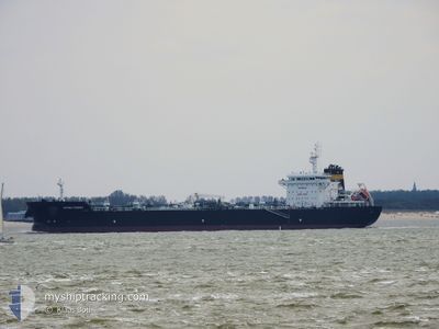
Tanker
Current Trip
| Time Travelled | 1 day |
|---|---|
| Remaining Time | 3 days |
| Distance Travelled | 527.53 nm |
| Remaining Distance | 1017.94 nm |
| AVG Speed | 9.9 Knopen |
| MAX Speed | 13.7 Knopen |
| AVG Wind | 5.5 knots |
| MAX Wind | 27.5 knots |
| MIN Temp | 13.1°C / 55.58°F |
| MAX Temp | 21.8°C / 71.24°F |
| Diepgang | 10.4 M |
| Positie ontvangen | 1 h, 24 m geleden |
Current Position
| Lengtegraad | 15.27254° |
|---|---|
| Breedtegraat | 36.41483° |
| Status | Under way using engine |
| Snelheid | 13.2 Knopen |
| Koers | 274.2° |
| Gebied | Mediterranean Sea - Eastern Basin |
| Station | T-AIS |
| Positie ontvangen | 1 h, 24 m geleden |
Info
Information
The current position of ASPHALT SYNERGY is in Mediterranean Sea - Eastern Basin with coordinates 36.41483° / 15.27254° as reported on 2024-05-16 15:55 by AIS to our vessel tracker app. The vessel's current speed is 13.2 Knopen and is heading at the port of GIBRALTAR. The estimated time of arrival as calculated by MyShipTracking vessel tracking app is 2024-05-20 00:45 LT
The vessel ASPHALT SYNERGY (IMO: 9794159, MMSI: 538007666) is a Tanker It's sailing under the flag of [MH] Marshall Is.
In this page you can find informations about the vessels current position, last detected port calls, and current voyage information. If the vessels is not in coverage by AIS you will find the latest position.
The current position of ASPHALT SYNERGY is detected by our AIS receivers and we are not responsible for the reliability of the data. The last position was recorded while the vessel was in Coverage by the Ais receivers of our vessel tracking app.
The current draught of ASPHALT SYNERGY as reported by AIS is 10.4 meters
Weather
| Temperature | 19.2°C / 66.56°F |
|---|---|
| Wind Speed | 5 knots |
| Direction | 92° E |
| Pressure | 1008.2 hPa |
| Humidity | 90.1 % |
| Cloud Coverage | 64 % |
Featured Company
Last Port Calls
| Port | Arrival | Departure | Time In Port |
|---|---|---|---|
| 2024-05-10 21:50 | 2024-05-14 20:16 | 3 d | |
| 2024-04-18 12:13 | 2024-04-28 13:37 | 10 d | |
| 2024-04-10 18:29 | 2024-04-11 11:02 | 16 h | |
| 2024-04-02 08:28 | 2024-04-05 22:19 | 3 d | |
| 2024-03-14 07:47 | 2024-03-18 18:56 | 4 d |
Most Visited Ports (Last year)
| Port | Arrivals | |
|---|---|---|
| 6 | ||
| 6 | ||
| 3 | ||
| 2 | ||
| 1 | ||
| 1 |
Last Trips
| Origin | Departure | Destination | Arrival | Distance | |
|---|---|---|---|---|---|
| 2024-04-28 15:37 | 2024-05-11 00:50 | 2999.59 nm | |||
| 2024-04-11 13:02 | 2024-04-18 14:13 | 1928.59 nm | |||
| 2024-04-06 01:19 | 2024-04-10 20:29 | 1252.62 nm | |||
| 2024-03-18 19:56 | 2024-04-02 11:28 | 3003.71 nm | |||
| 2024-02-15 09:11 | 2024-03-14 08:47 | 3415.11 nm |
Events
| Tijd | Evenement | Details | Positie / Bestemming | Info |
|---|---|---|---|---|
| 2024-05-16 16:03 | Status Changed | Default Under way using engine |
36.41667 / 15.23333
GI GIB
|
Snelheid: 13.2 kn Koers: 274.2° |
| 2024-05-16 15:55 | Buitenbereik |
36.41483 / 15.27254
Mediterranean Sea - Eastern Basin
GI GIB
|
Snelheid: 13.2 kn Koers: 274.2° |
|
| 2024-05-16 15:43 | Status Changed | Under way using engine Default |
36.41105 / 15.32723
GI GIB
|
Snelheid: 13.2 kn Koers: 276° |
| 2024-05-16 14:52 | Status Changed | Default Under way using engine |
36.39879 / 15.55493
GI GIB
|
Snelheid: 13 kn Koers: 273.6° |
| 2024-05-16 14:33 | Status Changed | Under way using engine Default |
36.39550 / 15.63768
GI GIB
|
Snelheid: 12 kn Koers: 272° |
| 2024-05-16 14:27 | Status Changed | Default Under way using engine |
36.39333 / 15.66500
GI GIB
|
Snelheid: 12.9 kn Koers: 272.7° |
| 2024-05-16 14:11 | Status Changed | Under way using engine Default |
36.39224 / 15.73589
GI GIB
|
Snelheid: 13 kn Koers: 274° |
| 2024-05-16 13:46 | Status Changed | Default Under way using engine |
36.38755 / 15.84382
GI GIB
|
Snelheid: 12.6 kn Koers: 274.2° |
| 2024-05-16 13:30 | Status Changed | Under way using engine Default |
36.38367 / 15.91387
GI GIB
|
Snelheid: 12.3 kn Koers: 273° |
| 2024-05-16 13:15 | Binnenbereik |
36.38383 / 15.91045
Mediterranean Sea - Eastern Basin
GI GIB
|
Snelheid: 12.5 kn Koers: 272.8° |