
ASIAN EMPIRE
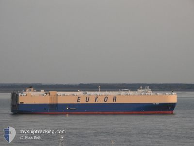
Vehicles Carrier
Current Trip
| Time Travelled | 51 days |
|---|---|
| Remaining Time | --- |
| Distance Travelled | 12268.47 nm |
| Remaining Distance | --- |
| AVG Speed | 16 Knopen |
| MAX Speed | 18.7 Knopen |
| AVG Wind | 12 knots |
| MAX Wind | 32.6 knots |
| MIN Temp | 12.4°C / 54.32°F |
| MAX Temp | 30°C / 86°F |
| Diepgang | 9 M |
| Positie ontvangen | 2 d geleden |
Current Position
| Lengtegraad | 16.26414° |
|---|---|
| Breedtegraat | -32.70378° |
| Status | Under way using engine |
| Snelheid | 16.6 Knopen |
| Koers | 325.2° |
| Gebied | South Atlantic Ocean |
| Station | T-AIS |
| Positie ontvangen | 2 d geleden |
Info
Information
The current position of ASIAN EMPIRE is in South Atlantic Ocean with coordinates -32.70378° / 16.26414° as reported on 2024-05-02 03:54 by AIS to our vessel tracker app. The vessel's current speed is 16.6 Knopen and is heading at the port of BARCELONA. The estimated time of arrival as calculated by MyShipTracking vessel tracking app is 2024-05-16 02:00 LT
The vessel ASIAN EMPIRE (IMO: 9176606, MMSI: 440114000) is a Vehicles Carrier that was built in 1998 ( 26 Jaar oud ). It's sailing under the flag of [KR] Korea.
In this page you can find informations about the vessels current position, last detected port calls, and current voyage information. If the vessels is not in coverage by AIS you will find the latest position.
The current position of ASIAN EMPIRE is detected by our AIS receivers and we are not responsible for the reliability of the data. The last position was recorded while the vessel was in Coverage by the Ais receivers of our vessel tracking app.
The current draught of ASIAN EMPIRE as reported by AIS is 9 meters
Weather
| Temperature | 22.7°C / 72.86°F |
|---|---|
| Wind Speed | 17 knots |
| Direction | 147° SSE |
| Pressure | 1015.9 hPa |
| Humidity | 73.1 % |
| Cloud Coverage | 51 % |
Featured Company
Last Port Calls
| Port | Arrival | Departure | Time In Port |
|---|---|---|---|
| 2024-03-12 14:19 | 2024-03-14 09:48 | 1 d | |
| 2024-03-09 16:51 | 2024-03-09 23:06 | 6 h |
Most Visited Ports (Last year)
| Port | Arrivals | |
|---|---|---|
| 4 | ||
| 3 | ||
| 3 | ||
| 2 | ||
| 2 | ||
| 2 |
Last Trips
| Origin | Departure | Destination | Arrival | Distance | |
|---|---|---|---|---|---|
| 2024-03-09 20:06 | 2024-03-12 11:19 | 917.13 nm | |||
| 2024-02-25 17:40 | 2024-03-09 13:51 | 3487.20 nm |
Events
| Tijd | Evenement | Details | Positie / Bestemming | Info |
|---|---|---|---|---|
| 2024-05-02 03:58 | Status Changed | Default Under way using engine |
-32.68946 / 16.25219
ES BCN
|
Snelheid: 16.6 kn Koers: 325.2° |
| 2024-05-02 03:54 | Buitenbereik |
-32.70378 / 16.26414
South Atlantic Ocean
ES BCN
|
Snelheid: 16.6 kn Koers: 325.2° |
|
| 2024-05-02 03:50 | Status Changed | Under way using engine Default |
-32.71954 / 16.27722
ES BCN
|
Snelheid: 17 kn Koers: 325° |
| 2024-05-02 03:45 | Status Changed | Default Under way using engine |
-32.74166 / 16.29500
ES BCN
|
Snelheid: 17.4 kn Koers: 325.9° |
| 2024-05-02 03:33 | Status Changed | Under way using engine Default |
-32.78737 / 16.33182
ES BCN
|
Snelheid: 17 kn Koers: 326° |
| 2024-05-02 03:26 | Binnenbereik |
-32.78374 / 16.32895
South Atlantic Ocean
ES BCN
|
Snelheid: 17.1 kn Koers: 325.5° |
|
| 2024-05-01 21:01 | Status Changed | Default Under way using engine |
-34.28537 / 17.56757
ES BCN
|
Snelheid: 16 kn Koers: 325.2° |
| 2024-05-01 20:57 | Buitenbereik |
-34.30005 / 17.57980
South Atlantic Ocean
ES BCN
|
Snelheid: 16 kn Koers: 325.2° |
|
| 2024-05-01 20:52 | Status Changed | Under way using engine Default |
-34.31923 / 17.59586
ES BCN
|
Snelheid: 16 kn Koers: 325° |
| 2024-05-01 20:12 | Status Changed | Default Under way using engine |
-34.46199 / 17.71961
ES BCN
|
Snelheid: 15.9 kn Koers: 318.6° |