
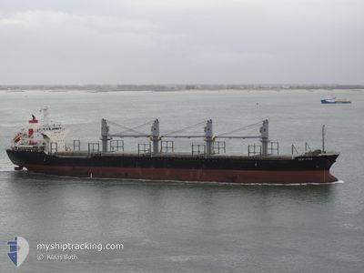
ASH ATLANTIC
Bulk Carrier
Current Trip
| Time Travelled | 3 days |
|---|---|
| Remaining Time | --- |
| Distance Travelled | 913.54 nm |
| Remaining Distance | --- |
| AVG Speed | 10.6 Knopen |
| MAX Speed | 10.6 Knopen |
| AVG Wind | 8 knots |
| MAX Wind | 30.9 knots |
| MIN Temp | 21.5°C / 70.7°F |
| MAX Temp | 35.3°C / 95.54°F |
| Diepgang | 9.9 M |
| Positie ontvangen | 2 h, 11 m geleden |
Current Position
| Lengtegraad | 13.85742° |
|---|---|
| Breedtegraat | 36.84222° |
| Status | Under way using engine |
| Snelheid | 10.9 Knopen |
| Koers | 285° |
| Gebied | Mediterranean Sea - Eastern Basin |
| Station | T-AIS |
| Positie ontvangen | 2 h, 11 m geleden |
Info
Information
The current position of ASH ATLANTIC is in Mediterranean Sea - Eastern Basin with coordinates 36.84222° / 13.85742° as reported on 2024-07-05 04:12 by AIS to our vessel tracker app. The vessel's current speed is 10.9 Knopen and is heading at the port of AVEIRO. The estimated time of arrival as calculated by MyShipTracking vessel tracking app is 2024-07-10 05:00 LT
The vessel ASH ATLANTIC (IMO: 9470844, MMSI: 538007470) is a Bulk Carrier that was built in 2008 ( 16 Jaar oud ). It's sailing under the flag of [MH] Marshall Is.
In this page you can find informations about the vessels current position, last detected port calls, and current voyage information. If the vessels is not in coverage by AIS you will find the latest position.
The current position of ASH ATLANTIC is detected by our AIS receivers and we are not responsible for the reliability of the data. The last position was recorded while the vessel was in Coverage by the Ais receivers of our vessel tracking app.
The current draught of ASH ATLANTIC as reported by AIS is 9.9 meters
Weather
| Temperature | 22.7°C / 72.86°F |
|---|---|
| Wind Speed | 3 knots |
| Direction | 51° NE |
| Pressure | 1014.2 hPa |
| Humidity | 75.1 % |
| Cloud Coverage | --- |
Featured Company
Last Port Calls
Last Trips
| Origin | Departure | Destination | Arrival | Distance | |
|---|---|---|---|---|---|
| 2024-06-12 16:01 | 2024-06-28 17:24 | 2805.51 nm | |||
| 2024-06-06 11:23 | 2024-06-09 16:43 | 480.32 nm | |||
| 2024-05-22 16:49 | 2024-05-31 17:02 | 2294.70 nm | |||
| 2024-05-08 17:53 | 2024-05-20 08:33 | 2332.38 nm | |||
| 2024-05-03 22:07 | 2024-05-06 08:48 | 498.38 nm |
Events
| Tijd | Evenement | Details | Positie / Bestemming | Info |
|---|---|---|---|---|
| 2024-07-05 04:22 | Status Changed | Default Under way using engine |
36.85080 / 13.81920
PT AVE
|
Snelheid: 10.9 kn Koers: 285° |
| 2024-07-05 04:12 | Buitenbereik |
36.84222 / 13.85742
Mediterranean Sea - Eastern Basin
PT AVE
|
Snelheid: 10.9 kn Koers: 285° |
|
| 2024-07-05 00:42 | Status Changed | Under way using engine Default |
36.66950 / 14.62980
PT AVE
|
Snelheid: 11.3 kn Koers: 284° |
| 2024-07-05 00:33 | Status Changed | Default Under way using engine |
36.66218 / 14.66378
PT AVE
|
Snelheid: 11.3 kn Koers: 286° |
| 2024-07-05 00:26 | Status Changed | Under way using engine Default |
36.65517 / 14.69277
PT AVE
|
Snelheid: 11.2 kn Koers: 286° |
| 2024-07-05 00:22 | Binnenbereik |
36.65700 / 14.68518
Mediterranean Sea - Eastern Basin
PT AVE
|
Snelheid: 11.3 kn Koers: 286° |
|
| 2024-07-04 22:41 | Status Changed | Default Under way using engine |
36.57487 / 15.08330
PT AVE
|
Snelheid: 11.2 kn Koers: 272° |
| 2024-07-04 22:37 | Buitenbereik |
36.57447 / 15.10133
Mediterranean Sea - Eastern Basin
PT AVE
|
Snelheid: 11.2 kn Koers: 272° |
|
| 2024-07-04 21:26 | Gevonden in zee | Italian part of the Mediterranean Sea - Eastern Basin |
36.56583 / 15.37865
Mediterranean Sea - Eastern Basin
PT AVE
|
Snelheid: 11.4 kn Koers: 272° |
| 2024-07-04 21:26 | Status Changed | Under way using engine Default |
36.56583 / 15.37865
PT AVE
|
Snelheid: 11.2 kn Koers: 271° |