

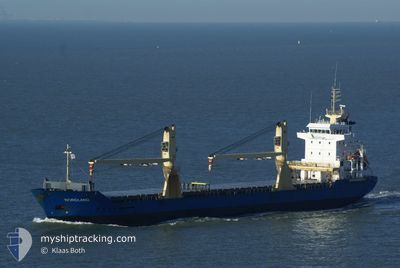
ASG PORTOFINO
General Cargo

Current Trip
| Trip Time | 37 days |
|---|---|
| Trip Distance | 3403.82 nm |
| AVG Speed | 8.6 Knopen |
| MAX Speed | 10.5 Knopen |
| Diepgang | 6.8 M |
| AVG Wind | 11 knots |
| MAX Wind | 29 knots |
| MIN Temp | 7.8°C / 46.04°F |
| MAX Temp | 20.3°C / 68.54°F |
| Positie ontvangen | 2 d geleden |
Current Position
| Lengtegraad | --- |
|---|---|
| Breedtegraat | --- |
| Status | Under way using engine |
| Snelheid | 9.5 Knopen |
| Koers | 72.3° |
| Gebied | Black Sea |
| Station | T-AIS |
| Positie ontvangen | 2 d geleden |
Information
The current position of ASG PORTOFINO is in Black Sea with coordinates 41.34533° / 29.56088° as reported on 2025-03-25 19:35 by AIS to our vessel tracker app. The vessel's current speed is 9.5 Knopen and is currently inside the port of SAMSUN.
The vessel ASG PORTOFINO (IMO: 9229087, MMSI: 511101258) is a General Cargo that was built in 2002 ( 23 Jaar oud ). It's sailing under the flag of [PW] Palau.
In this page you can find informations about the vessels current position, last detected port calls, and current voyage information. If the vessels is not in coverage by AIS you will find the latest position.
The current position of ASG PORTOFINO is detected by our AIS receivers and we are not responsible for the reliability of the data. The last position was recorded while the vessel was in Coverage by the Ais receivers of our vessel tracking app.
The current draught of ASG PORTOFINO as reported by AIS is 6.8 meters
Weather
| Temperature | 13.9°C / 57.02°F |
|---|---|
| Wind Speed | 4 knots |
| Direction | 200° SSW |
| Pressure | 1011.6 hPa |
| Humidity | 64.9 % |
| Cloud Coverage | 47 % |


Featured Company
Last Port Calls
| Port | Arrival | Departure | Time In Port |
|---|---|---|---|
| 2025-03-27 10:42 | |||
| 2025-03-13 14:01 | |||
| 2025-02-12 21:45 | 2025-02-17 23:39 | 5 d | |
| 2025-02-10 18:03 | 2025-02-10 22:50 | 4 h | |
| 2025-02-02 08:00 | 2025-02-06 19:22 | 4 d | |
| 2025-01-24 19:21 | 2025-01-24 20:09 | 47 m | |
| 2025-01-20 10:46 | 2025-01-20 11:15 | 29 m | |
| 2025-01-08 14:14 | 2025-01-09 12:48 | 22 h |
Most Visited Ports (Last year)
| Port | Arrivals | |
|---|---|---|
| 20 | ||
| 20 | ||
| 4 | ||
| 2 | ||
| 2 | ||
| 2 |
Last Trips
| Origin | Departure | Destination | Arrival | Distance | |
|---|---|---|---|---|---|
| 2025-02-17 23:39 | 2025-03-27 10:42 | 3403.82 nm | |||
| 2025-02-17 23:39 | 2025-03-13 14:01 | 1541.10 nm | |||
| 2025-02-10 22:50 | 2025-02-12 21:45 | 419.15 nm | |||
| 2025-02-06 19:22 | 2025-02-10 18:03 | 908.85 nm | |||
| 2025-01-24 20:09 | 2025-02-02 08:00 | 1592.81 nm | |||
| 2025-01-20 11:15 | 2025-01-24 19:21 | 49.17 nm | |||
| 2025-01-09 12:48 | 2025-01-20 10:46 | 2365.78 nm | |||
| 2024-12-31 19:56 | 2025-01-08 14:14 | 1590.35 nm |
Events
| Tijd | Evenement | Details | Positie / Bestemming | Info |
|---|---|---|---|---|
| 2025-03-27 08:26 | Stop beweging |
41.29072 / 36.34708
[TR] SAMSUN
|
Snelheid: Koers: 1° |
|
| 2025-03-27 07:42 | Aankomsthaven |
|
41.31018 / 36.36214
[TR] SAMSUN
|
Snelheid: 4.8 kn Koers: 204° |
| 2025-03-25 19:59 | Status Changed | Default Under way using engine |
41.36710 / 29.64311
SAMSUN
|
Snelheid: 9.5 kn Koers: 72.3° |
| 2025-03-25 19:35 | Buitenbereik |
41.34533 / 29.56088
Black Sea
|
Snelheid: 9.5 kn Koers: 72.3° |
|
| 2025-03-25 17:32 | Wijzig zee gebeid | Turkish part of the Black Sea Turkish part of the Sea of Marmara |
41.23083 / 29.15388
Black Sea
|
Snelheid: 9.4 kn Koers: 60.2° |
| 2025-03-25 14:39 | Start beweging | 1.74 nm, South East of ZEYTINBURNU |
40.95965 / 28.92147
SAMSUN
|
Snelheid: 5.6 kn Koers: 175.1° |
| 2025-03-25 14:31 | Status Changed | Under way using engine At anchor |
40.96152 / 28.92261
SAMSUN
|
Snelheid: 0.6 kn Koers: 237° |
| 2025-03-25 11:35 | Status Changed | At anchor Under way using engine |
40.96148 / 28.92248
SAMSUN
|
Snelheid: 0.2 kn Koers: 281° |
| 2025-03-25 11:34 | Stop beweging | 1.71 nm, South East of ZEYTINBURNU |
40.96142 / 28.92250
SAMSUN
|
Snelheid: 0.3 kn Koers: 284° |
| 2025-03-25 07:16 | Status Changed | Under way using engine Default |
40.77765 / 28.22705
SAMSUN
|
Snelheid: 9.7 kn Koers: 82° |