
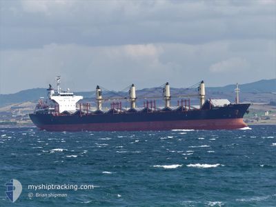
ASALET
Bulk Carrier
Current Trip
| Trip Time | 3 days |
|---|---|
| Trip Distance | 532.53 nm |
| AVG Speed | 10.3 Knopen |
| MAX Speed | 13 Knopen |
| Diepgang | 5.5 M |
| AVG Wind | 10 knots |
| MAX Wind | 20.8 knots |
| MIN Temp | 13.7°C / 56.66°F |
| MAX Temp | 18.6°C / 65.48°F |
| Positie ontvangen | 2 d geleden |
Current Position
| Lengtegraad | -0.25478° |
|---|---|
| Breedtegraat | 35.85096° |
| Status | Under way using engine |
| Snelheid | 2.8 Knopen |
| Koers | 234° |
| Gebied | Mediterranean Sea - Western Basin |
| Station | T-AIS |
| Positie ontvangen | 2 d geleden |
Info
Information
The current position of ASALET is in Mediterranean Sea - Western Basin with coordinates 35.85096° / -0.25478° as reported on 2024-04-29 09:38 by AIS to our vessel tracker app. The vessel's current speed is 2.8 Knopen and is currently inside the port of ARZEW.
The vessel ASALET (IMO: 9574169, MMSI: 271042325) is a Bulk Carrier that was built in 2010 ( 14 Jaar oud ). It's sailing under the flag of [TR] Turkey.
In this page you can find informations about the vessels current position, last detected port calls, and current voyage information. If the vessels is not in coverage by AIS you will find the latest position.
The current position of ASALET is detected by our AIS receivers and we are not responsible for the reliability of the data. The last position was recorded while the vessel was in Coverage by the Ais receivers of our vessel tracking app.
The current draught of ASALET as reported by AIS is 5.5 meters
Weather
| Temperature | 16.7°C / 62.06°F |
|---|---|
| Wind Speed | 13 knots |
| Direction | 258° WSW |
| Pressure | 1017.2 hPa |
| Humidity | 59.6 % |
| Cloud Coverage | 98 % |
Featured Company
Last Port Calls
| Port | Arrival | Departure | Time In Port |
|---|---|---|---|
| 2024-04-29 09:45 | |||
| 2024-04-25 11:26 | 2024-04-25 20:45 | 9 h | |
| 2024-04-18 05:17 | 2024-04-20 11:39 | 2 d | |
| 2024-04-05 02:53 | 2024-04-10 17:02 | 5 d | |
| 2024-03-28 05:03 | 2024-03-28 14:22 | 9 h | |
| 2024-03-09 19:38 | 2024-03-12 04:42 | 2 d |
Most Visited Ports (Last year)
| Port | Arrivals | |
|---|---|---|
| 2 | ||
| 1 | ||
| 1 | ||
| 1 | ||
| 1 | ||
| 1 |
Last Trips
| Origin | Departure | Destination | Arrival | Distance | |
|---|---|---|---|---|---|
| 2024-04-25 22:45 | 2024-04-29 10:45 | 532.53 nm | |||
| 2024-04-20 13:39 | 2024-04-25 13:26 | 1438.46 nm | |||
| 2024-04-10 20:02 | 2024-04-18 07:17 | 1338.90 nm | |||
| 2024-03-12 10:12 | 2024-04-05 05:53 | 5487.08 nm | |||
| 2024-03-12 10:12 | 2024-03-28 07:03 | 4352.32 nm | |||
| 2024-01-31 01:15 | 2024-03-10 01:08 | 4548.56 nm |
Events
| Tijd | Evenement | Details | Positie / Bestemming | Info |
|---|---|---|---|---|
| 2024-04-29 10:21 | Stop beweging |
35.85333 / -.29833
[DZ] ARZEW
|
Snelheid: Koers: -1° |
|
| 2024-04-29 09:45 | Status Changed | Default Under way using engine |
35.84500 / -.26500
[DZ] ARZEW
|
Snelheid: 2.8 kn Koers: 234° |
| 2024-04-29 09:45 | Aankomsthaven |
|
35.84500 / -.26500
[DZ] ARZEW
|
Snelheid: 2.8 kn Koers: 234° |
| 2024-04-29 09:38 | Buitenbereik |
35.85096 / -.25478
Mediterranean Sea - Western Basin
[DZ] ARZEW
|
Snelheid: 2.8 kn Koers: 226° |
|
| 2024-04-29 09:26 | Status Changed | Under way using engine Default |
35.86633 / -.24249
ARZEW
|
Snelheid: 5 kn Koers: 196° |
| 2024-04-29 09:10 | Status Changed | Default Under way using engine |
35.88500 / -.23333
ARZEW
|
Snelheid: 11.7 kn Koers: 201.3° |
| 2024-04-29 08:48 | Status Changed | Under way using engine Default |
35.95388 / -.20512
ARZEW
|
Snelheid: 11 kn Koers: 189° |
| 2024-04-29 08:34 | Status Changed | Default Under way using engine |
35.98833 / -.19667
ARZEW
|
Snelheid: 2 kn Koers: 167° |
| 2024-04-29 08:22 | Status Changed | Under way using engine Default |
36.00325 / -.20056
ARZEW
|
Snelheid: 1 kn Koers: -1° |
| 2024-04-29 07:51 | Status Changed | Default Under way using engine |
36.01333 / -.20333
ARZEW
|
Snelheid: 4.9 kn Koers: 213° |