

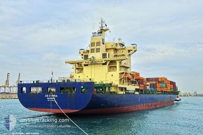
AS CYPRIA
Container Ship

Current Trip
| Time Travelled | 1 day |
|---|---|
| Remaining Time | --- |
| Distance Travelled | 61.24 nm |
| Remaining Distance | 41.93 nm |
| AVG Speed | 10.3 Knopen |
| MAX Speed | 13.9 Knopen |
| AVG Wind | 11.8 knots |
| MAX Wind | 24 knots |
| MIN Temp | 14.5°C / 58.1°F |
| MAX Temp | 19.1°C / 66.38°F |
| Diepgang | 8.6 M |
| Positie ontvangen | 5 h, 58 m geleden |
Current Position
| Lengtegraad | --- |
|---|---|
| Breedtegraat | --- |
| Status | At anchor |
| Snelheid | 0.2 Knopen |
| Koers | 200° |
| Gebied | North Atlantic Ocean |
| Station | T-AIS |
| Positie ontvangen | 5 h, 58 m geleden |
Information
The current position of AS CYPRIA is in North Atlantic Ocean with coordinates 36.07959° / -6.30799° as reported on 2025-02-22 05:44 by AIS to our vessel tracker app. The vessel's current speed is 0.2 Knopen and is heading at the port of TANGER MED. The estimated time of arrival as calculated by MyShipTracking vessel tracking app is 2025-02-24 04:00 LT
The vessel AS CYPRIA (IMO: 9315812, MMSI: 255806093) is a Container Ship that was built in 2006 ( 19 Jaar oud ). It's sailing under the flag of [PT] Portugal.
In this page you can find informations about the vessels current position, last detected port calls, and current voyage information. If the vessels is not in coverage by AIS you will find the latest position.
The current position of AS CYPRIA is detected by our AIS receivers and we are not responsible for the reliability of the data. The last position was recorded while the vessel was in Coverage by the Ais receivers of our vessel tracking app.
The current draught of AS CYPRIA as reported by AIS is 8.6 meters
Weather
| Temperature | 15.4°C / 59.72°F |
|---|---|
| Wind Speed | 10 knots |
| Direction | 349° N |
| Pressure | 1024.3 hPa |
| Humidity | 73.5 % |
| Cloud Coverage | 82 % |


Featured Company
Last Port Calls
| Port | Arrival | Departure | Time In Port |
|---|---|---|---|
| 2025-02-15 09:48 | 2025-02-20 13:23 | 5 d | |
| 2025-02-10 00:21 | 2025-02-10 21:05 | 20 h | |
| 2025-02-08 02:58 | 2025-02-09 02:41 | 23 h | |
| 2025-02-06 21:43 | 2025-02-07 09:25 | 11 h | |
| 2025-02-02 21:26 | 2025-02-03 10:09 | 12 h | |
| 2025-01-30 23:22 | 2025-02-01 02:37 | 1 d | |
| 2025-01-29 23:37 | 2025-01-30 16:45 | 17 h | |
| 2025-01-26 13:31 | 2025-01-27 16:11 | 1 d | |
| 2025-01-24 04:53 | 2025-01-24 13:46 | 8 h | |
| 2025-01-22 11:18 | 2025-01-23 06:44 | 19 h |
Most Visited Ports (Last year)
| Port | Arrivals | |
|---|---|---|
| 21 | ||
| 20 | ||
| 14 | ||
| 10 | ||
| 9 | ||
| 1 |
Last Trips
| Origin | Departure | Destination | Arrival | Distance | |
|---|---|---|---|---|---|
| 2025-02-09 05:41 | 2025-02-15 10:48 | 2301.59 nm | |||
| 2025-02-09 05:41 | 2025-02-10 02:21 | 362.41 nm | |||
| 2025-02-07 12:25 | 2025-02-08 05:58 | 88.22 nm | |||
| 2025-02-03 13:09 | 2025-02-07 00:43 | 689.31 nm | |||
| 2025-02-01 04:37 | 2025-02-03 00:26 | 598.72 nm | |||
| 2025-01-27 19:11 | 2025-01-31 01:22 | 772.14 nm | |||
| 2025-01-27 19:11 | 2025-01-30 01:37 | 628.89 nm | |||
| 2025-01-23 08:44 | 2025-01-26 16:31 | 783.97 nm | |||
| 2025-01-23 08:44 | 2025-01-24 06:53 | 62.04 nm | |||
| 2025-01-18 07:38 | 2025-01-22 13:18 | 1642.30 nm |
Events
| Tijd | Evenement | Details | Positie / Bestemming | Info |
|---|---|---|---|---|
| 2025-02-22 05:50 | Status Changed | Default At anchor |
36.07964 / -6.30819
MAPTM
|
Snelheid: 0.2 kn Koers: 200° |
| 2025-02-22 05:44 | Status Changed | At anchor Default |
36.07959 / -6.30799
MAPTM
|
Snelheid: 0.1 kn Koers: 201° |
| 2025-02-22 05:44 | Buitenbereik |
36.07959 / -6.30799
North Atlantic Ocean
MAPTM
|
Snelheid: 0.2 kn Koers: 84.2° |
|
| 2025-02-22 05:32 | Status Changed | Default At anchor |
36.07968 / -6.30810
MAPTM
|
Snelheid: 0.3 kn Koers: 200° |
| 2025-02-22 05:23 | Status Changed | At anchor Default |
36.07964 / -6.30802
MAPTM
|
Snelheid: 0.1 kn Koers: 199° |
| 2025-02-22 04:56 | Status Changed | Default At anchor |
36.07982 / -6.30828
MAPTM
|
Snelheid: 0.2 kn Koers: 193° |
| 2025-02-22 04:53 | Status Changed | At anchor Default |
36.07977 / -6.30837
MAPTM
|
Snelheid: 0.2 kn Koers: 199° |
| 2025-02-22 04:53 | Binnenbereik |
36.07977 / -6.30837
North Atlantic Ocean
MAPTM
|
Snelheid: 0.2 kn Koers: 310.2° |
|
| 2025-02-22 02:38 | Status Changed | Default At anchor |
36.07844 / -6.30761
MAPTM
|
Snelheid: 0.4 kn Koers: 273° |
| 2025-02-22 02:32 | Buitenbereik |
36.07840 / -6.30755
North Atlantic Ocean
MAPTM
|
Snelheid: 0.4 kn Koers: 169.7° |