

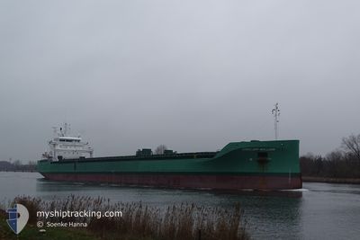
ARKLOW WILLOW
Cargo

Current Trip
| Time Travelled | 11 days |
|---|---|
| Remaining Time | 6 days |
| Distance Travelled | 1739.93 nm |
| Remaining Distance | 1457.11 nm |
| AVG Speed | 9.3 Knopen |
| MAX Speed | 14.9 Knopen |
| AVG Wind | 10 knots |
| MAX Wind | 31.7 knots |
| MIN Temp | -4.8°C / 23.36°F |
| MAX Temp | 9.5°C / 49.1°F |
| Diepgang | 8.2 M |
| Positie ontvangen | 2 h, 37 m geleden |
Current Position
| Lengtegraad | --- |
|---|---|
| Breedtegraat | --- |
| Status | Under way using engine |
| Snelheid | 8.8 Knopen |
| Koers | 207.7° |
| Gebied | North Sea |
| Station | T-AIS |
| Positie ontvangen | 2 h, 37 m geleden |
Information
The current position of ARKLOW WILLOW is in North Sea with coordinates 53.21455° / 4.42792° as reported on 2025-02-24 00:07 by AIS to our vessel tracker app. The vessel's current speed is 8.8 Knopen and is heading at the port of CASABLANCA. The estimated time of arrival as calculated by MyShipTracking vessel tracking app is 2025-03-02 08:41 LT
The vessel ARKLOW WILLOW (IMO: 9818955, MMSI: 250005692) is a Cargo It's sailing under the flag of [IE] Ireland.
In this page you can find informations about the vessels current position, last detected port calls, and current voyage information. If the vessels is not in coverage by AIS you will find the latest position.
The current position of ARKLOW WILLOW is detected by our AIS receivers and we are not responsible for the reliability of the data. The last position was recorded while the vessel was in Coverage by the Ais receivers of our vessel tracking app.
The current draught of ARKLOW WILLOW as reported by AIS is 8.2 meters
Weather
| Temperature | 8.3°C / 46.94°F |
|---|---|
| Wind Speed | 29 knots |
| Direction | 193° SSW |
| Pressure | 1016.1 hPa |
| Humidity | 81.3 % |
| Cloud Coverage | 100 % |


Featured Company
Last Port Calls
| Port | Arrival | Departure | Time In Port |
|---|---|---|---|
| 2025-02-07 15:49 | 2025-02-12 18:36 | 5 d | |
| 2025-01-29 17:14 | 2025-02-06 12:40 | 7 d | |
| 2025-01-23 14:30 | 2025-01-26 17:32 | 3 d | |
| 2025-01-17 21:09 | 2025-01-22 11:23 | 4 d | |
| 2025-01-14 09:27 | 2025-01-16 21:57 | 2 d | |
| 2025-01-10 22:09 | |||
| 2024-12-21 10:08 | 2024-12-24 04:36 | 2 d | |
| 2024-12-11 13:36 | 2024-12-17 18:15 | 6 d | |
| 2024-12-06 15:04 |
Most Visited Ports (Last year)
| Port | Arrivals | |
|---|---|---|
| 11 | ||
| 3 | ||
| 3 | ||
| 3 | ||
| 2 | ||
| 2 |
Last Trips
| Origin | Departure | Destination | Arrival | Distance | |
|---|---|---|---|---|---|
| 2025-02-06 12:40 | 2025-02-07 16:49 | 298.85 nm | |||
| 2025-01-26 18:32 | 2025-01-29 17:14 | 289.34 nm | |||
| 2025-01-22 11:23 | 2025-01-23 15:30 | 298.32 nm | |||
| 2025-01-16 22:57 | 2025-01-17 21:09 | 288.13 nm | |||
| 2025-01-10 22:09 | 2025-01-14 10:27 | 639.82 nm | |||
| 2024-12-17 18:15 | 2024-12-21 11:08 | 226.89 nm | |||
| 2024-12-06 16:04 | 2024-12-11 13:36 | 320.06 nm |
Events
| Tijd | Evenement | Details | Positie / Bestemming | Info |
|---|---|---|---|---|
| 2025-02-24 00:13 | Status Changed | Default Under way using engine |
53.20255 / 4.41765
MACAS VIA NOK
|
Snelheid: 8.8 kn Koers: 207.7° |
| 2025-02-24 00:07 | Status Changed | Under way using engine Default |
53.21455 / 4.42792
MACAS VIA NOK
|
Snelheid: 9.1 kn Koers: 207° |
| 2025-02-24 00:07 | Buitenbereik |
53.21455 / 4.42792
North Sea
MACAS VIA NOK
|
Snelheid: 8.8 kn Koers: 207.7° |
|
| 2025-02-23 23:48 | Status Changed | Default Under way using engine |
53.25772 / 4.46434
MACAS VIA NOK
|
Snelheid: 9.4 kn Koers: 200.1° |
| 2025-02-23 23:36 | Status Changed | Under way using engine Default |
53.28674 / 4.48434
MACAS VIA NOK
|
Snelheid: 9.7 kn Koers: 202° |
| 2025-02-23 23:25 | Status Changed | Default Under way using engine |
53.31398 / 4.50188
MACAS VIA NOK
|
Snelheid: 9.7 kn Koers: 200.6° |
| 2025-02-23 17:37 | Wijzig zee gebeid | Dutch part of the North Sea German part of the North Sea |
53.76902 / 6.07313
North Sea
MACAS VIA NOK
|
Snelheid: 10.9 kn Koers: 251.7° |
| 2025-02-23 17:37 | Status Changed | Under way using engine Default |
53.76902 / 6.07313
MACAS VIA NOK
|
Snelheid: 10.8 kn Koers: 252° |
| 2025-02-23 17:21 | Binnenbereik |
53.76902 / 6.07313
North Sea
MACAS VIA NOK
|
Snelheid: 10.9 kn Koers: 251.7° |
|
| 2025-02-23 15:29 | Buitenbereik |
53.87738 / 6.68616
North Sea
MACAS VIA NOK
|
Snelheid: 10.5 kn Koers: 253.5° |