
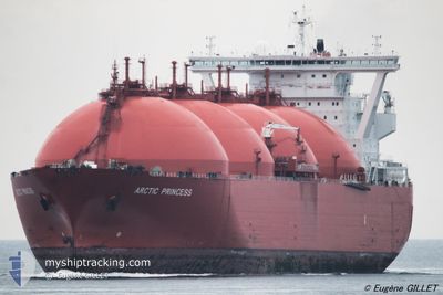
ARCTIC PRINCESS
Lng Tanker
Current Trip
| Time Travelled | 1 day |
|---|---|
| Remaining Time | 3 days |
| Distance Travelled | 310.98 nm |
| Remaining Distance | 939.77 nm |
| AVG Speed | 8.9 Knopen |
| MAX Speed | 14 Knopen |
| AVG Wind | 14.4 knots |
| MAX Wind | 27.8 knots |
| MIN Temp | 14.8°C / 58.64°F |
| MAX Temp | 22.4°C / 72.32°F |
| Diepgang | 11.4 M |
| Positie ontvangen | 6 m geleden |
Current Position
| Lengtegraad | -6.58781° |
|---|---|
| Breedtegraat | 36.05324° |
| Status | Under way using engine |
| Snelheid | 11.3 Knopen |
| Koers | 288.4° |
| Gebied | North Atlantic Ocean |
| Station | T-AIS |
| Positie ontvangen | 6 m geleden |
Info
Information
The current position of ARCTIC PRINCESS is in North Atlantic Ocean with coordinates 36.05324° / -6.58781° as reported on 2024-05-02 20:01 by AIS to our vessel tracker app. The vessel's current speed is 11.3 Knopen and is heading at the port of MONTOIR. The estimated time of arrival as calculated by MyShipTracking vessel tracking app is 2024-05-06 09:48 LT
The vessel ARCTIC PRINCESS (IMO: 9271248, MMSI: 257739000) is a Lng Tanker that was built in 2006 ( 18 Jaar oud ). It's sailing under the flag of [NO] Norway.
In this page you can find informations about the vessels current position, last detected port calls, and current voyage information. If the vessels is not in coverage by AIS you will find the latest position.
The current position of ARCTIC PRINCESS is detected by our AIS receivers and we are not responsible for the reliability of the data. The last position was recorded while the vessel was in Coverage by the Ais receivers of our vessel tracking app.
The current draught of ARCTIC PRINCESS as reported by AIS is 11.4 meters
Weather
| Temperature | 15.9°C / 60.62°F |
|---|---|
| Wind Speed | 12 knots |
| Direction | 329° NNW |
| Pressure | 1020.4 hPa |
| Humidity | 62.9 % |
| Cloud Coverage | 100 % |
Featured Company
Events
| Tijd | Evenement | Details | Positie / Bestemming | Info |
|---|---|---|---|---|
| 2024-05-02 20:01 | Status Changed | Under way using engine Default |
36.05324 / -6.58781
FRMTX
|
Snelheid: 11.4 kn Koers: 288° |
| 2024-05-02 19:54 | Status Changed | Default Under way using engine |
36.05109 / -6.57979
FRMTX
|
Snelheid: 11 kn Koers: 290.1° |
| 2024-05-02 17:19 | Wijzig zee gebeid | Spanish part of the North Atlantic Ocean Spanish part of the Strait of Gibraltar |
35.96543 / -5.98290
North Atlantic Ocean
FRMTX
|
Snelheid: 11.1 kn Koers: 270° |
| 2024-05-02 16:46 | Status Changed | Under way using engine Default |
35.96309 / -5.84234
FRMTX
|
Snelheid: 11.1 kn Koers: 271° |
| 2024-05-02 16:34 | Status Changed | Default Under way using engine |
35.96294 / -5.81813
FRMTX
|
Snelheid: 11.5 kn Koers: 269.7° |
| 2024-05-02 16:29 | Status Changed | Under way using engine Default |
35.96284 / -5.79242
FRMTX
|
Snelheid: 11.5 kn Koers: 270° |
| 2024-05-02 16:22 | Status Changed | Default Under way using engine |
35.96272 / -5.77083
FRMTX
|
Snelheid: 10.6 kn Koers: 270.2° |
| 2024-05-02 16:04 | Status Changed | Under way using engine Default |
35.96225 / -5.70023
FRMTX
|
Snelheid: 10.5 kn Koers: 270° |
| 2024-05-02 16:02 | Status Changed | Default Under way using engine |
35.96221 / -5.69543
FRMTX
|
Snelheid: 10.3 kn Koers: 270.1° |
| 2024-05-02 15:27 | Destination Changed | FRMTX ESHUV |
35.97555 / -5.57775
FRMTX
|
Snelheid: 9.5 kn Koers: 248.1° |