
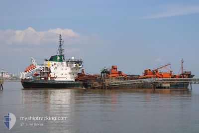
ARCO DIJK
Trailing Suction Hopper Dredger
Current Trip
| Time Travelled | 2 days |
|---|---|
| Remaining Time | --- |
| Distance Travelled | 269.11 nm |
| Remaining Distance | 12.63 nm |
| AVG Speed | 9.5 Knopen |
| MAX Speed | 15.2 Knopen |
| AVG Wind | 22.5 knots |
| MAX Wind | 33.5 knots |
| MIN Temp | 4.9°C / 40.82°F |
| MAX Temp | 11.3°C / 52.34°F |
| Diepgang | 7 M |
| Positie ontvangen | Nu |
Current Position
| Lengtegraad | --- |
|---|---|
| Breedtegraat | --- |
| Status | Under way using engine |
| Snelheid | 7.3 Knopen |
| Koers | 271° |
| Gebied | North Sea |
| Station | T-AIS |
| Positie ontvangen | Nu |
Info
Information
The current position of ARCO DIJK is in North Sea with coordinates 51.44995° / 0.39645° as reported on 2024-12-23 14:40 by AIS to our vessel tracker app. The vessel's current speed is 7.3 Knopen and is heading at the port of DAGENHAM. The estimated time of arrival as calculated by MyShipTracking vessel tracking app is 2024-12-23 15:30 LT
The vessel ARCO DIJK (IMO: 9034092, MMSI: 308165000) is a Trailing Suction Hopper Dredger that was built in 1992 ( 32 Jaar oud ). It's sailing under the flag of [BS] Bahamas.
In this page you can find informations about the vessels current position, last detected port calls, and current voyage information. If the vessels is not in coverage by AIS you will find the latest position.
The current position of ARCO DIJK is detected by our AIS receivers and we are not responsible for the reliability of the data. The last position was recorded while the vessel was in Coverage by the Ais receivers of our vessel tracking app.
The current draught of ARCO DIJK as reported by AIS is 7 meters
Weather
| Temperature | 6.2°C / 43.16°F |
|---|---|
| Wind Speed | 10 knots |
| Direction | 299° WNW |
| Pressure | 1022.9 hPa |
| Humidity | 70.1 % |
| Cloud Coverage | 100 % |
Featured Company
Last Port Calls
| Port | Arrival | Departure | Time In Port |
|---|---|---|---|
| 2024-12-21 00:13 | 2024-12-21 09:53 | 9 h | |
| 2024-12-17 06:34 | 2024-12-19 15:09 | 2 d | |
| 2024-12-17 06:12 | 2024-12-17 06:19 | 7 m | |
| 2024-12-16 09:46 | 2024-12-17 03:02 | 17 h | |
| 2024-12-14 20:34 | 2024-12-15 04:36 | 8 h | |
| 2024-12-12 23:30 | 2024-12-13 10:58 | 11 h | |
| 2024-12-12 22:35 | 2024-12-12 23:07 | 31 m | |
| 2024-12-11 20:16 | |||
| 2024-12-11 19:51 | |||
| 2024-12-11 19:51 |
Most Visited Ports (Last year)
| Port | Arrivals | |
|---|---|---|
| 66 | ||
| 44 | ||
| 21 | ||
| 15 | ||
| 1 | ||
| 1 |
Last Trips
| Origin | Departure | Destination | Arrival | Distance | |
|---|---|---|---|---|---|
| 2024-12-19 15:09 | 2024-12-21 00:13 | 259.18 nm | |||
| 2024-12-17 06:19 | 2024-12-17 06:34 | 0.45 nm | |||
| 2024-12-17 03:02 | 2024-12-17 06:12 | 37.06 nm | |||
| 2024-12-15 04:36 | 2024-12-16 09:46 | 291.05 nm | |||
| 2024-12-13 10:58 | 2024-12-14 20:34 | 315.39 nm | |||
| 2024-12-12 23:07 | 2024-12-12 23:30 | 1.25 nm | |||
| 2024-12-11 20:16 | 2024-12-12 22:35 | 218.94 nm | |||
| 2024-12-11 19:51 | 2024-12-11 19:51 | --- | |||
| 2024-12-06 16:34 | 2024-12-06 16:42 | 1.00 nm | |||
| 2024-12-05 06:28 | 2024-12-06 16:05 | 238.42 nm |
Events
| Tijd | Evenement | Details | Positie / Bestemming | Info |
|---|---|---|---|---|
| 2024-12-23 12:44 | ETA Changed | 2024/12/23 15:30 2024/12/23 14:45 |
51.48471 / .92745
DAGENHAM
|
Snelheid: 11 kn Koers: 280.8° |
| 2024-12-23 07:58 | Start beweging | 5.66 nm, North of RAMSGATE |
51.41490 / 1.37286
DAGENHAM
|
Snelheid: 3.3 kn Koers: 179° |
| 2024-12-23 07:56 | Status Changed | Under way using engine At anchor |
51.41600 / 1.37331
DAGENHAM
|
Snelheid: 0.7 kn Koers: 264° |
| 2024-12-23 01:40 | ETA Changed | 2024/12/23 14:45 2024/12/23 01:30 |
51.41535 / 1.37454
DAGENHAM
|
Snelheid: Koers: 323° |
| 2024-12-22 10:21 | Status Changed | At anchor Under way using engine |
51.41695 / 1.37432
DAGENHAM
|
Snelheid: 1.1 kn Koers: 233° |
| 2024-12-22 10:16 | Stop beweging | 5.77 nm, North of RAMSGATE |
51.41674 / 1.37272
DAGENHAM
|
Snelheid: 0.3 kn Koers: 259° |
| 2024-12-22 03:24 | Draught Changed | 7 4.7 |
52.18939 / 1.90169
DAGENHAM
|
Snelheid: 8.4 kn Koers: 203.7° |
| 2024-12-22 03:24 | Destination Changed | DAGENHAM DA 401/1-2B |
52.18939 / 1.90169
DAGENHAM
|
Snelheid: 8.4 kn Koers: 203.7° |
| 2024-12-22 03:24 | ETA Changed | 2024/12/23 01:30 2024/12/21 20:00 |
52.18939 / 1.90169
DAGENHAM
|
Snelheid: 8.4 kn Koers: 203.7° |
| 2024-12-22 03:23 | Status Changed | Under way using engine Default |
52.19154 / 1.90318
DA 401/1-2B
|
Snelheid: 7.7 kn Koers: 203° |