
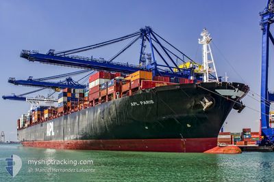
APL PARIS
Container Ship
Current Trip
| Time Travelled | 16 days |
|---|---|
| Remaining Time | 2 days |
| Distance Travelled | 6199.95 nm |
| Remaining Distance | 876.26 nm |
| AVG Speed | 15.9 Knopen |
| MAX Speed | 19.3 Knopen |
| AVG Wind | 13.9 knots |
| MAX Wind | 33 knots |
| MIN Temp | -2.4°C / 27.68°F |
| MAX Temp | 19.9°C / 67.82°F |
| Diepgang | 11.4 M |
| Positie ontvangen | 4 d geleden |
Current Position
| Lengtegraad | --- |
|---|---|
| Breedtegraat | --- |
| Status | Under way using engine |
| Snelheid | 13.3 Knopen |
| Koers | 232.2° |
| Gebied | Japan Sea |
| Station | T-AIS |
| Positie ontvangen | 4 d geleden |
Info
Information
The current position of APL PARIS is in Japan Sea with coordinates 41.14934° / 139.89898° as reported on 2025-02-23 08:22 by AIS to our vessel tracker app. The vessel's current speed is 13.3 Knopen and is heading at the port of HAI PHONG. The estimated time of arrival as calculated by MyShipTracking vessel tracking app is 2025-03-02 06:38 LT
The vessel APL PARIS (IMO: 9601302, MMSI: 566704000) is a Container Ship that was built in 2012 ( 13 Jaar oud ). It's sailing under the flag of [SG] Singapore.
In this page you can find informations about the vessels current position, last detected port calls, and current voyage information. If the vessels is not in coverage by AIS you will find the latest position.
The current position of APL PARIS is detected by our AIS receivers and we are not responsible for the reliability of the data. The last position was recorded while the vessel was in Coverage by the Ais receivers of our vessel tracking app.
The current draught of APL PARIS as reported by AIS is 11.4 meters
Weather
| Temperature | 16.1°C / 60.98°F |
|---|---|
| Wind Speed | 4 knots |
| Direction | 27° NNE |
| Pressure | 1017.5 hPa |
| Humidity | 87.2 % |
| Cloud Coverage | 5 % |
Featured Company
Last Port Calls
| Port | Arrival | Departure | Time In Port |
|---|---|---|---|
| 2025-02-06 12:21 | 2025-02-11 13:45 | 5 d | |
| 2025-01-19 06:37 | 2025-01-20 20:45 | 1 d | |
| 2025-01-17 11:45 | 2025-01-18 11:57 | 1 d | |
| 2024-12-19 10:06 | 2024-12-25 17:30 | 6 d | |
| 2024-12-10 12:23 | 2024-12-14 12:56 | 4 d |
Most Visited Ports (Last year)
| Port | Arrivals | |
|---|---|---|
| 4 | ||
| 4 | ||
| 3 | ||
| 3 | ||
| 3 | ||
| 2 |
Last Trips
| Origin | Departure | Destination | Arrival | Distance | |
|---|---|---|---|---|---|
| 2025-01-21 04:45 | 2025-02-06 04:21 | 7108.85 nm | |||
| 2025-01-18 19:57 | 2025-01-19 14:37 | 153.97 nm | |||
| 2024-12-25 09:30 | 2025-01-17 19:45 | 7446.85 nm | |||
| 2024-12-14 04:56 | 2024-12-19 02:06 | 1220.31 nm | |||
| 2024-11-23 10:04 | 2024-12-10 04:23 | 6652.18 nm |
Events
| Tijd | Evenement | Details | Positie / Bestemming | Info |
|---|---|---|---|---|
| 2025-02-23 08:28 | Status Changed | Default Under way using engine |
41.13741 / 139.87804
VNHPH
|
Snelheid: 13.3 kn Koers: 232.2° |
| 2025-02-23 08:22 | Buitenbereik |
41.14934 / 139.89898
Japan Sea
VNHPH
|
Snelheid: 13.3 kn Koers: 232.2° |
|
| 2025-02-23 08:17 | Status Changed | Under way using engine Default |
41.16081 / 139.91916
VNHPH
|
Snelheid: 13.1 kn Koers: 235° |
| 2025-02-23 08:14 | Status Changed | Default Under way using engine |
41.16819 / 139.93309
VNHPH
|
Snelheid: 12.7 kn Koers: 235.8° |
| 2025-02-23 07:58 | Status Changed | Under way using engine Default |
41.19783 / 139.99256
VNHPH
|
Snelheid: 12.2 kn Koers: 233° |
| 2025-02-23 07:42 | Binnenbereik |
41.19495 / 139.98705
Japan Sea
VNHPH
|
Snelheid: 12.1 kn Koers: 235.6° |
|
| 2025-02-23 06:59 | Status Changed | Default Under way using engine |
41.31455 / 140.22037
VNHPH
|
Snelheid: 13 kn Koers: 229.3° |
| 2025-02-23 06:56 | Buitenbereik |
41.32163 / 140.23128
Japan Sea
VNHPH
|
Snelheid: 13 kn Koers: 229.3° |
|
| 2025-02-23 06:55 | Status Changed | Under way using engine Default |
41.32359 / 140.23432
VNHPH
|
Snelheid: 12.9 kn Koers: 229° |
| 2025-02-23 06:53 | Status Changed | Default Under way using engine |
41.32787 / 140.24092
VNHPH
|
Snelheid: 12.8 kn Koers: 230.9° |