
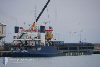
ANTARES
General Cargo
Current Trip
| Time Travelled | 13 days |
|---|---|
| Remaining Time | --- |
| Distance Travelled | 885.72 nm |
| Remaining Distance | --- |
| AVG Speed | 6.2 Knopen |
| MAX Speed | 6.2 Knopen |
| AVG Wind | 6.5 knots |
| MAX Wind | 22.8 knots |
| MIN Temp | -4.1°C / 24.62°F |
| MAX Temp | 9.6°C / 49.28°F |
| Diepgang | 2.8 M |
| Positie ontvangen | 7 d geleden |
Current Position
| Lengtegraad | --- |
|---|---|
| Breedtegraat | --- |
| Status | Under way using engine |
| Snelheid | 7.7 Knopen |
| Koers | 75.8° |
| Gebied | Black Sea |
| Station | T-AIS |
| Positie ontvangen | 7 d geleden |
Information
The current position of ANTARES is in Black Sea with coordinates 41.28046° / 29.38774° as reported on 2025-02-14 19:23 by AIS to our vessel tracker app. The vessel's current speed is 7.7 Knopen and is heading at the port of YEYSK. The estimated time of arrival as calculated by MyShipTracking vessel tracking app is 2025-02-18 08:00 LT
The vessel ANTARES (IMO: 8943404, MMSI: 667022000) is a General Cargo that was built in 1988 ( 37 Jaar oud ). It's sailing under the flag of [SL] Sierra Leone.
In this page you can find informations about the vessels current position, last detected port calls, and current voyage information. If the vessels is not in coverage by AIS you will find the latest position.
The current position of ANTARES is detected by our AIS receivers and we are not responsible for the reliability of the data. The last position was recorded while the vessel was in Coverage by the Ais receivers of our vessel tracking app.
The current draught of ANTARES as reported by AIS is 2.8 meters
Weather
| Temperature | -1.9°C / 28.58°F |
|---|---|
| Wind Speed | 22 knots |
| Direction | 40° NE |
| Pressure | 1031.2 hPa |
| Humidity | 60.6 % |
| Cloud Coverage | 20 % |
Featured Company
Events
| Tijd | Evenement | Details | Positie / Bestemming | Info |
|---|---|---|---|---|
| 2025-02-22 08:13 | Stop beweging | 10.9 nm, East of TAMAN |
45.06041 / 36.90265
RU YEY
|
Snelheid: 0.2 kn Koers: 70° |
| 2025-02-22 02:12 | Stop beweging | 10.9 nm, East of TAMAN |
45.06030 / 36.90270
RU YEY
|
Snelheid: 0.2 kn Koers: 63° |
| 2025-02-21 21:55 | Stop beweging | 10.89 nm, East of TAMAN |
45.06062 / 36.90245
RU YEY
|
Snelheid: 0.3 kn Koers: 61° |
| 2025-02-21 07:25 | Stop beweging | 11.14 nm, East of TAMAN |
45.05784 / 36.90725
RU YEY
|
Snelheid: 0.2 kn Koers: 68° |
| 2025-02-21 04:28 | Start beweging | 10.38 nm, South of TAMAN |
44.95195 / 36.69659
RU YEY
|
Snelheid: 4 kn Koers: 64° |
| 2025-02-21 00:39 | Stop beweging | 10.72 nm, South of TAMAN |
44.94529 / 36.68266
RU YEY
|
Snelheid: 0.3 kn Koers: 70° |
| 2025-02-21 00:09 | Start beweging | 10.26 nm, South of TAMAN |
44.95935 / 36.59350
RU YEY
|
Snelheid: 50.5 kn Koers: 268° |
| 2025-02-18 02:42 | Stop beweging | 10.69 nm, South of TAMAN |
44.94565 / 36.68217
RU YEY
|
Snelheid: 0.1 kn Koers: 68° |
| 2025-02-17 22:03 | Stop beweging | 10.72 nm, South of TAMAN |
44.94525 / 36.68250
RU YEY
|
Snelheid: 0.3 kn Koers: 59° |
| 2025-02-17 20:18 | Stop beweging | 10.72 nm, South of TAMAN |
44.94525 / 36.68232
RU YEY
|
Snelheid: 0.3 kn Koers: 49° |