
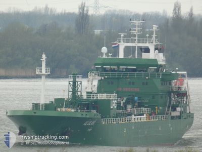
ALULAR
Lpg Tanker
Current Trip
| Time Travelled | 9 h, 44 mins |
|---|---|
| Remaining Time | 18 h, 59 mins |
| Distance Travelled | 107.14 nm |
| Remaining Distance | 196.55 nm |
| AVG Speed | 11 Knopen |
| MAX Speed | 12.8 Knopen |
| AVG Wind | 23.3 knots |
| MAX Wind | 32.8 knots |
| MIN Temp | 9.8°C / 49.64°F |
| MAX Temp | 10.8°C / 51.44°F |
| Diepgang | 5.6 M |
| Positie ontvangen | 56 m geleden |
Current Position
| Lengtegraad | 2.38553° |
|---|---|
| Breedtegraat | 52.11038° |
| Status | Under way using engine |
| Snelheid | 9.9 Knopen |
| Koers | 349.8° |
| Gebied | North Sea |
| Station | T-AIS |
| Positie ontvangen | 56 m geleden |
Info
Information
The current position of ALULAR is in North Sea with coordinates 52.11038° / 2.38553° as reported on 2024-04-28 11:07 by AIS to our vessel tracker app. The vessel's current speed is 9.9 Knopen and is heading at the port of TEES. The estimated time of arrival as calculated by MyShipTracking vessel tracking app is 2024-04-29 07:03 LT
The vessel ALULAR (IMO: 9578012, MMSI: 566660000) is a Lpg Tanker that was built in 2012 ( 12 Jaar oud ). It's sailing under the flag of [SG] Singapore.
In this page you can find informations about the vessels current position, last detected port calls, and current voyage information. If the vessels is not in coverage by AIS you will find the latest position.
The current position of ALULAR is detected by our AIS receivers and we are not responsible for the reliability of the data. The last position was recorded while the vessel was in Coverage by the Ais receivers of our vessel tracking app.
The current draught of ALULAR as reported by AIS is 5.6 meters
Weather
| Temperature | 10°C / 50°F |
|---|---|
| Wind Speed | 26 knots |
| Direction | 185° S |
| Pressure | 1000.3 hPa |
| Humidity | 89.5 % |
| Cloud Coverage | 90 % |
Featured Company
Last Port Calls
| Port | Arrival | Departure | Time In Port |
|---|---|---|---|
| 2024-04-27 04:24 | 2024-04-28 02:20 | 21 h | |
| 2024-04-24 16:16 | 2024-04-25 08:10 | 15 h | |
| 2024-04-21 17:01 | 2024-04-22 18:54 | 1 d | |
| 2024-04-18 21:26 | 2024-04-20 11:09 | 1 d | |
| 2024-04-11 22:23 | 2024-04-14 04:27 | 2 d | |
| 2024-04-05 16:32 | 2024-04-06 23:07 | 1 d | |
| 2024-03-27 12:06 | 2024-04-02 14:52 | 6 d | |
| 2024-03-23 02:08 | 2024-03-25 06:50 | 2 d | |
| 2024-03-20 08:13 | 2024-03-21 09:12 | 1 d | |
| 2024-03-16 03:51 | 2024-03-17 15:59 | 1 d |
Most Visited Ports (Last year)
| Port | Arrivals | |
|---|---|---|
| 12 | ||
| 8 | ||
| 6 | ||
| 6 | ||
| 5 | ||
| 5 |
Last Trips
| Origin | Departure | Destination | Arrival | Distance | |
|---|---|---|---|---|---|
| 2024-04-25 10:10 | 2024-04-27 06:24 | 567.63 nm | |||
| 2024-04-22 20:54 | 2024-04-24 18:16 | 536.07 nm | |||
| 2024-04-20 12:09 | 2024-04-21 19:01 | 306.71 nm | |||
| 2024-04-14 06:27 | 2024-04-18 22:26 | 492.45 nm | |||
| 2024-04-07 00:07 | 2024-04-12 00:23 | 458.96 nm | |||
| 2024-04-02 16:52 | 2024-04-05 17:32 | 290.69 nm | |||
| 2024-03-25 07:50 | 2024-03-27 13:06 | 79.39 nm | |||
| 2024-03-21 09:12 | 2024-03-23 03:08 | 264.25 nm | |||
| 2024-03-17 16:59 | 2024-03-20 08:13 | 259.52 nm | |||
| 2024-03-15 06:26 | 2024-03-16 04:51 | 256.69 nm |
Events
| Tijd | Evenement | Details | Positie / Bestemming | Info |
|---|---|---|---|---|
| 2024-04-28 11:12 | Status Changed | Default Under way using engine |
52.12318 / 2.38157
GB TEE
|
Snelheid: 9.9 kn Koers: 349.8° |
| 2024-04-28 10:28 | ETA Changed | 2024/04/29 09:00 2024/04/29 08:00 |
52.00167 / 2.42465
GB TEE
|
Snelheid: 10.5 kn Koers: 343.8° |
| 2024-04-28 10:04 | ETA Changed | 2024/04/29 08:00 2024/04/29 07:00 |
51.93693 / 2.45973
GB TEE
|
Snelheid: 10.4 kn Koers: 340.3° |
| 2024-04-28 09:31 | Wijzig zee gebeid | United Kingdom part of the North Sea Belgian part of the North Sea |
51.84877 / 2.51300
North Sea
GB TEE
|
Snelheid: 10.6 kn Koers: 337.4° |
| 2024-04-28 07:22 | Gevonden in zee | Belgian part of the North Sea |
51.54213 / 2.25263
North Sea
GB TEE
|
Snelheid: 11.5 kn Koers: 41.5° |
| 2024-04-28 06:31 | Wijzig zee gebeid | French part of the North Sea United Kingdom part of the North Sea |
51.41743 / 2.07933
North Sea
GB TEE
|
Snelheid: 11.9 kn Koers: 40.6° |
| 2024-04-28 04:40 | Wijzig zee gebeid | United Kingdom part of the North Sea French part of the North Sea |
51.11288 / 1.73915
North Sea
GB TEE
|
Snelheid: 12.8 kn Koers: 8° |
| 2024-04-28 04:13 | ETA Changed | 2024/04/29 07:00 2024/04/29 10:00 |
51.04622 / 1.79285
GB TEE
|
Snelheid: 10.2 kn Koers: 305.4° |
| 2024-04-28 03:28 | Status Changed | Under way using engine Default |
51.04373 / 1.99327
GB TEE
|
Snelheid: 11.9 kn Koers: 261° |
| 2024-04-28 03:20 | Status Changed | Default Under way using engine |
51.04770 / 2.03477
GB TEE
|
Snelheid: 11.8 kn Koers: 263.9° |