
ALLEGRA
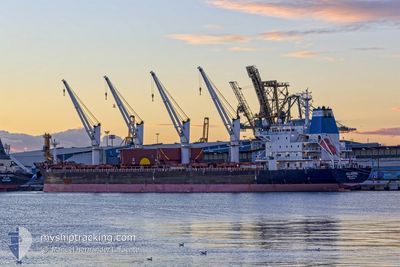
Bulk Carrier
Current Trip
| Trip Time | 8 days |
|---|---|
| Trip Distance | 1126.30 nm |
| AVG Speed | 9.5 Knopen |
| MAX Speed | 13.5 Knopen |
| Diepgang | 5.6 M |
| AVG Wind | 11.9 knots |
| MAX Wind | 24 knots |
| MIN Temp | 12.4°C / 54.32°F |
| MAX Temp | 21.2°C / 70.16°F |
| Positie ontvangen | 3 m geleden |
Current Position
| Lengtegraad | -1.23021° |
|---|---|
| Breedtegraat | 46.15754° |
| Status | Moored |
| Snelheid | |
| Koers | 52° |
| Gebied | Bay of Biscay |
| Station | T-AIS |
| Positie ontvangen | 3 m geleden |
Info
Information
The current position of ALLEGRA is in Bay of Biscay with coordinates 46.15754° / -1.23021° as reported on 2024-05-18 08:38 by AIS to our vessel tracker app. The vessel's current speed is 0 Knopen and is currently inside the port of LA PALLICE.
The vessel ALLEGRA (IMO: 9519169, MMSI: 215060000) is a Bulk Carrier that was built in 2011 ( 13 Jaar oud ). It's sailing under the flag of [MT] Malta.
In this page you can find informations about the vessels current position, last detected port calls, and current voyage information. If the vessels is not in coverage by AIS you will find the latest position.
The current position of ALLEGRA is detected by our AIS receivers and we are not responsible for the reliability of the data. The last position was recorded while the vessel was in Coverage by the Ais receivers of our vessel tracking app.
The current draught of ALLEGRA as reported by AIS is 5.6 meters
Weather
| Temperature | 13.7°C / 56.66°F |
|---|---|
| Wind Speed | 10 knots |
| Direction | 123° ESE |
| Pressure | 1012.3 hPa |
| Humidity | 80.2 % |
| Cloud Coverage | 98 % |
Featured Company
Last Port Calls
| Port | Arrival | Departure | Time In Port |
|---|---|---|---|
| 2024-05-16 15:25 | |||
| 2024-04-24 14:49 | 2024-05-07 19:10 | 13 d | |
| 2024-03-22 02:57 | 2024-03-24 13:55 | 2 d | |
| 2024-03-01 09:56 | 2024-03-07 09:21 | 5 d |
Most Visited Ports (Last year)
| Port | Arrivals | |
|---|---|---|
| 3 | ||
| 2 | ||
| 2 | ||
| 1 | ||
| 1 | ||
| 1 |
Last Trips
| Origin | Departure | Destination | Arrival | Distance | |
|---|---|---|---|---|---|
| 2024-05-07 19:10 | 2024-05-16 15:25 | 1126.30 nm | |||
| 2024-03-24 13:55 | 2024-04-24 14:49 | 5358.13 nm | |||
| 2024-03-07 09:21 | 2024-03-22 02:57 | 927.42 nm | |||
| 2024-02-25 10:00 | 2024-03-01 09:56 | 556.75 nm |
Events
| Tijd | Evenement | Details | Positie / Bestemming | Info |
|---|---|---|---|---|
| 2024-05-17 14:05 | Draught Changed | 5.6 5.7 |
46.15757 / -1.23019
[FR] LA PALLICE
|
Snelheid: Koers: 52° |
| 2024-05-17 14:05 | ETA Changed | 2024/05/16 03:00 |
46.15757 / -1.23019
[FR] LA PALLICE
|
Snelheid: Koers: 52° |
| 2024-05-17 13:59 | Draught Changed | 5.7 5.6 |
46.15756 / -1.23021
[FR] LA PALLICE
|
Snelheid: Koers: 52° |
| 2024-05-16 14:06 | Status Changed | Moored Under way using engine |
46.15754 / -1.23020
[FR] LA PALLICE
|
Snelheid: Koers: 53° |
| 2024-05-16 13:36 | Stop beweging |
46.15717 / -1.22996
[FR] LA PALLICE
|
Snelheid: 0.3 kn Koers: 63° |
|
| 2024-05-16 13:25 | Aankomsthaven |
|
46.15490 / -1.23889
[FR] LA PALLICE
|
Snelheid: 4.5 kn Koers: 70° |
| 2024-05-16 10:34 | Gevonden in zee | French part of the Bay of Biscay |
46.09575 / -1.84432
Bay of Biscay
|
Snelheid: 13.1 kn Koers: 67.1° |
| 2024-05-16 10:32 | Status Changed | Under way using engine Default |
46.09260 / -1.85491
LA PALLICE
|
Snelheid: 13.2 kn Koers: 68° |
| 2024-05-16 10:32 | Binnenbereik |
46.09575 / -1.84432
Bay of Biscay
|
Snelheid: 13.1 kn Koers: 67.1° |
|
| 2024-05-15 12:28 | Buitenbereik |
44.25483 / -7.79763
North Atlantic Ocean
LA PALLICE
|
Snelheid: 11.4 kn Koers: 63° |