
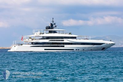
ALISA
Pleasure Craft
Current Trip
| Time Travelled | 1 day |
|---|---|
| Remaining Time | --- |
| Distance Travelled | 400.63 nm |
| Remaining Distance | --- |
| AVG Speed | 10.6 Knopen |
| MAX Speed | 13.3 Knopen |
| AVG Wind | 6.4 knots |
| MAX Wind | 10.6 knots |
| MIN Temp | 25.9°C / 78.62°F |
| MAX Temp | 32.5°C / 90.5°F |
| Diepgang | 2.7 M |
| Positie ontvangen | 2 h, 13 m geleden |
Current Position
| Lengtegraad | 14.99318° |
|---|---|
| Breedtegraat | 39.79418° |
| Status | Under way using engine |
| Snelheid | 10.9 Knopen |
| Koers | 341° |
| Gebied | Tyrrhenian Sea |
| Station | T-AIS |
| Positie ontvangen | 2 h, 13 m geleden |
Info
Information
The current position of ALISA is in Tyrrhenian Sea with coordinates 39.79418° / 14.99318° as reported on 2024-09-07 23:33 by AIS to our vessel tracker app. The vessel's current speed is 10.9 Knopen and is heading at the port of ARECHI. The estimated time of arrival as calculated by MyShipTracking vessel tracking app is 2024-09-08 06:30 LT
The vessel ALISA (IMO: 9946166, MMSI: 319220900) is a Pleasure Craft It's sailing under the flag of [KY] Cayman Is.
In this page you can find informations about the vessels current position, last detected port calls, and current voyage information. If the vessels is not in coverage by AIS you will find the latest position.
The current position of ALISA is detected by our AIS receivers and we are not responsible for the reliability of the data. The last position was recorded while the vessel was in Coverage by the Ais receivers of our vessel tracking app.
The current draught of ALISA as reported by AIS is 2.7 meters
Weather
| Temperature | 27.6°C / 81.68°F |
|---|---|
| Wind Speed | 7 knots |
| Direction | 313° NW |
| Pressure | 1015.2 hPa |
| Humidity | 70.8 % |
| Cloud Coverage | 9 % |
Featured Company
Events
| Tijd | Evenement | Details | Positie / Bestemming | Info |
|---|---|---|---|---|
| 2024-09-07 23:33 | Buitenbereik |
39.79418 / 14.99318
Tyrrhenian Sea
MARINA DI ARECHI
|
Snelheid: 10.9 kn Koers: 341° |
|
| 2024-09-07 23:09 | Destination Changed | MARINA DI ARECHI SALERNO |
39.72304 / 15.02325
MARINA DI ARECHI
|
Snelheid: 10.8 kn Koers: 342° |
| 2024-09-07 23:09 | ETA Changed | 2024/09/08 06:30 2024/09/08 07:00 |
39.72304 / 15.02325
MARINA DI ARECHI
|
Snelheid: 10.8 kn Koers: 342° |
| 2024-09-07 22:52 | Binnenbereik |
39.68617 / 15.03869
Tyrrhenian Sea
SALERNO
|
Snelheid: 10.8 kn Koers: 342.4° |
|
| 2024-09-07 21:15 | Buitenbereik |
39.40721 / 15.16325
Tyrrhenian Sea
SALERNO
|
Snelheid: 10.6 kn Koers: 340.4° |
|
| 2024-09-07 17:34 | Destination Changed | SALERNO GOLFO DE ARANCHI |
38.76164 / 15.41535
SALERNO
|
Snelheid: 11 kn Koers: 358.9° |
| 2024-09-07 17:34 | ETA Changed | 2024/09/08 07:00 2024/09/08 22:00 |
38.76164 / 15.41535
SALERNO
|
Snelheid: 11 kn Koers: 358.9° |
| 2024-09-07 15:06 | ETA Changed | 2024/09/08 22:00 2024/09/09 12:00 |
38.33122 / 15.65236
GOLFO DE ARANCHI
|
Snelheid: 11.1 kn Koers: 316.2° |
| 2024-09-07 14:34 | Wijzig zee gebeid | Italian part of the Tyrrhenian Sea Italian part of the Ionian Sea |
38.25358 / 15.66893
Tyrrhenian Sea
GOLFO DE ARANCHI
|
Snelheid: 10.9 kn Koers: 61.4° |
| 2024-09-07 07:37 | Binnenbereik |
38.32536 / 16.60830
Ionian Sea
GOLFO DE ARANCHI
|
Snelheid: 10.5 kn Koers: 225.6° |