
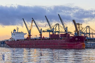
ALICIA
Bulk Carrier
Current Trip
| Time Travelled | 1 day |
|---|---|
| Remaining Time | --- |
| Distance Travelled | 133.35 nm |
| Remaining Distance | --- |
| AVG Speed | 10.6 Knopen |
| MAX Speed | 11.7 Knopen |
| AVG Wind | 6.9 knots |
| MAX Wind | 8.9 knots |
| MIN Temp | 27.1°C / 80.78°F |
| MAX Temp | 35.5°C / 95.9°F |
| Diepgang | 6.6 M |
| Positie ontvangen | 1 h, 21 m geleden |
Current Position
| Lengtegraad | 52.80688° |
|---|---|
| Breedtegraat | 26.08550° |
| Status | Under way using engine |
| Snelheid | 11 Knopen |
| Koers | 115.7° |
| Gebied | Persian Gulf |
| Station | T-AIS |
| Positie ontvangen | 1 h, 21 m geleden |
Info
Information
The current position of ALICIA is in Persian Gulf with coordinates 26.08550° / 52.80688° as reported on 2024-05-13 05:11 by AIS to our vessel tracker app. The vessel's current speed is 11 Knopen
The vessel ALICIA (IMO: 9663623, MMSI: 636015671) is a Bulk Carrier that was built in 2012 ( 12 Jaar oud ). It's sailing under the flag of [LR] Liberia.
In this page you can find informations about the vessels current position, last detected port calls, and current voyage information. If the vessels is not in coverage by AIS you will find the latest position.
The current position of ALICIA is detected by our AIS receivers and we are not responsible for the reliability of the data. The last position was recorded while the vessel was in Coverage by the Ais receivers of our vessel tracking app.
The current draught of ALICIA as reported by AIS is 6.6 meters
Weather
| Temperature | 27.8°C / 82.04°F |
|---|---|
| Wind Speed | 8 knots |
| Direction | 160° SSE |
| Pressure | 1007.7 hPa |
| Humidity | 73.6 % |
| Cloud Coverage | --- |
Featured Company
Most Visited Ports (Last year)
| Port | Arrivals | |
|---|---|---|
| 3 | ||
| 1 | ||
| 1 | ||
| 1 | ||
| 1 | ||
| 1 |
Last Trips
Events
| Tijd | Evenement | Details | Positie / Bestemming | Info |
|---|---|---|---|---|
| 2024-05-13 05:16 | Status Changed | Default Under way using engine |
26.07903 / 52.82165
QAUMS
|
Snelheid: 11 kn Koers: 115.7° |
| 2024-05-13 05:11 | Gevonden in zee | Iranian part of the Persian Gulf |
26.08550 / 52.80688
Persian Gulf
|
Snelheid: 11 kn Koers: 115.7° |
| 2024-05-13 05:11 | Status Changed | Under way using engine Default |
26.08550 / 52.80688
QAUMS
|
Snelheid: 10.9 kn Koers: 119° |
| 2024-05-13 05:11 | Buitenbereik |
26.08550 / 52.80688
Persian Gulf
|
Snelheid: 11 kn Koers: 115.7° |
|
| 2024-05-13 05:04 | Binnenbereik |
26.08550 / 52.80688
Persian Gulf
|
Snelheid: 11 kn Koers: 115.7° |
|
| 2024-05-12 22:06 | Status Changed | Default Under way using engine |
25.29044 / 51.84238
QAUMS
|
Snelheid: 11.2 kn Koers: 76.6° |
| 2024-05-12 21:58 | Buitenbereik |
25.28236 / 51.81947
Persian Gulf
|
Snelheid: 11.2 kn Koers: 76.6° |
|
| 2024-05-12 21:58 | Status Changed | Under way using engine Default |
25.28227 / 51.81903
QAUMS
|
Snelheid: 11.1 kn Koers: 71° |
| 2024-05-12 21:51 | Status Changed | Default Under way using engine |
25.27536 / 51.79774
QAUMS
|
Snelheid: 10.3 kn Koers: 62.9° |
| 2024-05-12 21:44 | Status Changed | Under way using engine Default |
25.26797 / 51.77719
QAUMS
|
Snelheid: 11.2 kn Koers: 33° |