
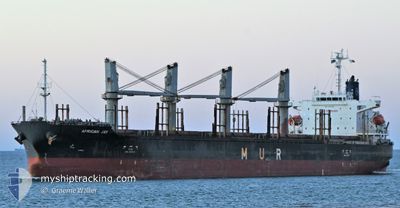
AFRICAN JAY
Cargo
Current Trip
| Time Travelled | 27 days |
|---|---|
| Remaining Time | --- |
| Distance Travelled | 7005.39 nm |
| Remaining Distance | 15.57 nm |
| AVG Speed | 10.4 Knopen |
| MAX Speed | 14.1 Knopen |
| AVG Wind | 10.4 knots |
| MAX Wind | 24 knots |
| MIN Temp | 20.8°C / 69.44°F |
| MAX Temp | 31.8°C / 89.24°F |
| Diepgang | 9.9 M |
| Positie ontvangen | 3 d geleden |
Current Position
| Lengtegraad | --- |
|---|---|
| Breedtegraat | --- |
| Status | Under way using engine |
| Snelheid | 10.6 Knopen |
| Koers | 304.5° |
| Gebied | Laccadive Sea |
| Station | T-AIS |
| Positie ontvangen | 3 d geleden |
Info
Information
The current position of AFRICAN JAY is in Laccadive Sea with coordinates 8.23658° / 76.70995° as reported on 2024-12-30 05:52 by AIS to our vessel tracker app. The vessel's current speed is 10.6 Knopen and is heading at the port of KANDLA. The estimated time of arrival as calculated by MyShipTracking vessel tracking app is 2025-01-03 10:00 LT
The vessel AFRICAN JAY (IMO: 9737046, MMSI: 311000383) is a Cargo It's sailing under the flag of [BS] Bahamas.
In this page you can find informations about the vessels current position, last detected port calls, and current voyage information. If the vessels is not in coverage by AIS you will find the latest position.
The current position of AFRICAN JAY is detected by our AIS receivers and we are not responsible for the reliability of the data. The last position was recorded while the vessel was in Coverage by the Ais receivers of our vessel tracking app.
The current draught of AFRICAN JAY as reported by AIS is 9.9 meters
Weather
| Temperature | 22.1°C / 71.78°F |
|---|---|
| Wind Speed | 6 knots |
| Direction | 60° ENE |
| Pressure | 1017.4 hPa |
| Humidity | 57.4 % |
| Cloud Coverage | 42 % |
Featured Company
Last Port Calls
| Port | Arrival | Departure | Time In Port |
|---|---|---|---|
| 2024-12-01 16:59 | 2024-12-06 12:28 | 4 d | |
| 2024-11-20 14:20 | 2024-11-23 09:29 | 2 d | |
| 2024-11-11 17:55 | 2024-11-16 08:47 | 4 d | |
| 2024-11-01 21:46 | 2024-11-02 21:18 | 23 h |
Most Visited Ports (Last year)
| Port | Arrivals | |
|---|---|---|
| 2 | ||
| 2 | ||
| 2 | ||
| 2 | ||
| 1 | ||
| 1 |
Last Trips
| Origin | Departure | Destination | Arrival | Distance | |
|---|---|---|---|---|---|
| 2024-11-23 20:29 | 2024-12-02 03:59 | 309.21 nm | |||
| 2024-11-16 19:17 | 2024-11-21 01:20 | 1133.78 nm | |||
| 2024-11-03 07:48 | 2024-11-12 04:25 | 297.38 nm | |||
| 2024-10-27 11:13 | 2024-11-02 08:16 | 49.52 nm |
Events
| Tijd | Evenement | Details | Positie / Bestemming | Info |
|---|---|---|---|---|
| 2025-01-03 03:09 | Stop beweging | 17.2 nm, South West of KANDLA |
22.76704 / 70.06411
IN IXY
|
Snelheid: 0.3 kn Koers: 55° |
| 2024-12-30 06:18 | Status Changed | Default Under way using engine |
8.28145 / 76.64471
IN IXY
|
Snelheid: 10.6 kn Koers: 304.5° |
| 2024-12-30 05:52 | Buitenbereik |
8.23658 / 76.70995
Laccadive Sea
IN IXY
|
Snelheid: 10.6 kn Koers: 304.5° |
|
| 2024-12-30 00:01 | Wijzig zee gebeid | Indian part of the Laccadive Sea Sri Lankan part of the Laccadive Sea |
7.61372 / 77.60052
Laccadive Sea
IN IXY
|
Snelheid: 11.1 kn Koers: 302.8° |
| 2024-12-30 00:01 | Status Changed | Under way using engine Default |
7.61372 / 77.60052
IN IXY
|
Snelheid: 11.2 kn Koers: 305° |
| 2024-12-29 23:47 | Binnenbereik |
7.61372 / 77.60052
Laccadive Sea
IN IXY
|
Snelheid: 11.1 kn Koers: 302.8° |
|
| 2024-12-29 17:48 | Status Changed | Default Under way using engine |
6.96710 / 78.57034
IN IXY
|
Snelheid: 11.3 kn Koers: 298.6° |
| 2024-12-29 17:47 | Status Changed | Under way using engine Default |
6.96582 / 78.57263
IN IXY
|
Snelheid: 11.2 kn Koers: 300° |
| 2024-12-29 17:47 | Buitenbereik |
6.96582 / 78.57263
Laccadive Sea
IN IXY
|
Snelheid: 11.3 kn Koers: 298.6° |
|
| 2024-12-29 17:35 | Binnenbereik |
6.96582 / 78.57263
Laccadive Sea
IN IXY
|
Snelheid: 11.3 kn Koers: 298.6° |