
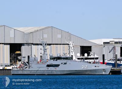
ADV CAPE SOLANDER
Military ops
Current Trip
GG
| Time Travelled | 16 h, 30 mins |
|---|---|
| Remaining Time | --- |
| Distance Travelled | --- |
| Remaining Distance | --- |
| AVG Speed | --- |
| MAX Speed | --- |
| AVG Wind | --- |
| MAX Wind | --- |
| MIN Temp | --- |
| MAX Temp | --- |
| Diepgang | 2.3 M |
| Positie ontvangen | 16 h, 23 m geleden |
Current Position
| Lengtegraad | 115.71783° |
|---|---|
| Breedtegraat | -32.14033° |
| Status | Moored |
| Snelheid | 21.9 Knopen |
| Koers | 103° |
| Gebied | Indian Ocean |
| Station | T-AIS |
| Positie ontvangen | 16 h, 23 m geleden |
Info
Information
The current position of ADV CAPE SOLANDER is in Indian Ocean with coordinates -32.14033° / 115.71783° as reported on 2024-06-07 00:23 by AIS to our vessel tracker app. The vessel's current speed is 21.9 Knopen
The vessel ADV CAPE SOLANDER (IMO: 4771932, MMSI: 503107000) is a Military ops It's sailing under the flag of [AU] Australia.
In this page you can find informations about the vessels current position, last detected port calls, and current voyage information. If the vessels is not in coverage by AIS you will find the latest position.
The current position of ADV CAPE SOLANDER is detected by our AIS receivers and we are not responsible for the reliability of the data. The last position was recorded while the vessel was in Coverage by the Ais receivers of our vessel tracking app.
The current draught of ADV CAPE SOLANDER as reported by AIS is 2.3 meters
Weather
| Temperature | 16.7°C / 62.06°F |
|---|---|
| Wind Speed | 2 knots |
| Direction | 198° SSW |
| Pressure | 1019.3 hPa |
| Humidity | 59.9 % |
| Cloud Coverage | 65 % |
Featured Company
Most Visited Ports (Last year)
| Port | Arrivals |
|---|
Last Trips
| Origin | Departure | Destination | Arrival | Distance |
|---|
Events
| Tijd | Evenement | Details | Positie / Bestemming | Info |
|---|---|---|---|---|
| 2024-06-07 00:23 | Buitenbereik |
-32.14033 / 115.71783
Indian Ocean
|
Snelheid: 21.9 kn Koers: 98.7° |
|
| 2024-06-07 00:23 | Gevonden in zee | Australian part of the Indian Ocean |
-32.14033 / 115.71783
Indian Ocean
|
Snelheid: 21.9 kn Koers: 98.7° |
| 2024-06-07 00:23 | Binnenbereik |
-32.14033 / 115.71783
Indian Ocean
|
Snelheid: 21.9 kn Koers: 98.7° |
|
| 2024-06-07 00:16 | Vertrekhaven |
|
-32.14033 / 115.71783
GG
|
Snelheid: Koers: 92° |
| 2024-06-05 07:56 | Buitenbereik |
-32.14384 / 115.76576
Tasman Sea
[AU] KWINANA
|
Snelheid: Koers: 212.4° |