
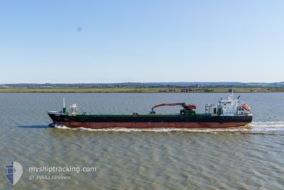
AASVIK
General Cargo
Current Trip
| Time Travelled | 7 h, 15 mins |
|---|---|
| Remaining Time | --- |
| Distance Travelled | 67.98 nm |
| Remaining Distance | --- |
| AVG Speed | 9.7 Knopen |
| MAX Speed | 10.9 Knopen |
| AVG Wind | 24.3 knots |
| MAX Wind | 29.9 knots |
| MIN Temp | 10.8°C / 51.44°F |
| MAX Temp | 11.8°C / 53.24°F |
| Diepgang | 6.4 M |
| Positie ontvangen | 1 m geleden |
Current Position
| Lengtegraad | -5.18000° |
|---|---|
| Breedtegraat | 50.81208° |
| Status | Under way using engine |
| Snelheid | 8.2 Knopen |
| Koers | 227.8° |
| Gebied | Celtic Sea |
| Station | T-AIS |
| Positie ontvangen | 1 m geleden |
Info
Information
The current position of AASVIK is in Celtic Sea with coordinates 50.81208° / -5.18000° as reported on 2024-04-30 04:48 by AIS to our vessel tracker app. The vessel's current speed is 8.2 Knopen and is heading at the port of LONDON. The estimated time of arrival as calculated by MyShipTracking vessel tracking app is 2024-05-01 19:40 LT
The vessel AASVIK (IMO: 9433389, MMSI: 255752000) is a General Cargo that was built in 2011 ( 13 Jaar oud ). It's sailing under the flag of [PT] Portugal.
In this page you can find informations about the vessels current position, last detected port calls, and current voyage information. If the vessels is not in coverage by AIS you will find the latest position.
The current position of AASVIK is detected by our AIS receivers and we are not responsible for the reliability of the data. The last position was recorded while the vessel was in Coverage by the Ais receivers of our vessel tracking app.
The current draught of AASVIK as reported by AIS is 6.4 meters
Weather
| Temperature | 11.8°C / 53.24°F |
|---|---|
| Wind Speed | 31 knots |
| Direction | 171° S |
| Pressure | 1002.9 hPa |
| Humidity | 90.7 % |
| Cloud Coverage | 100 % |
Featured Company
Last Port Calls
| Port | Arrival | Departure | Time In Port |
|---|---|---|---|
| 2024-04-29 08:30 | 2024-04-29 21:34 | 13 h | |
| 2024-04-26 22:24 | 2024-04-27 15:13 | 16 h | |
| 2024-04-25 07:34 | 2024-04-25 22:38 | 15 h | |
| 2024-04-23 21:13 | 2024-04-24 14:08 | 16 h | |
| 2024-04-21 04:54 | 2024-04-21 17:06 | 12 h | |
| 2024-04-17 14:06 | 2024-04-19 14:43 | 2 d | |
| 2024-04-12 08:45 | 2024-04-13 00:34 | 15 h | |
| 2024-04-07 16:41 | 2024-04-08 13:53 | 21 h | |
| 2024-04-03 06:17 | 2024-04-04 20:42 | 1 d | |
| 2024-04-01 18:15 | 2024-04-02 19:03 | 1 d |
Last Trips
| Origin | Departure | Destination | Arrival | Distance | |
|---|---|---|---|---|---|
| 2024-04-27 16:13 | 2024-04-29 09:30 | 497.17 nm | |||
| 2024-04-26 00:38 | 2024-04-26 23:24 | 199.81 nm | |||
| 2024-04-24 15:08 | 2024-04-25 09:34 | 193.92 nm | |||
| 2024-04-21 18:06 | 2024-04-23 22:13 | 530.60 nm | |||
| 2024-04-19 16:43 | 2024-04-21 05:54 | 421.47 nm | |||
| 2024-04-13 01:34 | 2024-04-17 16:06 | 1100.21 nm | |||
| 2024-04-08 15:53 | 2024-04-12 09:45 | 854.09 nm | |||
| 2024-04-04 22:42 | 2024-04-07 18:41 | 786.29 nm | |||
| 2024-04-02 20:03 | 2024-04-03 08:17 | 136.19 nm | |||
| 2024-04-01 19:08 | 2024-04-01 19:15 | 0.75 nm |
Events
| Tijd | Evenement | Details | Positie / Bestemming | Info |
|---|---|---|---|---|
| 2024-04-30 01:35 | Wijzig zee gebeid | United Kingdom part of the Celtic Sea United Kingdom part of the Bristol Channel |
51.14005 / -4.61785
Celtic Sea
GBLON
|
Snelheid: 9.2 kn Koers: 228.9° |
| 2024-04-30 00:50 | Draught Changed | 6.4 4.3 |
51.23373 / -4.47968
GBLON
|
Snelheid: 10 kn Koers: 221.2° |
| 2024-04-30 00:50 | Destination Changed | GBLON GBPTB |
51.23373 / -4.47968
GBLON
|
Snelheid: 10 kn Koers: 221.2° |
| 2024-04-30 00:50 | ETA Changed | 2024/05/01 19:40 2024/04/29 06:30 |
51.23373 / -4.47968
GBLON
|
Snelheid: 10 kn Koers: 221.2° |
| 2024-04-30 00:50 | Status Changed | Under way using engine Default |
51.23448 / -4.47860
GBPTB
|
Snelheid: 10.2 kn Koers: 222° |
| 2024-04-30 00:46 | Status Changed | Default Under way using engine |
51.24194 / -4.46779
GBPTB
|
Snelheid: 10.6 kn Koers: 223.5° |
| 2024-04-30 00:40 | Status Changed | Under way using engine Default |
51.25508 / -4.44859
GBPTB
|
Snelheid: 10.6 kn Koers: 223° |
| 2024-04-30 00:40 | Binnenbereik |
51.25508 / -4.44859
Bristol Channel
|
Snelheid: 10.6 kn Koers: 223.5° |
|
| 2024-04-29 21:34 | Vertrekhaven |
|
51.58109 / -3.82741
GBPTB
|
Snelheid: 5.7 kn Koers: 261° |
| 2024-04-29 21:26 | Start beweging |
51.58266 / -3.80501
[GB] PORT TALBOT
|
Snelheid: 4.5 kn Koers: 262° |