
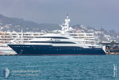
AALTO
Yacht
Current Trip
| Time Travelled | 9 days |
|---|---|
| Remaining Time | --- |
| Distance Travelled | 110.09 nm |
| Remaining Distance | --- |
| AVG Speed | 10.5 Knopen |
| MAX Speed | 15 Knopen |
| AVG Wind | 11 knots |
| MAX Wind | 19.9 knots |
| MIN Temp | 14.6°C / 58.28°F |
| MAX Temp | 24.6°C / 76.28°F |
| Diepgang | 3.9 M |
| Positie ontvangen | 1 d geleden |
Current Position
| Lengtegraad | 6.21179° |
|---|---|
| Breedtegraat | 42.90917° |
| Status | Under way using engine |
| Snelheid | 14.6 Knopen |
| Koers | 269.6° |
| Gebied | Mediterranean Sea - Western Basin |
| Station | T-AIS |
| Positie ontvangen | 1 d geleden |
Info
Information
The current position of AALTO is in Mediterranean Sea - Western Basin with coordinates 42.90917° / 6.21179° as reported on 2024-06-21 11:01 by AIS to our vessel tracker app. The vessel's current speed is 14.6 Knopen
The vessel AALTO (IMO: 1009118, MMSI: 538070869) is a Yacht that was built in 2007 ( 17 Jaar oud ). It's sailing under the flag of [MH] Marshall Is.
In this page you can find informations about the vessels current position, last detected port calls, and current voyage information. If the vessels is not in coverage by AIS you will find the latest position.
The current position of AALTO is detected by our AIS receivers and we are not responsible for the reliability of the data. The last position was recorded while the vessel was in Coverage by the Ais receivers of our vessel tracking app.
The current draught of AALTO as reported by AIS is 3.9 meters
Weather
| Temperature | 20.7°C / 69.26°F |
|---|---|
| Wind Speed | 19 knots |
| Direction | 253° WSW |
| Pressure | 1016.4 hPa |
| Humidity | 82.5 % |
| Cloud Coverage | 64 % |
Featured Company
Events
| Tijd | Evenement | Details | Positie / Bestemming | Info |
|---|---|---|---|---|
| 2024-06-21 11:01 | Buitenbereik |
42.90917 / 6.21179
Mediterranean Sea - Western Basin
MB92 LA CIOTAT
|
Snelheid: 14.6 kn Koers: 269.6° |
|
| 2024-06-21 11:01 | Binnenbereik |
42.90917 / 6.21179
Mediterranean Sea - Western Basin
MB92 LA CIOTAT
|
Snelheid: 14.6 kn Koers: 269.6° |
|
| 2024-06-21 08:53 | Buitenbereik |
43.14059 / 6.80037
Mediterranean Sea - Western Basin
MB92 LA CIOTAT
|
Snelheid: 14.5 kn Koers: 219.1° |
|
| 2024-06-21 06:56 | Destination Changed | MB92 LA CIOTAT GOLF JUAN |
43.54546 / 7.10819
MB92 LA CIOTAT
|
Snelheid: 8 kn Koers: 172.2° |
| 2024-06-21 06:56 | ETA Changed | 2024/06/22 15:00 2024/06/18 07:30 |
43.54546 / 7.10819
MB92 LA CIOTAT
|
Snelheid: 8 kn Koers: 172.2° |
| 2024-06-21 06:54 | Start beweging | 1.53 nm, South East of GOLFE JUAN |
43.54942 / 7.10719
GOLF JUAN
|
Snelheid: 5.8 kn Koers: 172.9° |
| 2024-06-21 06:51 | Destination Changed | GOLF JUAN MB92 LA CIOTAT |
43.55137 / 7.10619
GOLF JUAN
|
Snelheid: 0.4 kn Koers: 32° |
| 2024-06-21 06:51 | ETA Changed | 2024/06/18 07:30 2024/06/22 15:00 |
43.55137 / 7.10619
GOLF JUAN
|
Snelheid: 0.4 kn Koers: 32° |
| 2024-06-21 06:50 | Status Changed | Under way using engine At anchor |
43.55128 / 7.10609
MB92 LA CIOTAT
|
Snelheid: 0.6 kn Koers: 12° |
| 2024-06-21 05:58 | ETA Changed | 2024/06/22 15:00 2024/06/14 04:30 |
43.55060 / 7.10636
MB92 LA CIOTAT
|
Snelheid: Koers: 28° |