
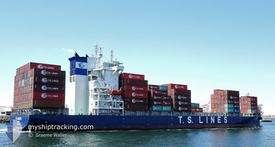
TS NAGOYA
Cargo A
Current Trip
| Time Travelled | 14 h, 22 mins |
|---|---|
| Remaining Time | --- |
| Distance Travelled | 86.64 nm |
| Remaining Distance | 38.51 nm |
| AVG Speed | 8.4 Knopen |
| MAX Speed | 16.3 Knopen |
| AVG Wind | 21.9 knots |
| MAX Wind | 27 knots |
| MIN Temp | 23.6°C / 74.48°F |
| MAX Temp | 32.1°C / 89.78°F |
| Diepgang | 6.9 M |
| Positie ontvangen | 13 h, 27 m geleden |
Current Position
| Lengtegraad | --- |
|---|---|
| Breedtegraat | --- |
| Status | Under way using engine |
| Snelheid | 11.9 Knopen |
| Koers | 150.7° |
| Gebied | South China Sea |
| Station | T-AIS |
| Positie ontvangen | 13 h, 27 m geleden |
Info
Information
The current position of TS NAGOYA is in South China Sea with coordinates 22.16857° / 114.19559° as reported on 2024-10-01 08:01 by AIS to our vessel tracker app. The vessel's current speed is 11.9 Knopen and is heading at the port of NANSHA. The estimated time of arrival as calculated by MyShipTracking vessel tracking app is 2024-10-01 22:00 LT
The vessel TS NAGOYA (IMO: 9919242, MMSI: 538009915) is a Cargo A It's sailing under the flag of [MH] Marshall Is.
In this page you can find informations about the vessels current position, last detected port calls, and current voyage information. If the vessels is not in coverage by AIS you will find the latest position.
The current position of TS NAGOYA is detected by our AIS receivers and we are not responsible for the reliability of the data. The last position was recorded while the vessel was in Coverage by the Ais receivers of our vessel tracking app.
The current draught of TS NAGOYA as reported by AIS is 6.9 meters
Weather
| Temperature | 23.6°C / 74.48°F |
|---|---|
| Wind Speed | 27 knots |
| Direction | 348° NNW |
| Pressure | 1008.9 hPa |
| Humidity | 75.9 % |
| Cloud Coverage | 98 % |
Featured Company
Last Port Calls
| Port | Arrival | Departure | Time In Port |
|---|---|---|---|
| 2024-09-30 12:35 | 2024-10-01 07:06 | 18 h | |
| 2024-09-27 14:44 | 2024-09-29 10:19 | 1 d | |
| 2024-09-26 19:49 | 2024-09-27 05:36 | 9 h | |
| 2024-09-24 23:32 | 2024-09-26 11:48 | 1 d | |
| 2024-09-22 16:11 | 2024-09-23 15:14 | 23 h | |
| 2024-09-20 23:34 | 2024-09-21 16:00 | 16 h | |
| 2024-09-20 01:29 | 2024-09-20 14:01 | 12 h | |
| 2024-09-18 12:20 | 2024-09-19 17:38 | 1 d | |
| 2024-09-15 19:12 | 2024-09-16 23:51 | 1 d | |
| 2024-09-14 03:34 | 2024-09-14 19:35 | 16 h |
Last Trips
| Origin | Departure | Destination | Arrival | Distance | |
|---|---|---|---|---|---|
| 2024-09-29 18:19 | 2024-09-30 20:35 | 352.24 nm | |||
| 2024-09-27 13:36 | 2024-09-27 22:44 | 135.24 nm | |||
| 2024-09-26 19:48 | 2024-09-27 03:49 | 113.65 nm | |||
| 2024-09-23 23:14 | 2024-09-25 07:32 | 489.56 nm | |||
| 2024-09-22 00:00 | 2024-09-23 00:11 | 352.48 nm | |||
| 2024-09-20 22:01 | 2024-09-21 07:34 | 134.70 nm | |||
| 2024-09-20 01:38 | 2024-09-20 09:29 | 110.63 nm | |||
| 2024-09-17 07:51 | 2024-09-18 20:20 | 489.43 nm | |||
| 2024-09-15 03:35 | 2024-09-16 03:12 | 353.10 nm | |||
| 2024-09-14 00:24 | 2024-09-14 11:34 | 137.19 nm |
Events
| Tijd | Evenement | Details | Positie / Bestemming | Info |
|---|---|---|---|---|
| 2024-10-01 08:01 | Status Changed | Default Under way using engine |
22.16709 / 114.19644
CNNSA
|
Snelheid: 11.9 kn Koers: 150.7° |
| 2024-10-01 08:01 | Status Changed | Under way using engine Default |
22.16857 / 114.19559
CNNSA
|
Snelheid: 12.2 kn Koers: 151° |
| 2024-10-01 08:01 | Buitenbereik |
22.16857 / 114.19559
South China Sea
CNNSA
|
Snelheid: 11.9 kn Koers: 150.7° |
|
| 2024-10-01 07:33 | Status Changed | Default Under way using engine |
22.23502 / 114.13406
CNNSA
|
Snelheid: 12.4 kn Koers: 128.9° |
| 2024-10-01 07:06 | Vertrekhaven |
|
22.31945 / 114.10466
CNNSA
|
Snelheid: 12.7 kn Koers: 245° |
| 2024-10-01 07:00 | Status Changed | Under way using engine Moored |
22.33146 / 114.12180
[HK] HONG KONG
|
Snelheid: 5.1 kn Koers: 224° |
| 2024-10-01 06:58 | Start beweging |
22.33240 / 114.12314
[HK] HONG KONG
|
Snelheid: 3.1 kn Koers: 246° |
|
| 2024-10-01 05:40 | Draught Changed | 6.9 8.2 |
22.33248 / 114.12512
[HK] HONG KONG
|
Snelheid: Koers: 342° |
| 2024-10-01 05:34 | Destination Changed | CNNSA HKHKG |
22.33254 / 114.12511
[HK] HONG KONG
|
Snelheid: Koers: 342° |
| 2024-10-01 05:34 | ETA Changed | 2024/10/01 22:00 2025/09/30 12:00 |
22.33254 / 114.12511
[HK] HONG KONG
|
Snelheid: Koers: 342° |