
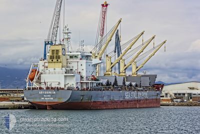
ABYSSINIAN
Cargo
Current Trip
| Time Travelled | 7 days |
|---|---|
| Remaining Time | --- |
| Distance Travelled | 1444.37 nm |
| Remaining Distance | --- |
| AVG Speed | 10.7 Knopen |
| MAX Speed | 15.3 Knopen |
| AVG Wind | 11.9 knots |
| MAX Wind | 26.5 knots |
| MIN Temp | 24.9°C / 76.82°F |
| MAX Temp | 30.6°C / 87.08°F |
| Diepgang | 9.5 M |
| Positie ontvangen | 3 d geleden |
Current Position
| Lengtegraad | 103.50647° |
|---|---|
| Breedtegraat | 1.21904° |
| Status | Under way using engine |
| Snelheid | 11.3 Knopen |
| Koers | 283.4° |
| Gebied | Singapore Strait |
| Station | T-AIS |
| Positie ontvangen | 3 d geleden |
Info
Information
The current position of ABYSSINIAN is in Singapore Strait with coordinates 1.21904° / 103.50647° as reported on 2024-06-23 03:26 by AIS to our vessel tracker app. The vessel's current speed is 11.3 Knopen and is heading at the port of EEMSHAVEN. The estimated time of arrival as calculated by MyShipTracking vessel tracking app is 2024-08-02 07:00 LT
The vessel ABYSSINIAN (IMO: 9646728, MMSI: 538005261) is a Cargo It's sailing under the flag of [MH] Marshall Is.
In this page you can find informations about the vessels current position, last detected port calls, and current voyage information. If the vessels is not in coverage by AIS you will find the latest position.
The current position of ABYSSINIAN is detected by our AIS receivers and we are not responsible for the reliability of the data. The last position was recorded while the vessel was in Coverage by the Ais receivers of our vessel tracking app.
The current draught of ABYSSINIAN as reported by AIS is 9.5 meters
Weather
| Temperature | 29.5°C / 85.1°F |
|---|---|
| Wind Speed | 9 knots |
| Direction | 199° SSW |
| Pressure | 1007.1 hPa |
| Humidity | 72 % |
| Cloud Coverage | 31 % |
Featured Company
Most Visited Ports (Last year)
| Port | Arrivals | |
|---|---|---|
| 2 | ||
| 1 | ||
| 1 | ||
| 1 | ||
| 1 | ||
| 1 |
Events
| Tijd | Evenement | Details | Positie / Bestemming | Info |
|---|---|---|---|---|
| 2024-06-23 03:33 | Status Changed | Default Under way using engine |
1.22407 / 103.48535
SG PEBGC>NLD NLEEM
|
Snelheid: 11.3 kn Koers: 283.4° |
| 2024-06-23 03:26 | Buitenbereik |
1.21904 / 103.50647
Singapore Strait
|
Snelheid: 11.3 kn Koers: 283.4° |
|
| 2024-06-23 03:12 | Gevonden in zee | Malaysian part of the Singapore Strait |
1.20852 / 103.55055
Singapore Strait
|
Snelheid: 11.6 kn Koers: 282.7° |
| 2024-06-23 03:12 | Status Changed | Under way using engine Default |
1.20839 / 103.55108
SG PEBGC>NLD NLEEM
|
Snelheid: 11.7 kn Koers: 284° |
| 2024-06-23 02:57 | Status Changed | Default Under way using engine |
1.19804 / 103.59644
SG PEBGC>NLD NLEEM
|
Snelheid: 11.7 kn Koers: 282.8° |
| 2024-06-23 02:37 | Wijzig zee gebeid | Indonesian part of the Singapore Strait Singaporean part of the Singapore Strait |
1.18525 / 103.66043
Singapore Strait
|
Snelheid: 11.3 kn Koers: 282.9° |
| 2024-06-23 00:21 | Start beweging | 3.94 nm, South West of TANAH MERAH |
1.28689 / 103.95723
SG PEBGC>NLD NLEEM
|
Snelheid: 3.1 kn Koers: 235° |
| 2024-06-23 00:02 | Status Changed | Under way using engine At anchor |
1.28832 / 103.96102
SG PEBGC>NLD NLEEM
|
Snelheid: 0.4 kn Koers: 238° |
| 2024-06-22 19:39 | Status Changed | At anchor Default |
1.28796 / 103.96162
SG PEBGC>NLD NLEEM
|
Snelheid: 0.1 kn Koers: 243° |
| 2024-06-22 19:36 | Status Changed | Default At anchor |
1.28797 / 103.96165
SG PEBGC>NLD NLEEM
|
Snelheid: 0.1 kn Koers: 245° |